FTB 06-18-2022: Numerous Showers And Storms To Support Higher Terrain Flood Threat

Issue Date: Saturday, June 18th, 2022
Issue Time: 10AM MDT

— A MODERATE flood threat has been issued for parts of the Southwest Slope and San Juan Mountains
— A LOW flood threat has been issued for parts of the Front Range, Northern Mountains, Central Mountains, Palmer Ridge, Southeast Mountains and Grand Valley
Flood threat will persist into the overnight hours
 Fire-Burn Forecast Summary: 5 burn areas under MODERATE threat, 4 burn areas under LOW threat; click HERE for more info

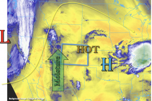
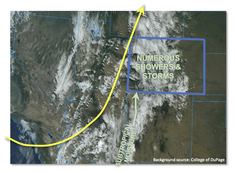
Moisture continues to stream into Colorado from the south, fueled by a somewhat unusual combination of a deep trough to the east and strong subtropical flow originating in Mexico (see visible satellite image, below). Moisture, by any measure, has increased over central and western Colorado since yesterday morning with Grand Junction PW coming in at 0.74 inches. Further south, a nearly saturated Albuquerque sounding showed a PW of 1.10 inches with a dewpoint temperature of 61F! This is the kind of airmass heading into our state today. Instability will also be notably higher than Friday, with CAPE values (briefly) up to 1,200 J/kg possible for far southwest Colorado and more generally in the 400-600 J/kg range further north and east. These are all factors that support a heavy rainfall threat over most of the higher terrain.

There are two main mitigating factors. First, cloud cover, as seen in the satellite image, is fairly expansive so that instability will be come and go today. Second, storm motion will continue to stay on the quicker side, especially towards the WY border. Further south, storm motion is expected to be slower which supports higher rainfall intensity. Nonetheless, a significant increase in shower and storm activity is expected today compared to Friday. The main flood threat will arise from 30-90 minute heavy rainfall that could lead to isolated flash flooding, debris slides and mud flows over most of the higher terrain. This supports a LOW flood threat. However, further southwest, due to higher instability and an expected more rounds of storms, a MODERATE flood threat is warranted as total 24-hour rainfall up to 2.4 inches is possible for parts of the San Juans.

Further east, Denver’s PW this morning was 0.79 inches but boundary layer and total column moisture has actually decreased since yesterday. Additionally, a stronger cap is in place today and will limit precipitation mainly to areas near the foothills. Thus, flooding is not expected.

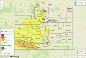
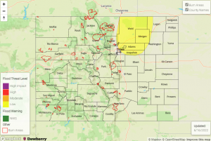
Today’s Flood Threat Map

For more information on today’s flood threat, see the map below. If there is a threat, hover over the threat areas for more details, and click on burn areas to learn more about them. For Zone-Specific forecasts, scroll below the threat map.

Zone-Specific Forecasts:

Northern Mountains, Northwest Slope, Front Range, Palmer Ridge, Southeast Mountains, Central Mountains, San Juan Mountains, San Luis Valley, Southwest Slope & Grand Valley:

Numerous showers and storms increasing in coverage this afternoon and lasting through the early overnight hours. Max 30-minute rain rates up to 0.8 inches, with max 1-hour rainfall up to 1.2 inches. A LOW flood threat is in effect for most of the area for isolated flash flooding, debris slides and mud flows.

For southwestern areas, storm coverage is expected to be highest leading to max 24-hour rainfall up to 2.4 inches. This will increase the chance for debris slides and mud flows over steeper terrain. Thus, a MODERATE flood threat has been issued here.

Primetime: 11AM through 3AM

Urban Corridor, Raton Ridge, Northeast Plains & Southeast Plains:

Mostly sunny to the east, partly/mostly cloudy to the west with continued warm temperatures of 3-10F above normal. Isolated to widely scattered showers and weaker thunderstorms are expected over the foothills closer to the mountains. Max 1-hour rainfall up to 0.8 inches is possible. However, flooding is NOT expected today.

Primetime: 1PM through Midnight
FTB 06-17-2022: Subtropical Moisture Arrives Along with Smoke and Heat for the East

Issue Date: Friday, June 17th, 2022
Issue Time: 9:45AM MDT

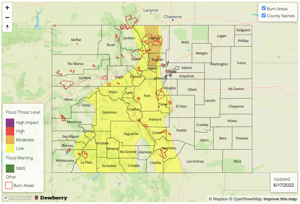
UPDATE (11:50AM MDT): A MODERATE flood threat has now been issued for portions of the Front Range

LOW flood threat has been issued for the San Juan Mountains, Central Mountains, Southeast Mountains, Front Range and portions the Northern Mountains and Raton Ridge
This flood threat continues into the overnight hours
 Fire-Burn Forecast Summary: 3 burn areas under MODERATE threat, 6 burn areas under LOW threat; click HERE for more info

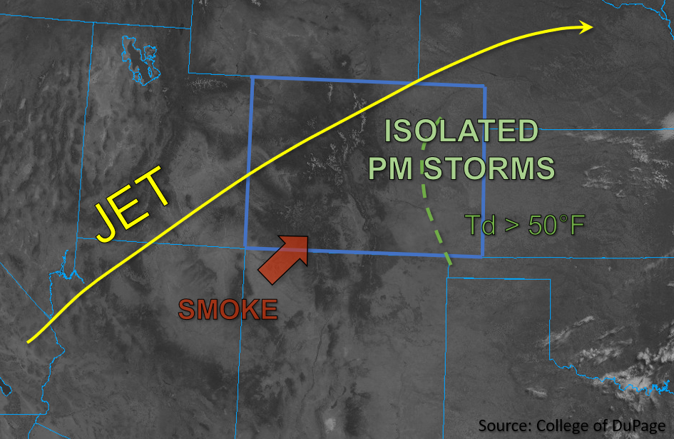
An early season subtropical moisture plume has arrived to western Colorado and the mountains today bringing some much needed widespread rainfall to the area through the weekend, but it also returns the flood threat. As the day continues, the Low will move slightly eastward along the main moisture plume, which is being syphoned northwards from this west coast Low and High pressure system over the Midwest. PW has jumped up to 0.51 inches in Grand Junction with a morning dew point measured at 24°F, and these values should continue to climb with surface moisture deepening over the next 24-hours as evidence by Albuquerque’s 48°F dew point. Equally notable is Denver’s PW morning value, which has increased to 0.83 inches with a dew point measured in the upper 50°Fs.

The jet stream associated with the Low will set up just to our east, which will help provide some extra dynamics for lift and keep storms moving at a quick pace across the state. However, with the abundance of moisture and mid-level energy moving through the southerly flow, numerous rounds of south to north moving storms are forecast to develop over the higher terrains, which will help increase local precipitation totals. This is especially true over south facing slopes. Initially, rain rates will likely be less efficient over the western high terrains due to a drier boundary layer; however, by this evening rain rates have the potential to exceed flood threat criteria. This could cause excessive runoff, mud flows and debris slides over the steeper terrains, so a LOW flood threat has been issued which continues into the overnight hours. Over the eastern mountains, there’s a bit more surface moisture to work with today, which means the storms that develop this afternoon and evening could cause localized flooding issues under the stronger cores. A LOW flood threat has also been issued for this area with the threat of mud flows and debris slides over the steeper terrains.

Out east, it’s going to be a smoky, hot day with a heat advisory issued for portions of the Urban Corridor and Northeast Plains. Due to the more south to north storm motion with the terrain being the driving feature of storm develop, spillover into the adjacent plains should be limited. However, a few showers may reach the I-25 corridor. Flooding is NOT anticipated for this area.

Today’s Flood Threat Map

For more information on today’s flood threat, see the map below. If there is a threat, hover over the threat areas for more details, and click on burn areas to learn more about them. For Zone-Specific forecasts, scroll below the threat map.

Zone-Specific Forecasts:

Northern Mountains, Northwest Slope, Central Mountains, San Juan Mountains, San Luis Valley, Southwest Slope & Grand Valley:

Smoke and widespread rainfall are forecast today. It’s likely that the valleys will stay fairly dry with the main threat from storms tracking off the mountains being lightning and gusty outflow winds. Isolated storm totals up to 0.20 inches will be possible on the outer edges of the valleys. A Red Flag Warning has been issued for the Grand Valley and Southwest Slope for dry lightning and thunderstorm wind gusts increasing fire danger over the area.

Over the elevated terrains, max 1-hour rain rates up to 1.25 inches (south) and 0.75 inches (north) will be possible by this evening, and isolated storm totals by morning over the San Juan Mountains could reach just over 2 inches. A LOW flood threat has been issued for these reasons. Flash flood threats include excessive runoff as well as mud flows and debris slides over the steeper terrains. The flood threat continues overnight, but it should wind down just after midnight with ongoing showers anticipated into tomorrow morning over the Central and San Juan Mountains.

Primetime: 1PM to Ongoing

Front Range, Southeast Mountains, Urban Corridor, Palmer Ridge, Raton Ridge, Northeast Plains & Southeast Plains:

Numerous afternoon thunderstorms and showers are anticipated to fire over the high terrains with better coverage of rainfall north. Max 30-min rainfall rates up to 1.4 inches will be possible, with a max 1-hour rate up to 2.0 inches so a LOW flood threat has been issued. This could cause localized mud flows and debris slides over the steeper terrains under the stronger storm cores as well as excessive runoff. Storms may spill into the adjacent plains, but likely won’t produce much rainfall and should stick areas along and west of the I-25 corridor. Max 1-hour rain rates up to 0.60 inches are possible for this area. A Heat Advisory has been issued for portions of the Urban Corridor and Northeast Plains. More information about this can be found from the NWS Boulder office.

Primetime: 12:30PM to 9:30PM

FTB 06-16-2022: Isolated Afternoon Storms May Bring Heavy Downpours, Hail, and Strong Winds

Issue Date: Thursday, June 16th, 2022
Issue Time: 10:50 AM MDT

— A LOW flood threat has been issued for the Urban Corridor and Northeast Plains

Skies are clear this morning throughout most of Colorado, aside from some lingering smoke and haze from fires in New Mexico and Arizona that is being advected into the southern half of the state. An upper-level ridge and associated high pressure continues to build over Colorado, bringing warmer temperatures statewide. Overall, moisture is quite limited this morning in western Colorado, with Grand Junction observing PW of only 0.20 inches and dew points primarily in the 20s and 30s west of the Continental Divide. Meanwhile, Denver observed PW of 0.44 inches this morning and higher moisture values are noted across all of Eastern Colorado, with dew points in the mid and upper 50s. The most appreciable moisture should increase across northeastern Colorado today as strengthening upslope flow brings additional moisture into the Northeast Plains, while a surge of dry air is expected to mix out moisture fairly quickly across the Southeast Plains this afternoon.

Due to the greater quality of moisture increasing across the Northeast Plains this afternoon in response to strengthening upslope flow and ample surface heating, moderately high instability is expected with CAPE values forecast to reach up to 2500-3000 J/kg across the area. This, along with localized convergence in the wake of a passing front should trigger at least a few isolated strong to severe storms across portions of the Northeast Plains this afternoon. Additional isolated storms could develop across the Southeast Plains this afternoon as well, but due to the surge of dry air that is forecast to move off the Raton Ridge eastward into the Southeast Plains, both storm intensity and longevity is less of a concern for flooding.

Due to forecast weaker midlevel flow, any storms that do form over the Northeast Plains may be slower moving and could produce heavy downpours, large hail, and damaging outflow wind gusts, especially in the vicinity of the higher instability and moisture further east. Additionally, a weak landspout or two may be possible where localized surface vorticity is maximized. Rain rates up to 1.75 inches per hour are possible across portions of the Urban Corridor and Northeast Plains, warranting the issuance of a LOW flood threat for these forecast zones.

Today’s Flood Threat Map

For more information on today’s flood threat, see the map below. If there is a threat, hover over the threat areas for more details, and click on burn areas to learn more about them. For Zone-Specific forecasts, scroll below the threat map.

Zone-Specific Forecasts:

Front Range, Urban Corridor, Palmer Ridge & Northeast Plains:

Skies are clear and temperatures are pleasant this morning. Later this afternoon, isolated storms are expected to develop initially along and east of the Front Range and Urban Corridor. These high based storms will be capable of producing heavy downpours, large hail and strong winds, along with a brief landspout or weak tornado, especially in the presence of the higher quality moisture and instability forecast further east into the Northeast Plains. Max 1-hour rain rates could reach 1.75 inches, thus warranting the issuance of a LOW flood threat for portions of the Urban Corridor and Northeast Plains.

Primetime: 4PM to 11PM

Southeast Mountains, Raton Ridge & Southeast Plains:

Aside from a bit of smoky haze, skies are clear this morning. Hot temperatures are expected this afternoon and dew points forecast to mix out fairly quickly should lead to high dewpoint depressions. A few isolated storms may develop this afternoon and evening, however given the dry air intrusion forecast to move into these zones this afternoon, dry downbursts and gusty outflow winds are the primary threats, though a few brief, heavy rain showers are possible. Flooding is NOT expected with these storms.
Primetime: 3pm to 10pm

San Luis Valley, San Juan Mountains, Southwest Slope, Central Mountains, Grand Valley, Northern Mountains & Northwest Slope:

A bit of lingering smoke and haze is present across the southern portions of these zones this morning, otherwise skies are clear. Dry and clear conditions are expected to be predominant across the western half of the state today. This evening and overnight, the early fringe of monsoonal moisture is forecast to move into the southern portions of the state and may bring a few very light sprinkles or showers to the eastern San Juan Mountains. Flooding is NOT expected today.

FTB 06-15-2022: Cooler, Calmer Weather Statewide, Dry Conditions Return

Issue Date: Wednesday, June 15th, 2022
Issue Time: 9:45 AM MDT

— Flooding is NOT expected today

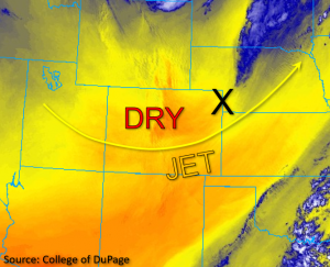
Early this morning, the last remaining band of precipitation moved out of northeastern Colorado in conjunction with the departing jet streak, as noted by the “X” in the water vapor image below. Westerly midlevel flow in the wake of the trough is forecast to weaken throughout the day, with calmer, cooler and much drier conditions expected statewide as compared to yesterday. The dryness is evidenced this morning with PW of only 0.17 inches and a high dewpoint depression observed in Grand Junction. Denver is slightly more moist by comparison, but still drier than yesterday with a PW of 0.38 inches. Due to this very dry boundary layer, minimal instability, and subsidence in the wake of the trough no precipitation is expected today in Colorado. Therefore, NO flood threat has been issued.

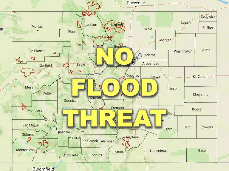
Today’s Flood Threat Map

For more information on today’s flood threat, see the map below. If there is a threat, hover over the threat areas for more details, and click on burn areas to learn more about them. For Zone-Specific forecasts, scroll below the threat map.

Zone-Specific Forecasts:

Front Range, Urban Corridor, Palmer Ridge, Northeast Plains, Southeast Plains, Raton Ridge & Southeast Mountains:

Early this morning, the shallow cloud cover left in the wake of the band of overnight precipitation has quickly mixed out, leaving behind clear skies and dry conditions across these zones. Aside from a few high mountain clouds, skies should remain clear throughout the day. Winds are forecast to be lighter than yesterday but may still be a bit gusty this afternoon. A Red Flag Warning has been issued for Central and Southeast Park County from 11AM until 7PM this evening for winds out of the west at 10 to 15mph, gusting up to 30mph and relative humidity as low as 7 percent. Please tune into to your local NWS office for the latest critical fire weather information. Flooding is NOT expected today.

Northwest Slope, Northern Mountains, Grand Valley, Central Mountains, Southwest Slope, San Juan Mountains, & San Luis Valley:

Aside from a few high mountain clouds, skies are clear across western Colorado this morning. Winds are forecast to be calmer compared to yesterday, but could still reach gusts of up to 20 to 30mph in the higher elevations and further south near the New Mexico border later this afternoon and evening. Otherwise, clear and dry conditions are expected across the western portion of the state today, and flooding is NOT expected.