Issue Date: Thursday, June 16th, 2022
Issue Time: 10:50 AM MDT
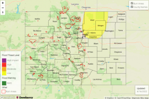
— A LOW flood threat has been issued for the Urban Corridor and Northeast Plains
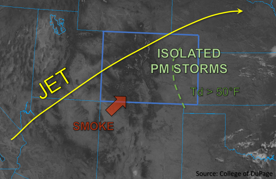
Skies are clear this morning throughout most of Colorado, aside from some lingering smoke and haze from fires in New Mexico and Arizona that is being advected into the southern half of the state. An upper-level ridge and associated high pressure continues to build over Colorado, bringing warmer temperatures statewide. Overall, moisture is quite limited this morning in western Colorado, with Grand Junction observing PW of only 0.20 inches and dew points primarily in the 20s and 30s west of the Continental Divide. Meanwhile, Denver observed PW of 0.44 inches this morning and higher moisture values are noted across all of Eastern Colorado, with dew points in the mid and upper 50s. The most appreciable moisture should increase across northeastern Colorado today as strengthening upslope flow brings additional moisture into the Northeast Plains, while a surge of dry air is expected to mix out moisture fairly quickly across the Southeast Plains this afternoon.
Due to the greater quality of moisture increasing across the Northeast Plains this afternoon in response to strengthening upslope flow and ample surface heating, moderately high instability is expected with CAPE values forecast to reach up to 2500-3000 J/kg across the area. This, along with localized convergence in the wake of a passing front should trigger at least a few isolated strong to severe storms across portions of the Northeast Plains this afternoon. Additional isolated storms could develop across the Southeast Plains this afternoon as well, but due to the surge of dry air that is forecast to move off the Raton Ridge eastward into the Southeast Plains, both storm intensity and longevity is less of a concern for flooding.
Due to forecast weaker midlevel flow, any storms that do form over the Northeast Plains may be slower moving and could produce heavy downpours, large hail, and damaging outflow wind gusts, especially in the vicinity of the higher instability and moisture further east. Additionally, a weak landspout or two may be possible where localized surface vorticity is maximized. Rain rates up to 1.75 inches per hour are possible across portions of the Urban Corridor and Northeast Plains, warranting the issuance of a LOW flood threat for these forecast zones.
Today’s Flood Threat Map
For more information on today’s flood threat, see the map below. If there is a threat, hover over the threat areas for more details, and click on burn areas to learn more about them. For Zone-Specific forecasts, scroll below the threat map.
Zone-Specific Forecasts:
Front Range, Urban Corridor, Palmer Ridge & Northeast Plains:
Skies are clear and temperatures are pleasant this morning. Later this afternoon, isolated storms are expected to develop initially along and east of the Front Range and Urban Corridor. These high based storms will be capable of producing heavy downpours, large hail and strong winds, along with a brief landspout or weak tornado, especially in the presence of the higher quality moisture and instability forecast further east into the Northeast Plains. Max 1-hour rain rates could reach 1.75 inches, thus warranting the issuance of a LOW flood threat for portions of the Urban Corridor and Northeast Plains.
Primetime: 4PM to 11PM
Southeast Mountains, Raton Ridge & Southeast Plains:
Aside from a bit of smoky haze, skies are clear this morning. Hot temperatures are expected this afternoon and dew points forecast to mix out fairly quickly should lead to high dewpoint depressions. A few isolated storms may develop this afternoon and evening, however given the dry air intrusion forecast to move into these zones this afternoon, dry downbursts and gusty outflow winds are the primary threats, though a few brief, heavy rain showers are possible. Flooding is NOT expected with these storms.
Primetime: 3pm to 10pm
San Luis Valley, San Juan Mountains, Southwest Slope, Central Mountains, Grand Valley, Northern Mountains & Northwest Slope:
A bit of lingering smoke and haze is present across the southern portions of these zones this morning, otherwise skies are clear. Dry and clear conditions are expected to be predominant across the western half of the state today. This evening and overnight, the early fringe of monsoonal moisture is forecast to move into the southern portions of the state and may bring a few very light sprinkles or showers to the eastern San Juan Mountains. Flooding is NOT expected today.

