Issue Date: Friday, September 30th, 2022
Issue Time: 10:40AM MDT
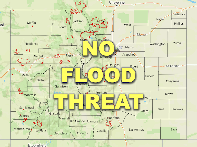
— Flooding is NOT expected today
— Fire-Burn Forecast Summary: 3 burn areas under MODERATE threat, 6 burn areas under LOW threat; click HERE for more info
This is the last scheduled Flood Threat Bulletin for the 2022 season. It has been a pleasure to serve the state of Colorado for another flood season! The next FTB season begins on May 1, 2023.
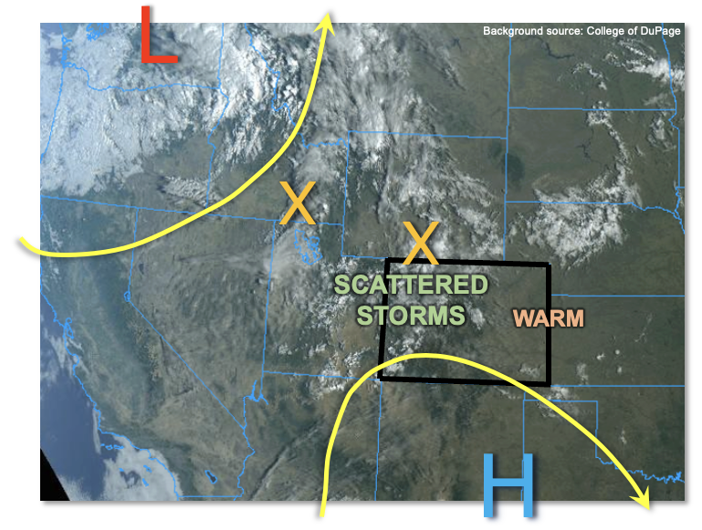
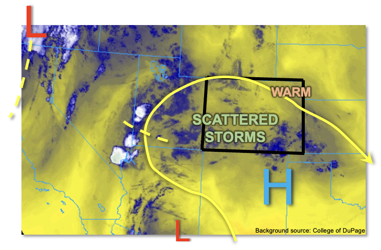
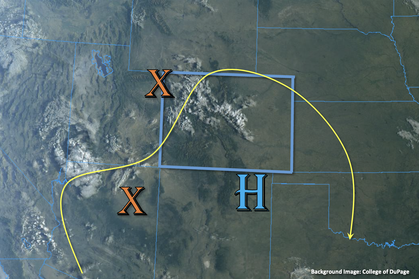
The strong Low pressure center, shown below, will increase moisture and dynamics over the state today as it slowly moves southeastward and cuts itself off from the main steering flow. Already, it is helping to produce some showers and weak thunderstorms over portions of central and northern western Colorado. An increase in southwesterly flow is forecast across the state as the upper-level jet, associated with the Low, moves over the northwest corner of the state. While additional moisture advection is unlikely, it should help provide some additional lift and shear for storm development. One benefit of the jet being overhead will be fast steering flows, which should limit the flood threat from individual storms.
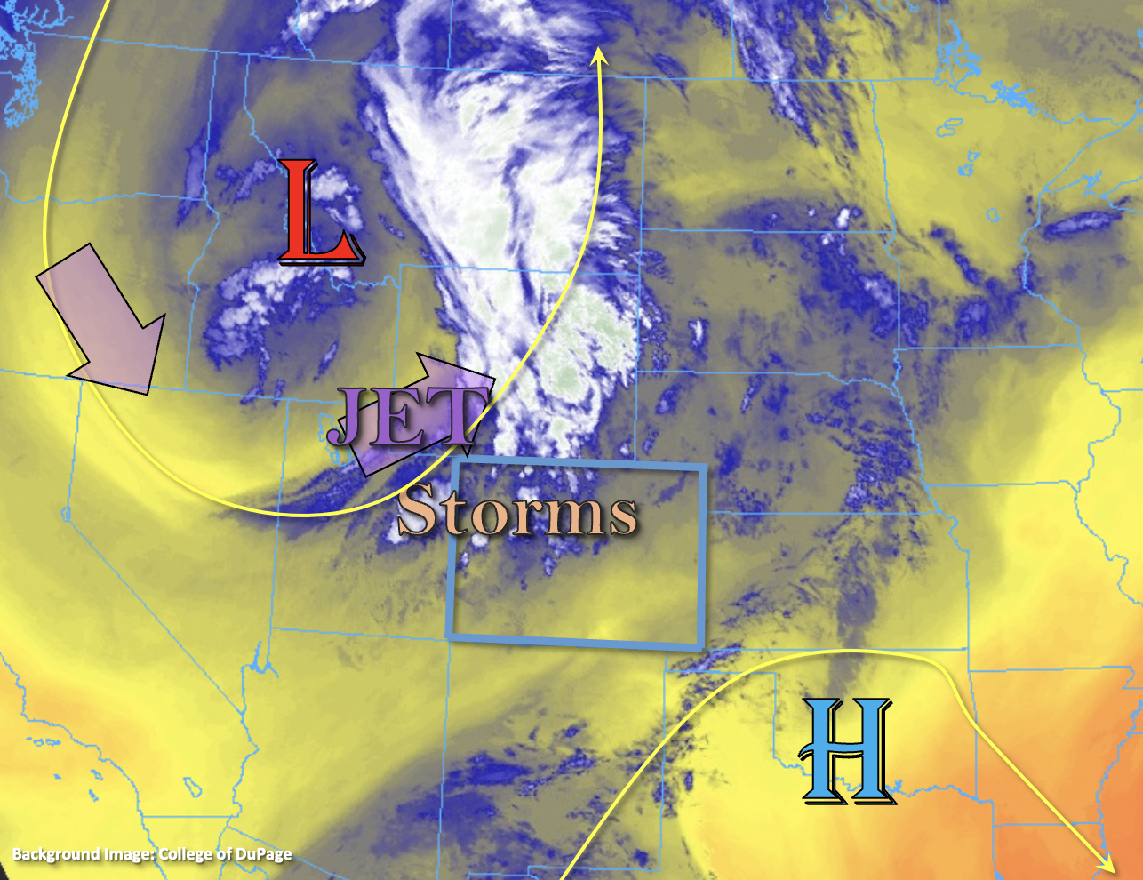
PW at Grand Junction has not changed much from yesterday and was measured at 0.78 inches. The majority of this moisture still looks to be above the boundary layer, thus any thunderstorms that do develop should only produce brief heavy rainfall and perhaps isolated outflow winds. PW at Platteville, over eastern Colorado, was measured at 0.62, so again, little change from yesterday. So, it looks like the main difference between yesterday and today will be that increase in mid and upper-level dynamics as well as a frontal boundary moving in from Wyoming and Utah. So, as daytime heating continues and upslope flow/dynamics increase, expect storms to become more scattered to numerous over western Colorado and the northern/central mountains. There is a high chance for training storms to develop over steeper terrain, which may help to increase local totals. However, embedded convection should be limited with only minimal instability forecast, so longer duration, gradual stratiform rainfall is expected to be the dominate storm type . With both 30-minute and 3-hour totals remaining under flood threat criteria, flooding is NOT expected today. Scroll down to the zone-specific forecasts for more details.
Today’s Flood Threat Map
For more information on today’s flood threat, see the map below. If there is a threat, hover over the threat areas for more details, and click on burn areas to learn more about them. For Zone-Specific forecasts, scroll below the threat map.
Zone-Specific Forecasts:
Northern Mountains, Central Mountains, Northwest Slope, Grand Valley, San Juan Mountains & Southwest Slope:
Morning showers and thunderstorms should expand in coverage throughout the day with a second wave of storms arriving late this afternoon into the evening hours. Isolated max 30-minute rain rates up to 0.8 inches and 3-hour rain rates up to 1.5 inches will be possible. Some high elevation snow is likely to start developing around dusk with light precipitation lingering over the high terrain through tomorrow morning. Flooding is NOT expected.
Primetime: Ongoing to 11PM
Southeast Mountains, Front Range, Raton Ridge, Urban Corridor, San Luis Valley, Southeast Plains, Northeast Plains & Palmer Ridge:
Light rainfall is currently occurring over the northern Front Range. Storm coverage should be limited to the Front Range and adjacent eastern plains today. Isolated max 30-minute rain rates up to 0.5 inches and 3-hour totals up to 1.1 inches may be possible under the stronger storm cores that develop, but outside of nuisance ponding, flooding is NOT expected. As thunderstorms roll off the foothills later this afternoon, some strong, but brief outflow winds may also occur. Storms intensity should drop off by later this evening with some light rainfall possible over the northern Urban Corridor and Northeast Plains into tonight.
Primetime: 2:30PM to 10:30PM