Issue Date: Tuesday, September 27th, 2022
Issue Time: 9:25AM MDT
— Flooding is NOT expected today
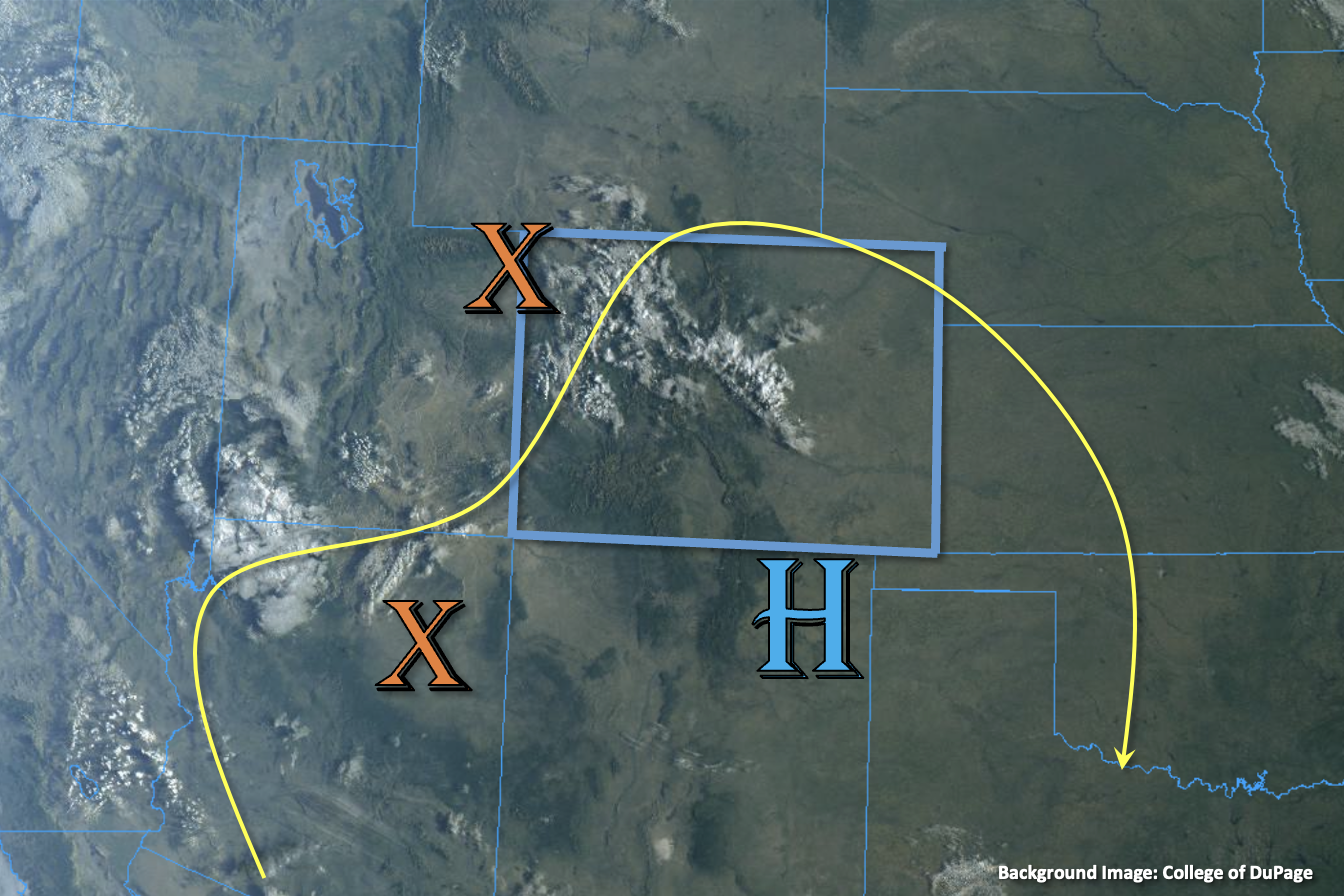
There is some cloud cover and isolated light showers over northwestern Colorado this morning, which can be seen in the visible satellite image below. The cause of these are weak mid-level lift and a bit of moisture that has circulated under the ridge (orange “X”). The High will continue to sit south of the border today, which will help to rotate this weak shortwave and moisture eastward across the state. This and the diurnal flow are expected to return isolated to widely scattered PM storms to the high terrain. With PW estimated around a half inch and surface moisture still lacking, only brief light to moderate rainfall rates are expected under the small storm cores that develop. Some storms may move off the high terrain into the adjacent eastern plains with clockwise motion around the High. With PW at Platteville being measured at 0.52 inches, dew points only in the 30s °F to low 40s °F, and little to no moisture advection forecast this afternoon, only minimal rainfall activity is forecast with plenty of virga and gusty outflow winds possible. Best chance for brief moderate rainfall rates will be over the elevated ridges where extra convergence is forecast. Despite the uptick in the chance for rainfall today, flooding is NOT expected.
Today’s Flood Threat Map
For more information on today’s flood threat, see the map below. If there is a threat, hover over the threat areas for more details, and click on burn areas to learn more about them. For Zone-Specific forecasts, scroll below the threat map.

Zone-Specific Forecasts:
Southeast Mountains, San Juan Mountains, Northern Mountains, Central Mountains, Front Range, Raton Ridge & Palmer Ridge:
Isolated to widely scattered weak t-storms may be possible over these zones this afternoon. In addition to light to moderate rainfall rates, storms may produce some strong outflow winds, especially as they move into the adjacent plains. Max 30-minute rain rates up to 0.25 inches (north) and 0.4 inches (south) may be possible. Flooding is NOT expected.
Primetime: 12:30PM to 10PM
Northwest Slope, Grand Valley, Southwest Slope, Urban Corridor, San Luis Valley, Southeast Plains & Northeast Plains:
Another gorgeous dry and warm weather day is on tap. Best chance for rainfall will be over the immediate adjacent eastern plains this evening, but rainfall totals should remain under 0.2 inches. As storms move off the high terrain, they may produce some strong outflow winds before dissipating. Flooding is NOT expected.
Primetime: 4:30PM to 10PM