FTB 06-22-2022: Subtropical Moisture And The Flood Threat Return For Southern Colorado

Issue Date: Wednesday, June 22nd, 2022
Issue Time: 9:50AM MDT

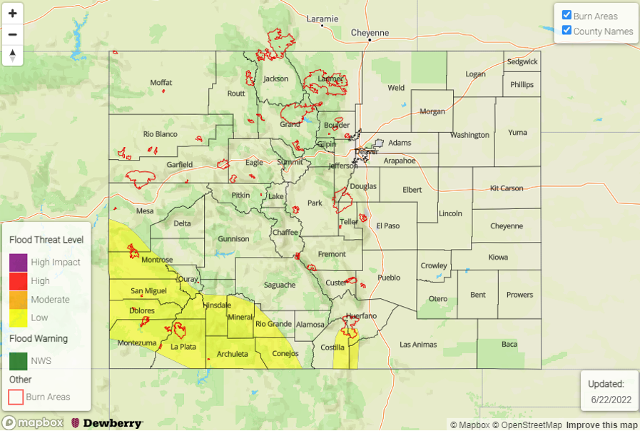
— LOW flood threat has been issued for portions of the Southwest Slope, San Juan Mountains and Southeast Mountains
— The flood threat will persist into the overnight hours
— Fire-Burn Forecast Summary: 1 burn areas under LOW threat; click HERE for more info

Colorado continues to sit between a cutoff Low to our west and a High pressure system to our east. Southerly flow has helped pull another subtropical moisture plume northward into the state, and this will spread north and eastward today as it rotates clockwise around the High. PW at Denver and Grand Junction was only measured at 0.34 inches this morning with both soundings showing dry mid-levels and limited surface moisture. However, there is a very sharp gradient in PW when moving towards the southern border, and PW at Albuquerque was measured at 1.22 inches! It is likely that PW over the Southeast Plains is also over 1 inch where there are some ongoing light showers this morning. There is also a noticeable mid-level disturbance (orange “X”) moving northwards through the flow, part of which is likely remanent of TC Blas. This, paired with increasing moisture throughout the day, should help spark scattered storms across the southern half of the state by early this afternoon.
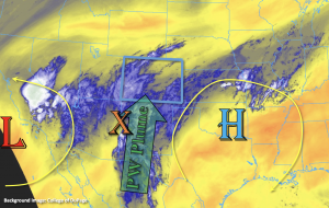
Although it may take a couple hours for the boundary layer to moisten and rain rates to become more efficient, slower steering flows, the possibility of storms anchoring to the mountains and numerous rounds of rainfall should help to increase local accumulations over the southern high terrains. Additionally, a nearly stationary shortwave/trough feature over the Four Corners region tonight will likely sustain and generate more storms across southwest Colorado with some embedded convection possible. So, while the ongoing cloud cover may limit the instability that can build and the flood threat from the 1-hour storm, a LOW flood threat has been issued for longer duration and overnight rainfall accumulation. Mud flows and debris slides will be possible over the steeper terrains as well as an increase in runoff causing rises in local streams and creeks.

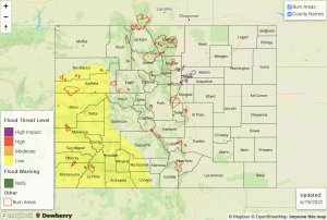
Today’s Flood Threat Map

For more information on today’s flood threat, see the map below. If there is a threat, hover over the threat areas for more details, and click on burn areas to learn more about them. For Zone-Specific forecasts, scroll below the threat map.

Zone-Specific Forecasts:

San Juan Mountains, Southeast Mountains, Southwest Slope, Raton Ridge, Southeast Plains & San Luis Valley:

Increasing moisture and mid-level dynamics will cause widespread storms to fire over the high terrains beginning this afternoon and lasting into the overnight hours. Max 3-hour rain rates up to 1.8 inches and 24-hour totals just over 2 inches will be possible. Over the same area that received copious amounts of rainfall this weekend, this may cause mud flows and debris slides over steeper terrains as well as an increase in runoff causing rises in local streams and creeks. A LOW flood threat has been issued that lasts into the overnight hours. Lighter showers will be likely over the mountains tomorrow morning. An isolated area or two of the San Luis Valley could see up to 0.50 inches of rainfall by morning.

Out east, southerly surface winds will help to keep dew points in the 50Fs. If any instability can develop from breaks in the cloud deck later this morning, max 1-hour rain rates up to 1.5 inches will be possible over the Southeast Plains late this afternoon/evening. It is more likely storms will produce 1-hour rain rates up to 0.80 inches later today. Flooding is not expected for this region though nuisance ponding may occur if the higher rain rates are realized.

Primetime: 1PM to 3AM (southwest); 1PM to 8PM (Southeast Mountains) 

Northern Mountains, Northwest Slope, Central Mountains, Front Range, Urban Corridor, Palmer Ridge, Northeast Plains & Grand Valley:

More isolated storms are forecast for the southern Central Mountains and Front Range near the Continental Divide. Max 1-hour rain rates up to 0.20 inches will be possible with most storms producing totals under 0.10 inches and only cloud cover. There may be a few sprinkles over the Flat Tops and Roan Cliffs as well. Flooding is NOT forecast for these zones. Afternoon high temperatures will reach into the upper 80Fs across the lower elevations and upper 70Fs for the mountain valleys.

Primetime: 1:30PM to 8PM
FTB 06-21-2022: Showers and Storms To Develop Across Southern Colorado

Issue Date: June 21st, 2022
Issue Time: 10:10AM MDT

— Flooding is NOT expected today
— A PM forecast update is possible today

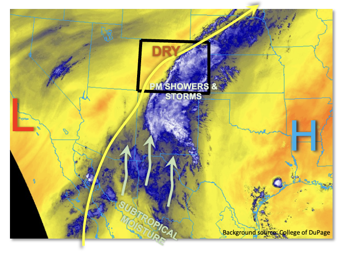
A very interesting weather pattern has developed across the southern Four Corners region. As shown in the water vapor image, below, Colorado is sandwiched between a strong upper-level ridge well to the east and a modest cut-off low pressure over California. The end result is a deep southerly flow that will begin to pump moisture originating from well into the subtropics (or even tropics?!) into our state, at least the southern half of it. To add even more emphasis, there are two tropical disturbances that will help import moisture northward over the next 3-5 days as well. As mentioned in yesterday’s Outlook, this overall pattern may not be a short-term anomaly but instead the predominant flow through most of this week.

But let us not get ahead of ourselves. This morning, most of Colorado remains quite dry. PW at Denver was 0.40 inches, while Grand Junction was even lower at 0.23 inches. Nonetheless, with Albuquerque PW coming in at 0.91 inches, weak southerly flow in the mid-levels of the atmosphere will advect some moisture back into Colorado later today. By late afternoon, we expect PW in the 0.6 – 1.0 inch range along our southern border. Dynamics-wise, a mid-level disturbance with some weak jet-stream support was draped across New Mexico this morning. It shows up well in the water vapor loop below. This feature will trek very slowly northward through the day and will serve as the primary rainfall generation mechanism. A large complex of storms will form over New Mexico later today and move slowly northward. Outflow boundaries could push moist, unstable air into the San Juans before instability wanes around sunset. But at this time, it looks improbable that the heavy rainfall threat will cross into our state as guidance has backed off on rain intensity over the past 24 hours. This is consistent with only marginal instability of perhaps 300-500 J/kg over the southern portion of the San Juan Mountains. Nonetheless, while we do NOT foresee a flood threat at this time, an afternoon update may be required today should moisture and instability trend upward. The San Juan Mountains have received a large amount of rainfall over the past 72 hours so that will promote more effective runoff than normal, should heavy rainfall develop.

Further east, afternoon showers and embedded storms are expected to cross into the Southeast Mountains, Raton Ridge and Southeast Plains. However, with limited instability, sustained but light/moderate intensity rainfall is anticipated and flooding is not expected today.

For the rest of the state, a pleasantly cool and dry Tuesday is in store.

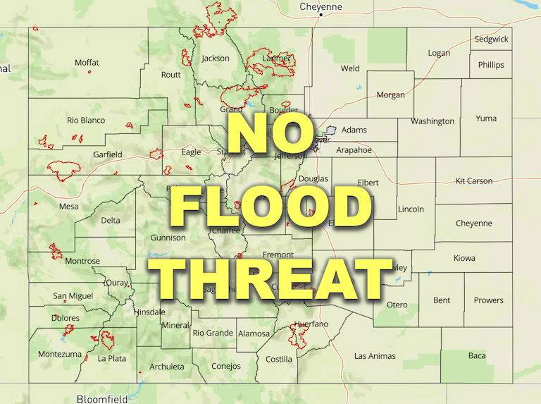
Today’s Flood Threat Map

For more information on today’s flood threat, see the map below. If there is a threat, hover over the threat areas for more details, and click on burn areas to learn more about them. For Zone-Specific forecasts, scroll below the threat map.

Zone-Specific Forecasts:

San Juan Mountains, Southwest Slope, San Luis Valley, Southeast Mountains, Raton Ridge & Southeast Plains:

Increasing clouds and cool with widely scattered showers and storms developing by late afternoon. Highest coverage will be right along the NM border. Max 30-minute rainfall up to 0.5 inches possible, with max 1-hour rainfall up to 0.7 inches mainly over the San Juan mountains. Further east, steadier light/moderate rain showers are expected to develop by mid-afternoon with total accumulation by tomorrow morning up to 0.5 inches possible. Flooding is NOT expected at this time, but an afternoon update may be needed today for the San Juan Mountains.

Primetime (west): 5PM to 11PM

Primetime (east): 2PM into the overnight hours

Northern Mountains, Central Mountains, Grand Valley, Northwest Slope, Northeast Plains, Front Range, Urban Corridor & Palmer Ridge:

Mostly sunny today and seasonably cool today with temperatures running 4-7F below normal. Isolated showers could clip the far southeast portions of the Northeast Plains later today, but rainfall is expected to stay below 0.1 inches.

FTB 06-20-2022: Cooler Day Ahead with Rainfall Forecast Over The Southeast Plains

Issue Date: Monday, June 20th, 2022
Issue Time: 9:25AM MDT

Flooding is NOT expected today

A cooler and drier day is forecast for most of Colorado as the subtropical moisture plume that was over western Colorado and the mountains this weekend has been replaced by a very dry air mass. PW at Grand Junction and Denver have dropped to 0.28 inches and 0.54 inches, respectively. This is quite the difference over western Colorado where PW has gone from the 95th percentile yesterday morning to below the 10th percentile this morning! With stronger upper-level winds moving over western Colorado, due to the movement of the Low, windy, westerly surface winds are forecast for the area later today. With the cooler temperatures and plenty of rainfall from the weekend, the fire weather risk should remain subdued over western Colorado and the mountains.

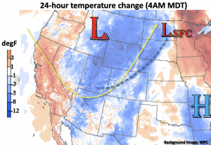
Below is the 24-hour temperature change, and a cold front (blue dashed line) is expected to slowly dip across the state late today/tonight as the trough moves to the northeast. A trough axis and this front should help to generate some storms and showers over the Southeast Plains this afternoon and into the overnight hours as the subtropical moisture plume has moved into this area. However, surface moisture is expected to become limited with the very dry air mixing eastward throughout the day, so flooding is NOT expected.

Today’s Flood Threat Map

For more information on today’s flood threat, see the map below. If there is a threat, hover over the threat areas for more details, and click on burn areas to learn more about them. For Zone-Specific forecasts, scroll below the threat map.

Zone-Specific Forecasts:

Palmer Ridge, Raton Ridge, Northeast Plains & Southeast Plains:

Widely scattered storms are likely to develop over the eastern Raton Ridge and Southeast Plains this afternoon with lighter showers possible during the overnight hours over the far eastern plains. Max 1-hour rain rates up to 0.60 inches will be possible this afternoon and evening along with strong gusty winds under the stronger storm cores. Flooding is NOT expected. Low to mid-90°Fs are forecast today and breezy southwest winds may cause pockets of enhanced fire weather over the plains.  

Primetime: 3PM to Midnight

Northern Mountains, Northwest Slope, Central Mountains, San Juan Mountains, Front Range, Urban Corridor, Southeast Mountains, San Luis Valley, Southwest Slope & Grand Valley:

Drier air has moved overhead and will continue to spread eastward, which will keep the chance of precipitation close to zero today. Isolated storms may graze the northwest corner through mid-afternoon, but storms will likely produce more virga than measurable rainfall. Therefore, flooding is NOT forecast. It is also forecast to get breezy by this afternoon with westerly winds forecast in the 15-25 mph range. High temperatures should run around average or slightly below normal.

FTB 06-19-2022: Rainfall Continues For Western Colorado And The High Terrains

Issue Date: Sunday, June 19th, 2022
Issue Time: 10:25AM MDT

LOW flood threat has been issued for the Grand Valley, Southwest Slope, San Juan Mountains and portions of the Central Mountains and Northwest Slope
 Fire-Burn Forecast Summary: 4 burn areas under MODERATE threat, 4 burn areas under LOW threat; click HERE for more info

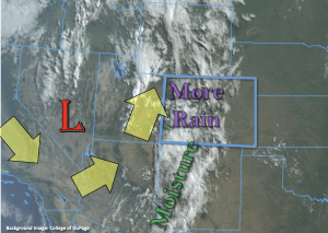
The closed Low has relocated eastward and will continue to move slightly northeast today, which means western Colorado will be under the influence of stronger wind speeds with a more easterly steering component. Thankfully, the plume of moisture will remain overhead, so with the rainfall and cloud cover ongoing and forecast to continue, critical fire weather should remain east of our border. The plume of subtropical moisture is once again marked in the visible satellite imagery below with a significant moisture increase noted in today’s morning sounding at Grand Junction. PW was measured at 0.91 inches, which is around the 95th percentile for this time of year! The dew point has also jumped up to 55°F and much deeper moisture is present within the boundary layer, which should help storms to produce more efficient rainfall rates today with higher accumulations likely over the lower elevation valleys, especially north.

Today is a rinse and repeat pattern with the main area of rainfall forecast to be over western Colorado and the western high terrains with the highest accumulation totals south. Less coverage of storms and lower rain rates are anticipated for the high terrains east of the Continental Divide. Over the last 48-hours, a large portion of the San Juan Mountains has seen 1 to 1.5 inches of rainfall with smaller pockets of these lower-end totals over the Central Mountains. That means soils are likely widely saturated, and rises have already been seen in local creeks and rivers over these areas. With multiple rounds of rainfall forecast today and this evening over that area and meaningful accumulation likely again, there is a better potential for mud flows, debris slides, increased runoff and local creeks running at bankfull conditions. Similar to yesterday, lack of instability (ongoing cloud cover) and quick storm motion should help to limit the flood threat areal coverage, but isolated flash flooding will be possible if any stronger storm cores can develop where there are breaks in cloud cover. These are already occurring over the Grand Valley and northern Southwest Slope. A LOW flood threat has been reissued for the above reasoning.

Over the adjacent eastern plains, surface moisture at Denver is similar to yesterday, which means another day with more of a wind/virga threat than measurable rainfall as storms move off the eastern high terrains with southeasterly steering flow. There are some higher dew points east of the 104°W longitude line, so if a couple storms can make it that far east, more moderate rainfall will be possible. However, flooding is not anticipated for this region.

Today’s Flood Threat Map

For more information on today’s flood threat, see the map below. If there is a threat, hover over the threat areas for more details, and click on burn areas to learn more about them. For Zone-Specific forecasts, scroll below the threat map.

Zone-Specific Forecasts:

Northern Mountains, Northwest Slope, Central Mountains, San Juan Mountains, San Luis Valley, Southwest Slope & Grand Valley:

Another round of widespread rainfall is forecast today with the potential for a few stronger storms to develop where there are breaks in cloud cover. Max 30-minute rain rates up to 0.75 inches will be possible in these areas, and isolated storm totals up to 2 inches possible again over the San Juan Mountains. A LOW flood threat has been issued for isolated flash flooding issues as well as the potential for mud flows and debris slides over the steeper terrains where stronger storm cores or long duration rainfall occurs. A couple showers may continue over the mountains tonight, but the flood threat from rainfall should end as the sun sets.

Primetime: Ongoing to 3AM

Front Range, Southeast Mountains, Urban Corridor, Palmer Ridge, Raton Ridge, Northeast Plains & Southeast Plains:

Scattered afternoon storms are possible over the eastern high terrains this afternoon with an increase in the easterly portion of the steering flow. Max 1-hour rain rates up to 0.75 inches are possible over the moutnains with lesser amounts possible over the immediate adjacent plains. As storms move off the mountains, strong outflow winds will be the main threat. If storms can hold together and make it into the eastern portions of the Northeast Plains/Palmer Ridge/Southeast Plains, max 1-hour rain rates up to 0.6 inches will be possible. The far eastern plains should remain dry, and 25 to 30 mph southerly winds will increase the fire danger over the area.

Primetime: 12PM to 11PM