SPM 09-25-2020: No Rain and Plenty of Sunshine

Issue Date: Friday, September 25th, 2020
Issue Time: 9:50AM MDT

Summary:

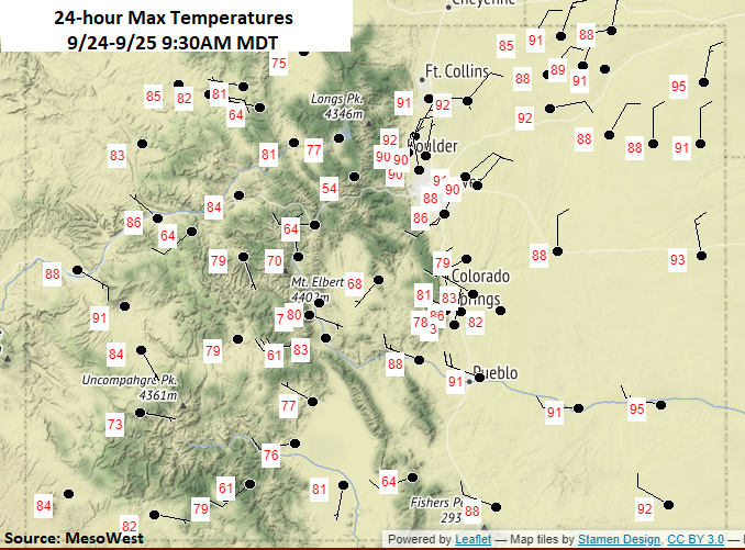
Not a drop of rain across the state yesterday, and outside of a narrow band of clouds, it was bluebird day. Under the influence of a ridge, high temperatures reached at least 90F over eastern Colorado (lower elevations) and up to 90F over the Grand Valley. Over the mountains, temperatures reached into the 70Fs and 80Fs. Southwesterly winds picked up over the Northwest Slope during the afternoon hours, and observations were generally between 13 and 23 mph with gusts just over 35 mph. Surface winds over the northern mountains were slightly less and reached between 9 and 15 mph. This did not affect the containment of any of the ongoing fires listed below. With a dry and windy couple of days ahead, we’ll be monitoring changes closely.
Continuing Colorado wildfire update (as of 9:40AM from InciWeb):
Cameron Peak in the Medicine Bow Mountains: 104,895 acres; 27% contained
Middle Fork Fire in Routt County: 6,760 acres; 0% containment
Williams Fork in the Arapaho National Forest: 12,320 acres; 25% contained

To see precipitation estimates over your neighborhood the last 72-hours, scroll down to the State Precipitation Map below.

Click Here For Map Overview
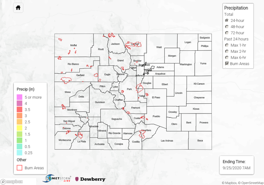
The map below shows radar-estimated, rainfall gage-adjusted Quantitative Precipitation Estimates (QPE) across Colorado. The map is updated daily during the operational season (May 1 – Sep 30) by 11AM. The following six layers are currently available: 24-hour, 48-hour and 72-hour total precipitation, as well as maximum 1-hour, 2-hour and 6-hour precipitation over the past 24 hour period (to estimate where flash flooding may have occurred). The 24-hour, 48-hour and 72-hour total precipitation contain bias corrections that are not disaggregated into the hourly estimates, so there will likely be some differences. The accumulation ending time is 7AM of the date shown in the bottom right corner. Also shown optionally are vulnerable fire burn areas (post 2012), which are updated throughout the season to include new, vulnerable burn areas. The home button in the top left corner resets the map to the original zoom.

SPM 09-24-2020: Isolated Rainfall with a Rumble of Thunder or Two

Issue Date: Thursday, September 24th, 2020
Issue Time: 9:30AM MDT

Summary:

Generally, subsidence and the drying atmosphere behind the departing trough kept the state rain-free on Wednesday. However, the trough left a little bit of moisture for a couple storms to fire over the Southeast Mountains and Palmer Ridge during the afternoon. For the most part, storms only produce light rainfall and a minimal lightning, and all activity ended by the evening. QPE indicates isolated totals up to 0.25 inches, but mostly storms produced under 0.10 inches. The small storm cores made observations hard to come by, but a Weather Underground station in southern Teller County picked up 0.11 inches. As guessed, flooding was not reported.

Large ongoing Colorado wildfires update (as of 9:15AM from InciWeb):

Cameron Peak in the Medicine Bow Mountains: 104,791 acres; 27% contained
Middle Fork Fire in Routt County: 6,760 acres; 0% containment
Williams Fork in the Arapaho National Forest: 12,320 acres; 16% contained

To see precipitation estimates over your neighborhood the last 24 to 48-hours, scroll down to the State Precipitation Map below.

Click Here For Map Overview
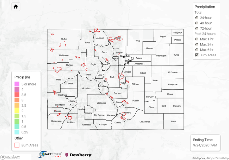
The map below shows radar-estimated, rainfall gage-adjusted Quantitative Precipitation Estimates (QPE) across Colorado. The map is updated daily during the operational season (May 1 – Sep 30) by 11AM. The following six layers are currently available: 24-hour, 48-hour and 72-hour total precipitation, as well as maximum 1-hour, 2-hour and 6-hour precipitation over the past 24 hour period (to estimate where flash flooding may have occurred). The 24-hour, 48-hour and 72-hour total precipitation contain bias corrections that are not disaggregated into the hourly estimates, so there will likely be some differences. The accumulation ending time is 7AM of the date shown in the bottom right corner. Also shown optionally are vulnerable fire burn areas (post 2012), which are updated throughout the season to include new, vulnerable burn areas. The home button in the top left corner resets the map to the original zoom.

SPM 09-23-2020: Weak Mountain Showers & A Couple Strong Storms Over Western Plains

Issue Date: Wednesday, September 23rd, 2020
Issue Time: 10:40AM MDT

Summary:

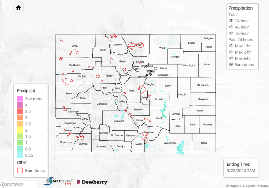
Numerous showers and thunderstorms fired over the mountain regions and adjacent plains of Colorado yesterday. Showers & storms over the high terrain were generally weak, with mountain rain gauges reporting 0.18 inches of total rainfall. A stronger thunderstorm zippered its way south from El Paso to Pueblo County after bubbling up over the top of the Palmer Ridge. This outflow-driven convective cell brought some of the heaviest rain we have seen since the early cold Fall storm earlier this month. A Weather Underground station near where the storm fired over northern El Paso County reported 0.61 inches of rainfall. This high storm core total was isolated as a nearby CoCoRaHS observer reported 0.27 inches. The storm created a narrow path of heavy rain through eastern El Paso and Pueblo counties, which unfortunately is not well instrumented with rain gauges. The QPE map indicates up to 1.5 inches fell in this storm core path. Gusty outflow winds were also associated with this storm as the Pueblo airport reported a 45 mph wind gust. A second isolated thunderstorm fired over southern Pueblo County around the same time as this Palmer Ridge storm, again creating a very small isolated storm core with heavy rain reported. There was fortunately a CoCoRaHS observer near the core of this storm, who reported 0.98 inches of rain accumulation with some pea-sized hail. This storm core was not picked up on the QPE map, likely due to the later CoCoRaHS report. No flooding was reported from these storms yesterday.

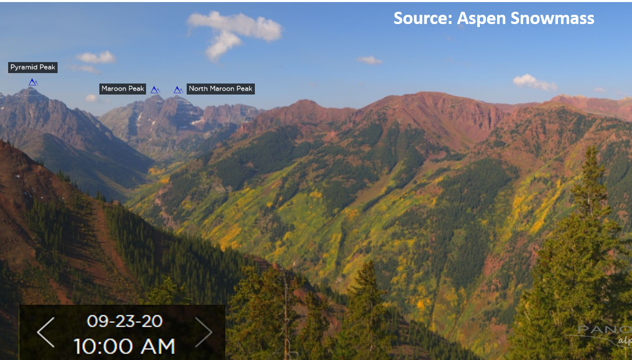
Since dry weather is expected in the forecast, you may want to schedule your fall foliage mountain viewing trip. The mountain webcams, like the one from Aspen Highlands in the image below, shows the Aspens are starting to turn their orange Fall colors. Enjoy it while the wildfire smoke concentration stays low. Check out the webcam here:
https://aspen.roundshot.com/highlands/

Large ongoing Colorado wildfires update (as of 10:30AM from InciWeb):
Middle Fork in the Park Range: 6,187 acres; 0% contained
Cameron Peak in the Medicine Bow Mountains: 104,652 acres; 17% contained (slight increase in size & containment)
Williams Fork in the Arapaho National Forest: 12,320 acres; 16% contained

For rainfall estimates in your neck of the woods over the last 24, 48, and 72 hours, check out our State Precipitation Map below.

Click Here For Map Overview
The map below shows radar-estimated, rainfall gage-adjusted Quantitative Precipitation Estimates (QPE) across Colorado. The map is updated daily during the operational season (May 1 – Sep 30) by 11AM. The following six layers are currently available: 24-hour, 48-hour and 72-hour total precipitation, as well as maximum 1-hour, 2-hour and 6-hour precipitation over the past 24 hour period (to estimate where flash flooding may have occurred). The 24-hour, 48-hour and 72-hour total precipitation contain bias corrections that are not disaggregated into the hourly estimates, so there will likely be some differences. The accumulation ending time is 7AM of the date shown in the bottom right corner. Also shown optionally are vulnerable fire burn areas (post 2012), which are updated throughout the season to include new, vulnerable burn areas. The home button in the top left corner resets the map to the original zoom.

SPM 09-22-2020: Isolated Storms Produce Spotty Rainfall

Issue Date: Tuesday, September 22nd, 2020
Issue Time: 10:00AM MDT

Summary:

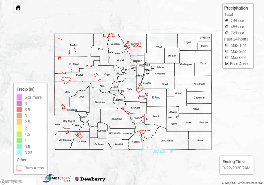
There were some rare morning showers over the eastern plains yesterday along a moisture boundary associated with the lee trough. Storms didn’t produce much rainfall, but light totals were still recorded as the feature moved east throughout the morning. Isolated storms returned to the mountains yesterday afternoon with some mid-level moisture being advected around the monsoon High. Not much rainfall coming out of the storms with the high cloud bases, but a little bit of rain was recorded here and there. The most wetting rainfall came from the weak thunderstorms that developed further south and over the elevated ridges. Over the San Juan Mountains, up to 0.25 inches of precipitation was recorded with most totals between 0.05 and 0.15 inches over western Colorado. A couple weak thunderstorms developed mid afternoon and lasted into the early evening over El Paso County. QPE was just over a quarter of an inch, but isolated totals slightly higher were definitely possible since storms didn’t move much over the two hour period. Storm cores were small, which made observations hard to come by. Two CoCoRaHS stations in eastern Fremont County had between 0.15 and 0.20 inches, which seems about right for storm totals over the Southeast Mountains yesterday. Flooding was not reported.


Large ongoing Colorado wildfires update (as of 10AM from InciWeb):
Cameron Peak in the Medicine Bow Mountains: 104,530 acres; 15% contained
Middle Fork Fire in Routt County: 6,187 acres; 0% containment
Williams Fork in the Arapaho National Forest: 12,320 acres; 16% contained

To see precipitation estimates over your neighborhood yesterday, keep scrolling down to the State Precipitation Map.

Click Here For Map Overview

The map below shows radar-estimated, rainfall gage-adjusted Quantitative Precipitation Estimates (QPE) across Colorado. The map is updated daily during the operational season (May 1 – Sep 30) by 11AM. The following six layers are currently available: 24-hour, 48-hour and 72-hour total precipitation, as well as maximum 1-hour, 2-hour and 6-hour precipitation over the past 24 hour period (to estimate where flash flooding may have occurred). The 24-hour, 48-hour and 72-hour total precipitation contain bias corrections that are not disaggregated into the hourly estimates, so there will likely be some differences. The accumulation ending time is 7AM of the date shown in the bottom right corner. Also shown optionally are vulnerable fire burn areas (post 2012), which are updated throughout the season to include new, vulnerable burn areas. The home button in the top left corner resets the map to the original zoom.