Issue Date: Wednesday, September 23rd, 2020
Issue Time: 10:40AM MDT
Summary:
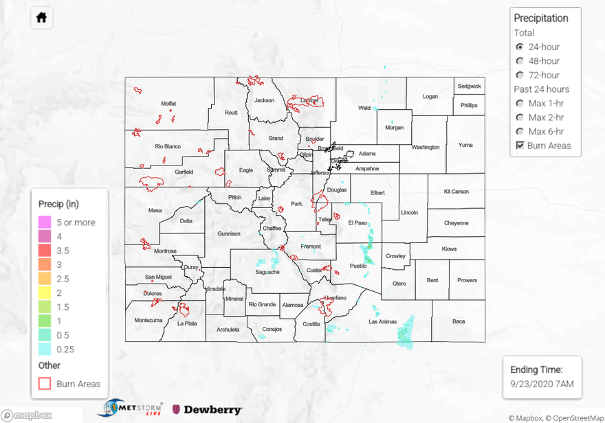
Numerous showers and thunderstorms fired over the mountain regions and adjacent plains of Colorado yesterday. Showers & storms over the high terrain were generally weak, with mountain rain gauges reporting 0.18 inches of total rainfall. A stronger thunderstorm zippered its way south from El Paso to Pueblo County after bubbling up over the top of the Palmer Ridge. This outflow-driven convective cell brought some of the heaviest rain we have seen since the early cold Fall storm earlier this month. A Weather Underground station near where the storm fired over northern El Paso County reported 0.61 inches of rainfall. This high storm core total was isolated as a nearby CoCoRaHS observer reported 0.27 inches. The storm created a narrow path of heavy rain through eastern El Paso and Pueblo counties, which unfortunately is not well instrumented with rain gauges. The QPE map indicates up to 1.5 inches fell in this storm core path. Gusty outflow winds were also associated with this storm as the Pueblo airport reported a 45 mph wind gust. A second isolated thunderstorm fired over southern Pueblo County around the same time as this Palmer Ridge storm, again creating a very small isolated storm core with heavy rain reported. There was fortunately a CoCoRaHS observer near the core of this storm, who reported 0.98 inches of rain accumulation with some pea-sized hail. This storm core was not picked up on the QPE map, likely due to the later CoCoRaHS report. No flooding was reported from these storms yesterday.
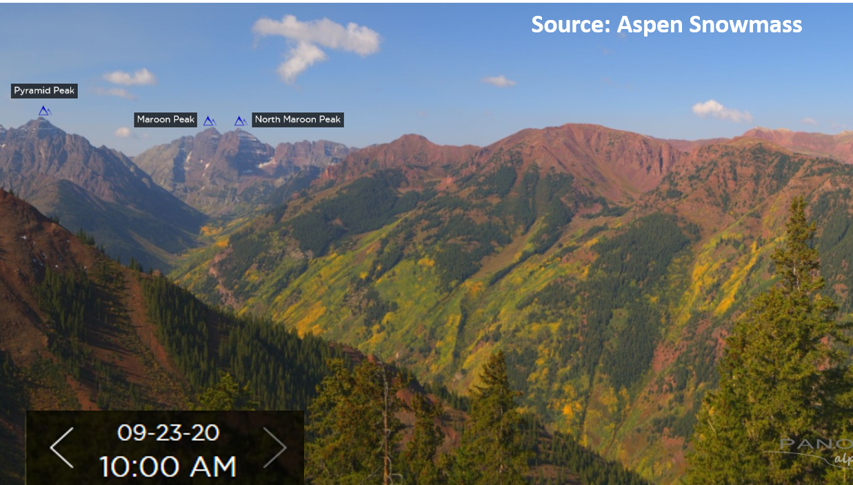
Since dry weather is expected in the forecast, you may want to schedule your fall foliage mountain viewing trip. The mountain webcams, like the one from Aspen Highlands in the image below, shows the Aspens are starting to turn their orange Fall colors. Enjoy it while the wildfire smoke concentration stays low. Check out the webcam here:
https://aspen.roundshot.com/highlands/
Large ongoing Colorado wildfires update (as of 10:30AM from InciWeb):
Middle Fork in the Park Range: 6,187 acres; 0% contained
Cameron Peak in the Medicine Bow Mountains: 104,652 acres; 17% contained (slight increase in size & containment)
Williams Fork in the Arapaho National Forest: 12,320 acres; 16% contained
For rainfall estimates in your neck of the woods over the last 24, 48, and 72 hours, check out our State Precipitation Map below.
Click Here For Map Overview