Issue Date: Tuesday, September 22nd, 2020
Issue Time: 10:00AM MDT
Summary:
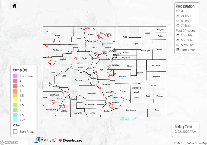
There were some rare morning showers over the eastern plains yesterday along a moisture boundary associated with the lee trough. Storms didn’t produce much rainfall, but light totals were still recorded as the feature moved east throughout the morning. Isolated storms returned to the mountains yesterday afternoon with some mid-level moisture being advected around the monsoon High. Not much rainfall coming out of the storms with the high cloud bases, but a little bit of rain was recorded here and there. The most wetting rainfall came from the weak thunderstorms that developed further south and over the elevated ridges. Over the San Juan Mountains, up to 0.25 inches of precipitation was recorded with most totals between 0.05 and 0.15 inches over western Colorado. A couple weak thunderstorms developed mid afternoon and lasted into the early evening over El Paso County. QPE was just over a quarter of an inch, but isolated totals slightly higher were definitely possible since storms didn’t move much over the two hour period. Storm cores were small, which made observations hard to come by. Two CoCoRaHS stations in eastern Fremont County had between 0.15 and 0.20 inches, which seems about right for storm totals over the Southeast Mountains yesterday. Flooding was not reported.
Large ongoing Colorado wildfires update (as of 10AM from InciWeb):
Cameron Peak in the Medicine Bow Mountains: 104,530 acres; 15% contained
Middle Fork Fire in Routt County: 6,187 acres; 0% containment
Williams Fork in the Arapaho National Forest: 12,320 acres; 16% contained
To see precipitation estimates over your neighborhood yesterday, keep scrolling down to the State Precipitation Map.
Click Here For Map Overview