SPM 05-14-2022: Pleasant Late Spring Day, Though Still Very Dry

Issue Date: Saturday, May 14th, 2022
Issue Time: 9:35 AM MDT

Summary:

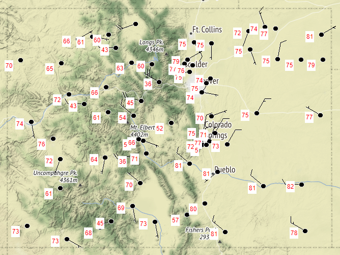
As mentioned in the FTB yesterday, relatively benign zonal flow kept the conditions dry and calm across the state. There is no precipitation to report, and overall temperatures were cooler than it has been recently, as seen in the map below. For Western Colorado, yesterday’s highs were even bit below seasonal normal. It was also the first day without any high wind reports in Colorado since May 7. That’s not to say it wasn’t windy at all, just not as extreme over the past week or so.

Even with the relatively calmer weather, conditions remain especially dry with particularly high fire danger. Grass fires continued to pop up around Colorado Springs, and a fire was also ignited in the mountains near Durango. The High Park Fire in Teller County has continued to grow to now 931 acres and 0% containment

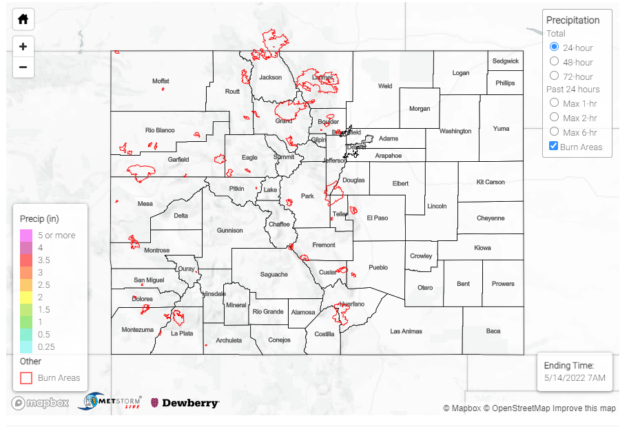
There were no flood reports yesterday. For rainfall estimates in your area, including antecedent conditions, check out the MetStorm Live QPE below.
Click Here For Map Overview

The map below shows radar-estimated, rainfall gage-adjusted Quantitative Precipitation Estimates (QPE) across Colorado. The map is updated daily during the operational season (May 1 – Sep 30) by 11AM. The following six layers are currently available: 24-hour, 48-hour and 72-hour total precipitation, as well as maximum 1-hour, 2-hour and 6-hour precipitation over the past 24 hour period (to estimate where flash flooding may have occurred). The accumulation ending time is 7AM of the date shown in the bottom right corner. Also shown optionally are vulnerable fire burn areas (post 2012), which are updated throughout the season to include new, vulnerable burn areas. The home button in the top left corner resets the map to the original zoom.

SPM 05-13-2022: Windy Day with Multiple Fires Igniting Near Colorado Springs

Issue Date: Friday, May 13th, 2022
Issue Time: 10:25 AM MDT

Summary:

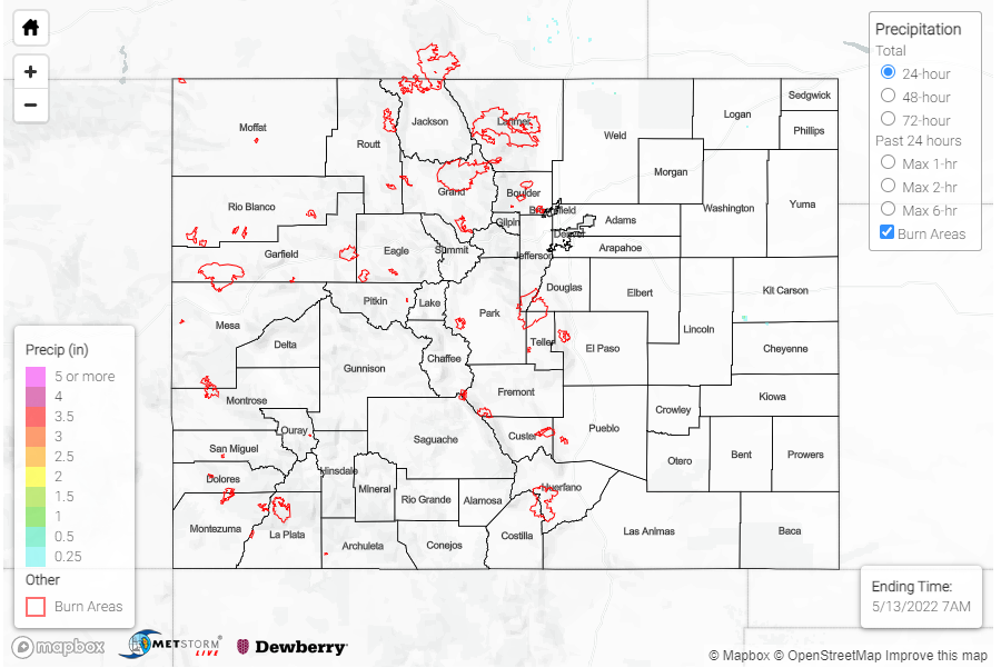
Isolated storms associated with a low in Wyoming dipped just south of the WY-CO border yesterday in the late morning and early afternoon. Unfortunately, just 0.01 inch of precipitation was recorded in Nunn on the Northeast Plains, as well as at a few personal weather stations near the state line – none of which is enough to show up on the precipitation map below.

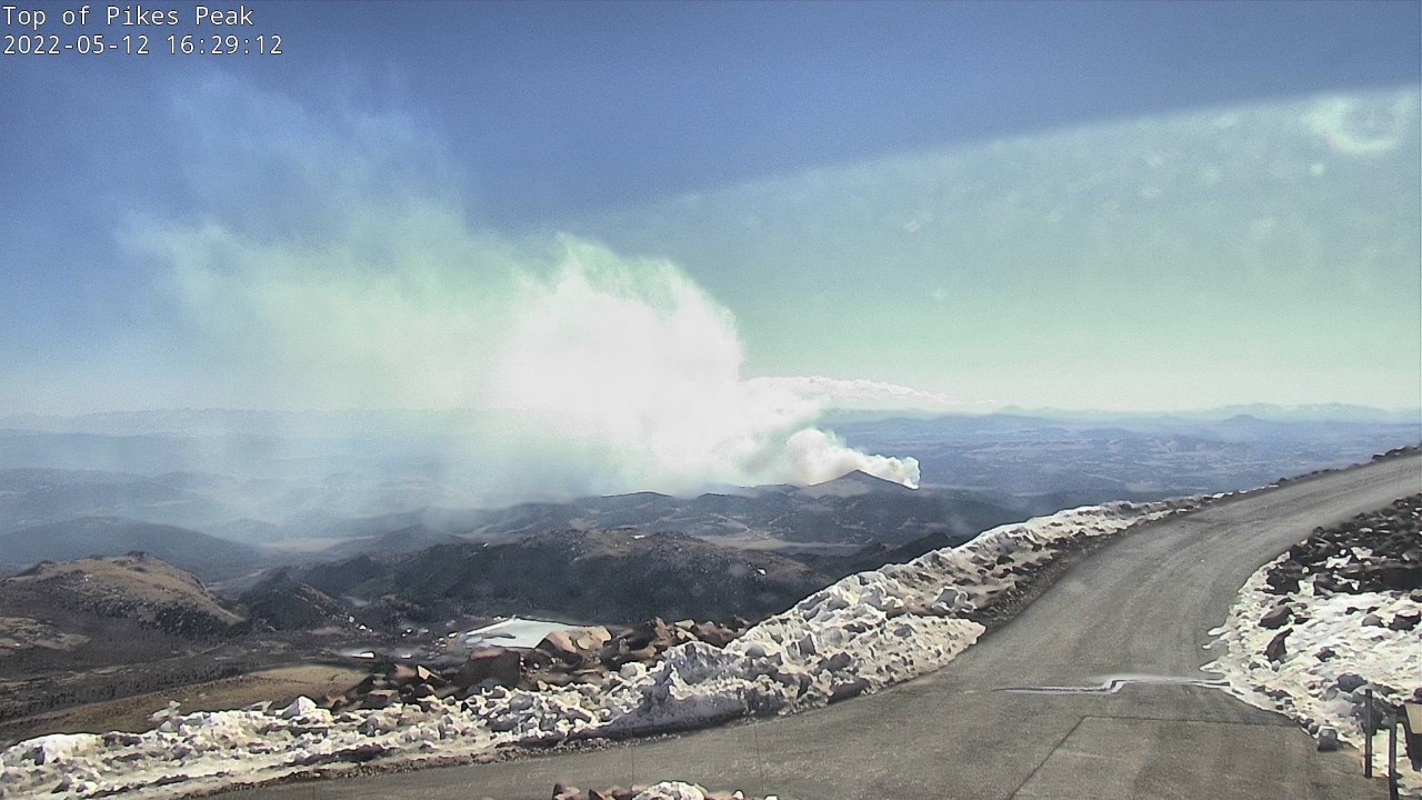
Instead, the pressure system and associated front caused more high winds, so Northern Colorado saw a majority of those reports yesterday including several on the Front Range and Urban Corridor. High winds and dry conditions also allowed for multiple fires to ignite yesterday afternoon.  Several fires were in or near Colorado Springs, including the Arturus Fire which caused the Colorado Springs Airport to be evacuated. A bit further west, the High Park fire ignited near Cripple Creek. Smoke from the High Park Fire can be seen in the picture below from the top of Pikes Peak taken yesterday afternoon.

There were no flood reports yesterday. For rainfall estimates in your area, including antecedent moisture over the last 72-hours, check out the MetStorm Live QPE below.
Click Here For Map Overview

The map below shows radar-estimated, rainfall gage-adjusted Quantitative Precipitation Estimates (QPE) across Colorado. The map is updated daily during the operational season (May 1 – Sep 30) by 11AM. The following six layers are currently available: 24-hour, 48-hour and 72-hour total precipitation, as well as maximum 1-hour, 2-hour and 6-hour precipitation over the past 24 hour period (to estimate where flash flooding may have occurred). The accumulation ending time is 7AM of the date shown in the bottom right corner. Also shown optionally are vulnerable fire burn areas (post 2012), which are updated throughout the season to include new, vulnerable burn areas. The home button in the top left corner resets the map to the original zoom.

SPM 05-12-2022: Severe Thunderstorm in Far Southeast Colorado; Relentless Wind Continues

Issue Date: Thursday, May 12th, 2022
Issue Time: 9:40 AM MDT

Summary:

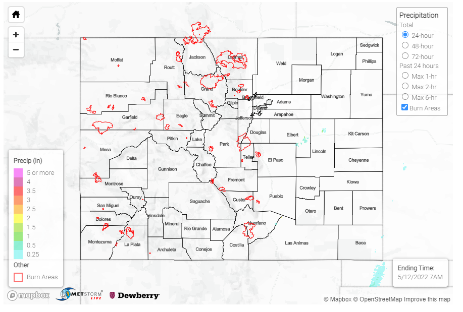
Late afternoon yesterday saw the development of a line of storms along a dryline extending from Western Texas up into Kansas, at the very edge of the CO-KS border. A severe thunderstorm warning was issued for a portion of Baca County, right at the border, after radar indicated the potential for 60-mph winds and quarter-size hail from a thunderstorm cell. An 0.88-inch hail report was made in Stonington, along with a 55-mph thunderstorm wind gust associated with this severe thunderstorm. A nearby MesoWest gauge picked up only 0.04 inches of precipitation however with this cell. As it was mentioned in the FTB yesterday, high steering winds quickly moved storms eastward into Kansas and the lack of moisture limited precipitation totals and flood potential.

For the remainder of the state, relentless wind and heat continues to dominate the weather story. An 89-mph non-thunderstorm wind gust was reported on Douglass Pass, which has seen some exceptionally high gusts lately along with much of the Western Slopes and Grand Valley. In Colorado Springs, a 67-mph gust was recorded along with a report of a 12-inch diameter tree snapping at its base! Colorado Springs also broke their record high temperature yesterday, reaching an unseasonably hot 88 degrees. It was even warmer in Denver, which saw its first 90-degree day of the year, tying the record high for the day. All across Eastern Colorado, temperatures felt more appropriate for summer than mid-May. A wildfire also ignited near Evergreen yesterday, but thankfully it was quickly contained, and evacuations were lifted.

High winds out of the south brought plenty of smoke and haze to Southeastern Colorado from fires burning in New Mexico. The Pueblo WFO shared the following satellite image showing the plume extending from fires near Santa Fe, NM up into Las Animas, Otero, Crowley, and Lincoln Counties. The cumulus field in the Southeast Plains further developed into the severe thunderstorm mentioned earlier.


There were no flood reports yesterday. For rainfall estimates in your area, check out the MetStorm Live QPE below.
Click Here For Map Overview

The map below shows radar-estimated, rainfall gage-adjusted Quantitative Precipitation Estimates (QPE) across Colorado. The map is updated daily during the operational season (May 1 – Sep 30) by 11AM. The following six layers are currently available: 24-hour, 48-hour and 72-hour total precipitation, as well as maximum 1-hour, 2-hour and 6-hour precipitation over the past 24 hour period (to estimate where flash flooding may have occurred). The accumulation ending time is 7AM of the date shown in the bottom right corner. Also shown optionally are vulnerable fire burn areas (post 2012), which are updated throughout the season to include new, vulnerable burn areas. The home button in the top left corner resets the map to the original zoom.

SPM 05-11-2022: Another Day of High Wind Reports for Western Slopes

Issue Date: Wednesday, May 11th, 2022
Issue Time: 10:00 AM MDT

Summary:

As mentioned in yesterday’s FTB, a lack of available moisture and a particularly strong jet stream have maintained exceptionally dry and windy conditions across Colorado. Douglas Pass in Garfield County recorded a 72-mph gust yesterday, and high wind reports exceeding 50mph were recorded all across the Western Slopes, Grand Valley, and Southeast Plains.  Strong southerly wind also brought smoke from large fires currently burning in New Mexico to Southern and Eastern Colorado.

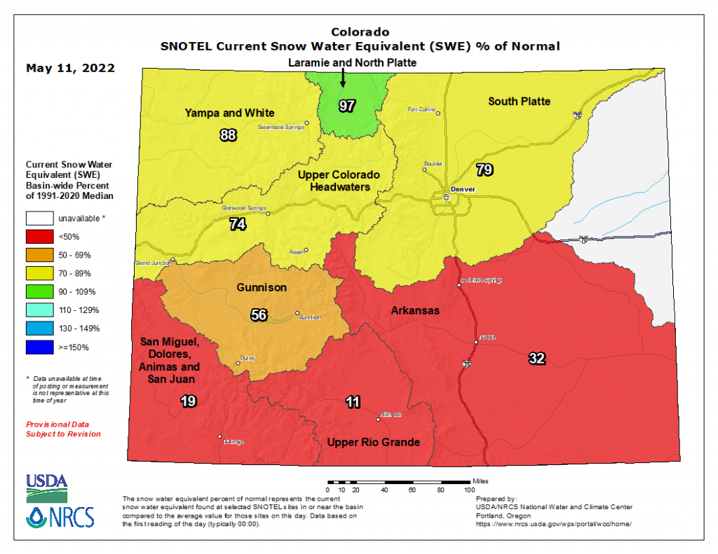
There has been basically no precipitation across the state in the last 48-hours, as seen in the QPE map below; and high temperatures coupled with strong winds have allowed for rapid melt of mountain snowpack, especially in Southern Colorado. The current map of Snow Water Equivalent (SWE) below shows a clear distinction between Northern and Southern Colorado, with the southern basins at 32% of normal or less for this time of year. Gunnison is not faring much better with only 56% of average SWE for this time of year. Only the Laramie & North Platte Basin in the very northern portion of the state is near normal.

There were no flood reports yesterday. For rainfall estimates in your area, check out the MetStorm Live QPE below.
Click Here For Map Overview

The map below shows radar-estimated, rainfall gage-adjusted Quantitative Precipitation Estimates (QPE) across Colorado. The map is updated daily during the operational season (May 1 – Sep 30) by 11AM. The following six layers are currently available: 24-hour, 48-hour and 72-hour total precipitation, as well as maximum 1-hour, 2-hour and 6-hour precipitation over the past 24 hour period (to estimate where flash flooding may have occurred). The accumulation ending time is 7AM of the date shown in the bottom right corner. Also shown optionally are vulnerable fire burn areas (post 2012), which are updated throughout the season to include new, vulnerable burn areas. The home button in the top left corner resets the map to the original zoom.