Issue Date: Wednesday, May 11th, 2022
Issue Time: 10:00 AM MDT
Summary:
As mentioned in yesterday’s FTB, a lack of available moisture and a particularly strong jet stream have maintained exceptionally dry and windy conditions across Colorado. Douglas Pass in Garfield County recorded a 72-mph gust yesterday, and high wind reports exceeding 50mph were recorded all across the Western Slopes, Grand Valley, and Southeast Plains. Strong southerly wind also brought smoke from large fires currently burning in New Mexico to Southern and Eastern Colorado.
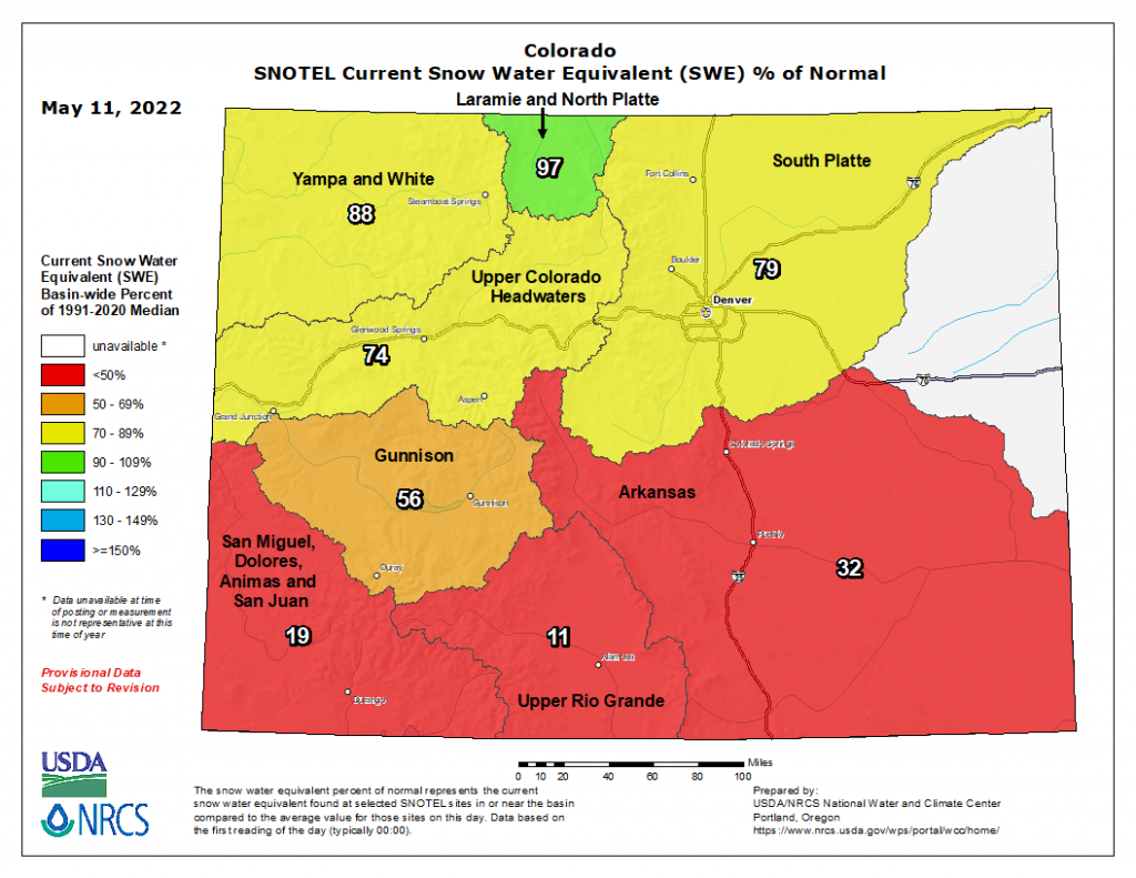
There has been basically no precipitation across the state in the last 48-hours, as seen in the QPE map below; and high temperatures coupled with strong winds have allowed for rapid melt of mountain snowpack, especially in Southern Colorado. The current map of Snow Water Equivalent (SWE) below shows a clear distinction between Northern and Southern Colorado, with the southern basins at 32% of normal or less for this time of year. Gunnison is not faring much better with only 56% of average SWE for this time of year. Only the Laramie & North Platte Basin in the very northern portion of the state is near normal.
There were no flood reports yesterday. For rainfall estimates in your area, check out the MetStorm Live QPE below.
