SPM 05-18-2022: Scattered Thunderstorms Across Northern Colorado

Issue Date: Wednesday, May 18th, 2022
Issue Time: 10:00 AM MDT

Summary:

Yesterday afternoon, scattered storms began to develop along a boundary and associated plume of higher moisture draped across Northern Colorado, extending from the Northwest Slope to the Northeast Plains. Overall precipitation totals were modest, but 0.01-0.20 inch observations were reported across Northern Colorado. By evening, storms had increased in coverage and spread onto the Palmer Ridge and portions of the Southeast Plains as well, while the rest Southern Colorado remained largely warm and dry.

As discussed in the FTB yesterday, the threat of severe weather was greater than the threat of heavy rainfall from these storms. Idalia in Yuma County saw the highest rainfall total yesterday – 0.34 from a CoCoRaHS observer, but there were also reports of 1-inch tree limbs broken and shingles blown off from high winds.  Elsewhere, thunderstorms produced gusty outflow winds, including a 48-mph gust in Meeker and 54-mph in Glenwood Springs. On the Eastern Plains, a severe thunderstorm warning was issued along the Kansas border, which caused a 60-mph wind gust in Firstview in Cheyenne County.

In other weather news, a fire started yesterday afternoon near Pagosa Springs in the San Juan Mountains, now called the Plumtaw Fire. More information about that fire is seen in the tweet from the Forest Service below. On a more positive note, the High Park Fire is now 69% contained as of last night.

There were no flood reports yesterday. For rainfall estimates in your area check out the MetStorm Live QPE below.
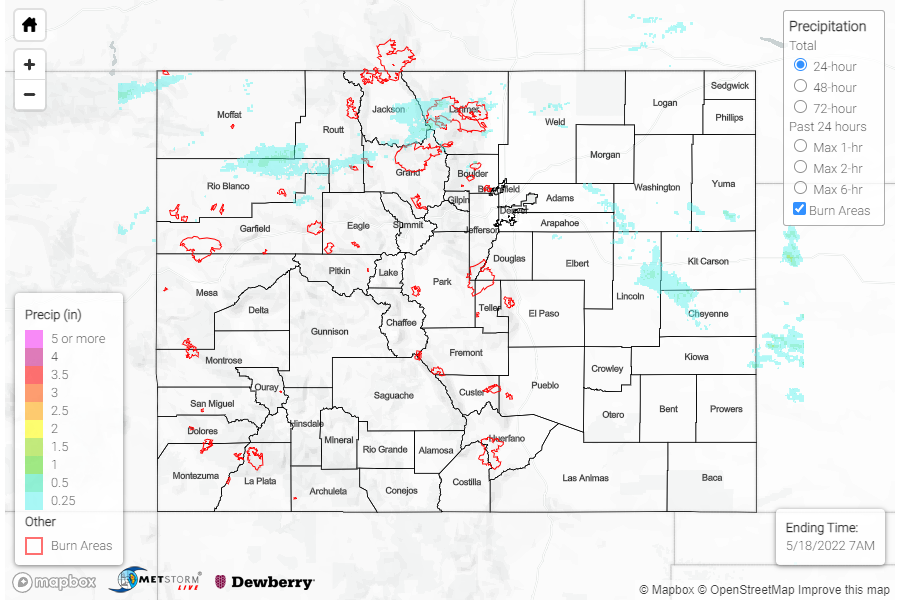
Click Here For Map Overview

The map below shows radar-estimated, rainfall gage-adjusted Quantitative Precipitation Estimates (QPE) across Colorado. The map is updated daily during the operational season (May 1 – Sep 30) by 11AM. The following six layers are currently available: 24-hour, 48-hour and 72-hour total precipitation, as well as maximum 1-hour, 2-hour and 6-hour precipitation over the past 24 hour period (to estimate where flash flooding may have occurred). The accumulation ending time is 7AM of the date shown in the bottom right corner. Also shown optionally are vulnerable fire burn areas (post 2012), which are updated throughout the season to include new, vulnerable burn areas. The home button in the top left corner resets the map to the original zoom.

SPM 05-17-2022: Severe Thunderstorms on Eastern Plains

Issue Date: Tuesday, May 17th, 2022
Issue Time: 10:25 AM MDT

Summary:

Early afternoon yesterday, isolated showers began to pop up over the Northern, Central, and Southeast Mountains associated with the eastward progression of a disturbance embedded in the overall ridge pattern. After moving east off the mountains, storms were able to tap into a bit of additional available moisture and fill in, developing into more widespread convective cells, especially on the Palmer and Raton Ridges and Eastern Plains.

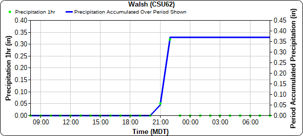
Two severe thunderstorm warnings were issued yesterday for both the very northeast and southeast corners of the state, though the main threats were high winds and damaging hail versus heavy rain. A trained spotter reported a weak landspout tornado southeast of Iliff in the Northeast Plains, and several 50-60 mph wind gusts were reported northeast of Sterling near the Wyoming and Nebraska borders. A CoCoRaHS observer in Iliff also reported 0.34 inches of rain yesterday associated with the storms. On the Southeast Plains, the severe thunderstorm near Walsh produced 65 mph wind gusts and pea-sized hail. The cell also went over the CoAgMet station in Walsh, which picked up the highest precipitation across Colorado yesterday, a quick 0.37 between 9 and 11 pm, as seen in the hyetograph below.

Western Colorado remained largely dry yesterday, with a few non-thunderstorm high wind reports, including a 46 mph gust on Douglas Pass – which has seen some impressive gusts so far this year. The High Park Fire also continued to grow; it is now at 1572 acres with 37% containment. What little rain fell over the fire yesterday was not sufficient to increase any moisture in burning fuels, and gusty outflow winds from storms caused erratic fire behavior.

There were no flood reports yesterday. For rainfall estimates in your area check out the MetStorm Live QPE below.
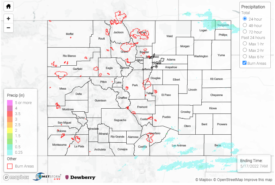
Click Here For Map Overview

The map below shows radar-estimated, rainfall gage-adjusted Quantitative Precipitation Estimates (QPE) across Colorado. The map is updated daily during the operational season (May 1 – Sep 30) by 11AM. The following six layers are currently available: 24-hour, 48-hour and 72-hour total precipitation, as well as maximum 1-hour, 2-hour and 6-hour precipitation over the past 24 hour period (to estimate where flash flooding may have occurred). The accumulation ending time is 7AM of the date shown in the bottom right corner. Also shown optionally are vulnerable fire burn areas (post 2012), which are updated throughout the season to include new, vulnerable burn areas. The home button in the top left corner resets the map to the original zoom.

SPM 05-16-2022: Seasonable Temperatures and Mostly Clear Skies for Last Night’s Lunar Eclipse

Issue Date: Monday, May 16th, 2022
Issue Time: 9:45 AM MDT

Summary:

As anticipated, yesterday was an overall quiet day for weather across Colorado with generally seasonable to slightly warmer temperatures and dry conditions for much of the state. In the late afternoon, cloud coverage and very isolated showers developed in Southern Colorado, including the southern portion of the Front Range Mountains, Southeast Mountains, San Luis Valley, Palmer and Raton Ridges, and Southeast Plains – however the very dry surface layer inhibited most rainfall, instead producing virga. There are only a handful of Trace-0.01 observations across the region.

From my vantage point in Trinidad, we received 0.01 inches of rain (not enough to show up on the QPE map below) and the clouds were timed just right to cover most of last night’s lunar eclipse. If you missed it last night too, the #cowx hashtag is full of great shots from across the state of of the Super Flower Blood Moon lunar eclipse, including this one from William Woody in Montrose.

There were no flood reports yesterday. For rainfall estimates in your area, including antecedent conditions, check out the MetStorm Live QPE below.
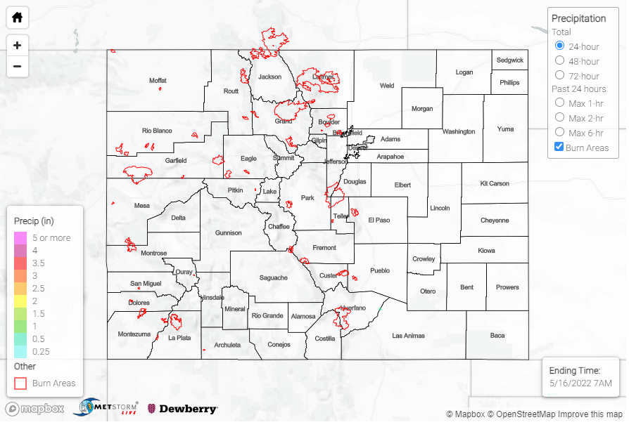
Click Here For Map Overview

The map below shows radar-estimated, rainfall gage-adjusted Quantitative Precipitation Estimates (QPE) across Colorado. The map is updated daily during the operational season (May 1 – Sep 30) by 11AM. The following six layers are currently available: 24-hour, 48-hour and 72-hour total precipitation, as well as maximum 1-hour, 2-hour and 6-hour precipitation over the past 24 hour period (to estimate where flash flooding may have occurred). The accumulation ending time is 7AM of the date shown in the bottom right corner. Also shown optionally are vulnerable fire burn areas (post 2012), which are updated throughout the season to include new, vulnerable burn areas. The home button in the top left corner resets the map to the original zoom.

SPM 05-15-2022: Mild and Pleasant Spring Day

Issue Date: Sunday, May 15th, 2022
Issue Time: 9:40 AM MDT

Summary:

Zonal flow aloft yesterday allowed for another quiet and dry day across Colorado. There was no precipitaiton reported across the state, with mostly breezy conditions and seasonable tempertaures all around. Fire danger remained high however – grass fires continued to spark up around Colorado Springs and the High Park Fire burning in Teller County is now at over 1150 acres with only 10% containment. Smoke from the High Park Fire also resulted in poor air quality in Teller and El Paso Counties. A prescribed burn near Aspen also contributed to poor air quality in the Pikes Peak region as well.

Winds generally out of the west has kept smoke from the large Calf Canyon and Hermits Peak fires in New Mexico out of Southern and Eastern Colorado this weekend. Matt Minnillo shared the following image on twitter of the pyrocumulus, a cloud formed from rising hot air above a fire, from those fires near their viewpoint around Alamosa.

There were no flood reports yesterday. For rainfall estimates in your area, including antecedent conditions, check out the MetStorm Live QPE below.
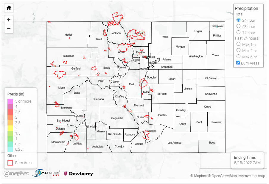
Click Here For Map Overview

The map below shows radar-estimated, rainfall gage-adjusted Quantitative Precipitation Estimates (QPE) across Colorado. The map is updated daily during the operational season (May 1 – Sep 30) by 11AM. The following six layers are currently available: 24-hour, 48-hour and 72-hour total precipitation, as well as maximum 1-hour, 2-hour and 6-hour precipitation over the past 24 hour period (to estimate where flash flooding may have occurred). The accumulation ending time is 7AM of the date shown in the bottom right corner. Also shown optionally are vulnerable fire burn areas (post 2012), which are updated throughout the season to include new, vulnerable burn areas. The home button in the top left corner resets the map to the original zoom.