Issue Date: Tuesday, May 17th, 2022
Issue Time: 10:25 AM MDT
Summary:
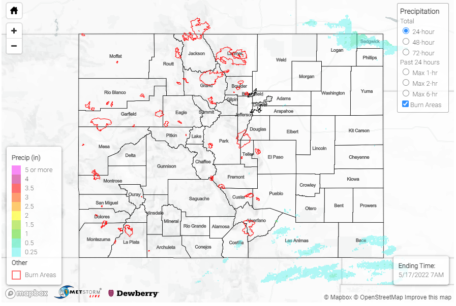
Early afternoon yesterday, isolated showers began to pop up over the Northern, Central, and Southeast Mountains associated with the eastward progression of a disturbance embedded in the overall ridge pattern. After moving east off the mountains, storms were able to tap into a bit of additional available moisture and fill in, developing into more widespread convective cells, especially on the Palmer and Raton Ridges and Eastern Plains.
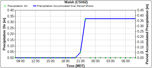
Two severe thunderstorm warnings were issued yesterday for both the very northeast and southeast corners of the state, though the main threats were high winds and damaging hail versus heavy rain. A trained spotter reported a weak landspout tornado southeast of Iliff in the Northeast Plains, and several 50-60 mph wind gusts were reported northeast of Sterling near the Wyoming and Nebraska borders. A CoCoRaHS observer in Iliff also reported 0.34 inches of rain yesterday associated with the storms. On the Southeast Plains, the severe thunderstorm near Walsh produced 65 mph wind gusts and pea-sized hail. The cell also went over the CoAgMet station in Walsh, which picked up the highest precipitation across Colorado yesterday, a quick 0.37 between 9 and 11 pm, as seen in the hyetograph below.
Western Colorado remained largely dry yesterday, with a few non-thunderstorm high wind reports, including a 46 mph gust on Douglas Pass – which has seen some impressive gusts so far this year. The High Park Fire also continued to grow; it is now at 1572 acres with 37% containment. What little rain fell over the fire yesterday was not sufficient to increase any moisture in burning fuels, and gusty outflow winds from storms caused erratic fire behavior.
There were no flood reports yesterday. For rainfall estimates in your area check out the MetStorm Live QPE below.

