SPM 08-05-2019: Flash Flooding over Lake Christine Burn Area

Issue Date: Monday, August 5, 2019
Issue Time: 10:45AM MDT

Summary:

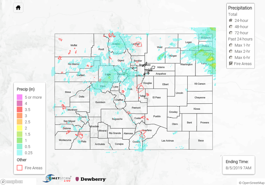
Yesterday was a very active day for emergency crews in Eagle and Pitkin Counties near Basalt. Radar derived between 0.5 and 0.6 inches over and near the Lake Christine burn area early last night. A Flash Flood Warning was issued by the NWS around 5:45 PM yesterday, which extended until 11:45 PM last night. Emergency officials closed Frying Pan Road around 6 PM with reports of four individual mud slides over the road.  Water was reported over to be flowing over roadways throughout the area. Approximately 10 vehicles were stuck between the slides on Frying Pan Road, but luckily no injuries were reported. Frying Pan Road and Two Rivers Road were able to open by 9 PM but conditions remained variable as emergency crews removed debris. Mud slides and high water levels impacted up to 30 homes, and mud was reported to be around several homes. Luckily there were no injuries or reports of property damage in the area. The Central Mountains received the highest rainfall totals for the mountains yesterday as the shortwave passed overhead. Radar derived up to an inch over central eagle County, with a CoCoRaHS station reporting 1.23 inches near Avon.

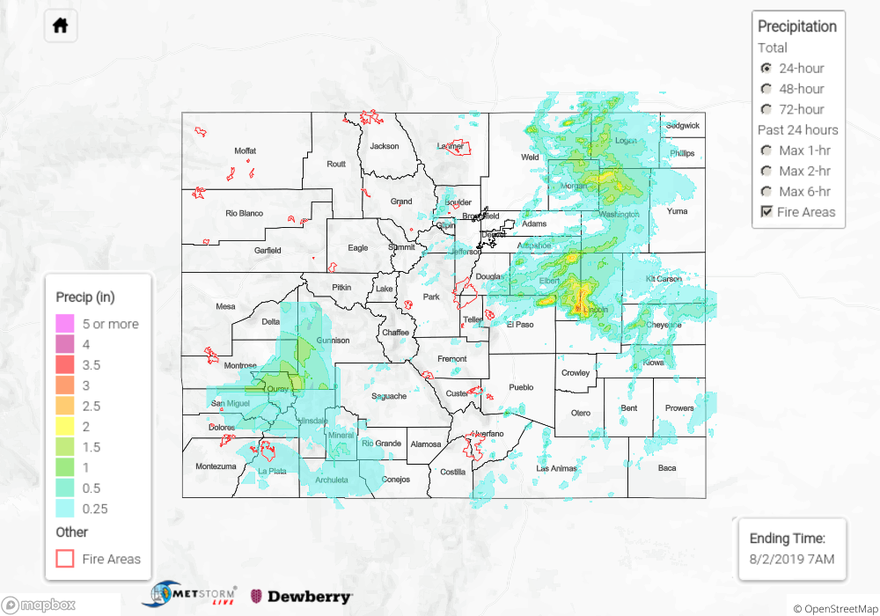
Multiple Areal Flood Advisories were issued over the Hayden Pass and Spring Creek burn areas. Radar derived up to 0.5 inches over the area but no flooding was reported. The other main rainfall story yesterday was over the far Northeast Plains. Three storms passed over the area between 8 PM and 3 AM yesterday, with radar deriving up to 2.5 inches over Yuma County. Another round of light rain passed through the area again this morning around sunrise, which contributed to the total. A CoCoRaHS station near Yuma reported up to 2.25 inches of rain yesterday.

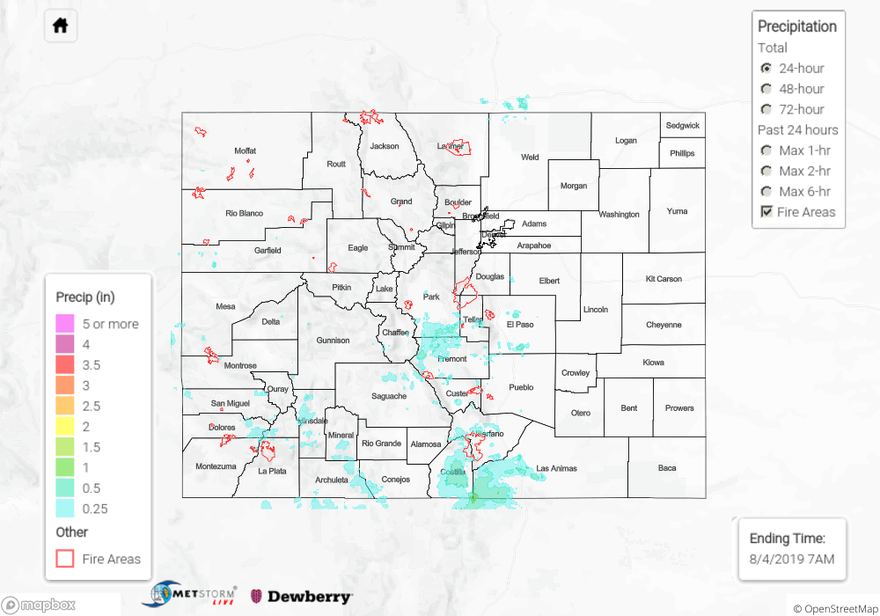
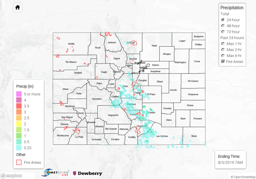
For a look at precipitation in your area, please see the State Precipitation Map below.

Click Here For Map Overview

The map below shows radar-estimated, rainfall gage-adjusted Quantitative Precipitation Estimates (QPE) across Colorado. The map is updated daily during the operational season (May 1 – Sep 30) by 11AM. The following six layers are currently available: 24-hour, 48-hour and 72-hour total precipitation, as well as maximum 1-hour, 2-hour and 6-hour precipitation over the past 24 hour period (to estimate where flash flooding may have occurred). The 24-hour, 48-hour and 72-hour total precipitation contain bias corrections that are not disaggregated into the hourly estimates, so there will likely be some differences. The accumulation ending time is 7AM of the date shown in the bottom right corner. Also shown optionally are vulnerable fire burn areas (post 2012), which are updated throughout the season to include new, vulnerable burn areas. The home button in the top left corner resets the map to the original zoom.

SPM 08-04-2019: Flash Flooding over the Spring Creek Burn Area

Issue Date: Sunday, August 4, 2019
Issue Time: 10:30AM MDT

Summary:

The Wet Mountains (a portion of the Southeast Mountains) are holding up to their name this season. More moderate to heavy rain over the area caused multiple Areal Flood Advisories to be issued yesterday afternoon and early evening. Flash flooding was reported to the NWS over the Spring Creek burn area, with a rock slide closing CR 572. Heavy rainfall of 1.07 inches fell over 70 minutes near Crestone in eastern Saguache County. Multiple CoCoRaHS stations reported up to 1.1 inches of rain in eastern Saguache and Alamosa Counties. Heavy rainfall avoided most of the other burn areas over the Southeast Mountains and San Juan Mountains. Up to 0.25 inches were reported over the northern edge of the 416 burn area, with most rainfall falling to the southeast in La Plata and Archulta Counties. 1.03 inches was recorded by a CoCoRaHS station to the east of Pagosa Springs. Radar derived up to 0.5 inches over the San Juan Mountains and Southwest Slope. Most other areas of the state remained dry, with trace amounts reported over the northern Front Range and Northwest Slope.

For a look at precipitation over your area, please visit the State Precipitation Map below.

Click Here For Map Overview

The map below shows radar-estimated, rainfall gage-adjusted Quantitative Precipitation Estimates (QPE) across Colorado. The map is updated daily during the operational season (May 1 – Sep 30) by 11AM. The following six layers are currently available: 24-hour, 48-hour and 72-hour total precipitation, as well as maximum 1-hour, 2-hour and 6-hour precipitation over the past 24 hour period (to estimate where flash flooding may have occurred). The 24-hour, 48-hour and 72-hour total precipitation contain bias corrections that are not disaggregated into the hourly estimates, so there will likely be some differences. The accumulation ending time is 7AM of the date shown in the bottom right corner. Also shown optionally are vulnerable fire burn areas (post 2012), which are updated throughout the season to include new, vulnerable burn areas. The home button in the top left corner resets the map to the original zoom.

SPM 08-03-2019: Flash Flooding over Spring Creek burn area and Colorado Springs

Issue Date: Saturday, August 3rd, 2019
Issue Time: 10:45AM MDT

Summary:

Upslope flow of moisture from the southwest and eastern plains provided moderate rainfall over the San Juan Mountains, Southwest Slope and Southeast Mountains.  Storms moved off of the Southeast Mountains yesterday afternoon, providing decent totals over the foothills and adjacent plains.  The highest accumulation yesterday was over Pueblo County, where radar derived up to 1.5 inches.  CoCoRaHS stations reported moderate rainfall up to 1.15 inches near Colorado Springs in El Paso County.  An Area Flood Advisory was issued at 2:45PM over the area, with a reports of urban and small stream flooding after 0.6 inches fell in 45 minutes.  Flash Flood Warnings were issued last night around 8PM over the Spring Creek burn area, with law enforcement reporting flash flooding over the northeast portion of the burn area.

There were two reports of heavy rain over La Plata County near Hesperus and Archuleta County near Pagosa Springs of 1.0 and 0.69 inches respectively.  Most of the precipitation fell overnight, but there were no reports of flooding due to the heavy rains.  High winds and pea sized hail caused downed branches near Hesperus.  Westerly flow aloft kept most other areas over the west pretty dry.  An isolated storm near Pine Ridge to the north of Grand Junction in Mesa County recorded 0.21 inches.  Air underneath the storm base was a little drier up to the north, which limited storms and rainfall over the northern Front Range and Urban Corridor.  CoCoRaHS stations reported up to 0.31 inches in Boulder and Larimer Counties, with trace amounts over most of the Urban Corridor.

For a look at precipitation over your area, please visit the State Precipitation Map below. Note: the Grand Junction Radar is up and running again today, however totals over western Colorado are likely underestimated due to radar maintenance yesterday.

Click Here For Map Overview

The map below shows radar-estimated, rainfall gage-adjusted Quantitative Precipitation Estimates (QPE) across Colorado. The map is updated daily during the operational season (May 1 – Sep 30) by 11AM. The following six layers are currently available: 24-hour, 48-hour and 72-hour total precipitation, as well as maximum 1-hour, 2-hour and 6-hour precipitation over the past 24 hour period (to estimate where flash flooding may have occurred). The 24-hour, 48-hour and 72-hour total precipitation contain bias corrections that are not disaggregated into the hourly estimates, so there will likely be some differences. The accumulation ending time is 7AM of the date shown in the bottom right corner. Also shown optionally are vulnerable fire burn areas (post 2012), which are updated throughout the season to include new, vulnerable burn areas. The home button in the top left corner resets the map to the original zoom.

SPM 08-02-2019: Monsoon Surge Causes Statewide Heavy Rainfall

Issue Date: Friday, August 2nd, 2019
Issue Time: 10:00AM MDT

Summary:

Heavy rainfall day across the state during the peak of the latest monsoon surge. Only a few isolated areas didn’t receive any rainfall. We’ll start over eastern Colorado. Lee troughing allowed for some severe weather over the eastern plains as well thanks to directional shear. Storms began to form over the mountains around 1PM with additional storms forming over the Northeast Plains a couple hours later. A Severe Thunderstorm Watch was issued around 3PM for the Northeast Plains, Palmer Ridge and eastern portion of the Urban Corridor. Storms eventually moved east and formed into a cluster, which allowed for some widespread rain last night. Overall, storms yesterday initially (before they clustered into a MCS) produced 60 mph gusts with hail up to 1.75 inches reported over Logan County. Smaller hail was realized over Cheyenne County (0.7 inches) as instability/dynamics decreased later into the night. There were several reports of heavy rain over Lincoln County with the highest report being 3 inches in 1.5 hours. Another spotter recorded 1.94 inches in 45 minutes over this area. MetStorm indicates up to 3.5 inches fell in this core, although this value seems a little inflated given the reports in the area. Up to 2.5 inches fell in northern Washington County according to radar estimations. A CoCoRaHS station in Akron recorded 1.63 inches for the event.

A hefty amount of rain also fell over Southwest Colorado. QPE (especially Max 1-6 hours) by MetStorm may be a little wonky spatially over the high terrains due to the GJT radar being down (routine maintenance through Aug 3rd), but still some great observations over the area. Over Southern La Plata County and Conejos County, there were two reports of 0.83 inches and 0.79 inches, respectively. An Areal Flood Advisory was issued for the 416 burn area at 6PM. They do have the PX1000 radar running again, so that was nice to have to monitor the situation. Flooding was not reported as of this morning, although gages near the scar recorded between 0.33 and 0.5 inches. The heaviest rainfall was over Ouray and southwestern Gunnison County. MetStorm estimates up to 1.7 inches fell for the 24-hour period. Two CoCoRaHS sites near Ridgeway, CO recorded 1.48 and 1.05 inches. A SNOTEL site near Lake City, CO had 0.8 inches for the day. Thankfully, higher rainfall amounts were just to the east and south of the Lake Christine burn area. Despite the heavy rainfall yesterday, there were no reports of flooding as of this morning.

To see estimated precipitation totals over your neighborhood on Thursday, scroll down the State Precipitation Map below.

Click Here For Map Overview

The map below shows radar-estimated, rainfall gage-adjusted Quantitative Precipitation Estimates (QPE) across Colorado. The map is updated daily during the operational season (May 1 – Sep 30) by 11AM. The following six layers are currently available: 24-hour, 48-hour and 72-hour total precipitation, as well as maximum 1-hour, 2-hour and 6-hour precipitation over the past 24 hour period (to estimate where flash flooding may have occurred). The 24-hour, 48-hour and 72-hour total precipitation contain bias corrections that are not disaggregated into the hourly estimates, so there will likely be some differences. The accumulation ending time is 7AM of the date shown in the bottom right corner. Also shown optionally are vulnerable fire burn areas (post 2012), which are updated throughout the season to include new, vulnerable burn areas. The home button in the top left corner resets the map to the original zoom.