Issue Date: Monday, August 5, 2019
Issue Time: 10:45AM MDT
Summary:
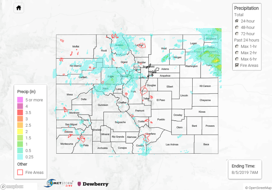
Yesterday was a very active day for emergency crews in Eagle and Pitkin Counties near Basalt. Radar derived between 0.5 and 0.6 inches over and near the Lake Christine burn area early last night. A Flash Flood Warning was issued by the NWS around 5:45 PM yesterday, which extended until 11:45 PM last night. Emergency officials closed Frying Pan Road around 6 PM with reports of four individual mud slides over the road. Water was reported over to be flowing over roadways throughout the area. Approximately 10 vehicles were stuck between the slides on Frying Pan Road, but luckily no injuries were reported. Frying Pan Road and Two Rivers Road were able to open by 9 PM but conditions remained variable as emergency crews removed debris. Mud slides and high water levels impacted up to 30 homes, and mud was reported to be around several homes. Luckily there were no injuries or reports of property damage in the area. The Central Mountains received the highest rainfall totals for the mountains yesterday as the shortwave passed overhead. Radar derived up to an inch over central eagle County, with a CoCoRaHS station reporting 1.23 inches near Avon.
Multiple Areal Flood Advisories were issued over the Hayden Pass and Spring Creek burn areas. Radar derived up to 0.5 inches over the area but no flooding was reported. The other main rainfall story yesterday was over the far Northeast Plains. Three storms passed over the area between 8 PM and 3 AM yesterday, with radar deriving up to 2.5 inches over Yuma County. Another round of light rain passed through the area again this morning around sunrise, which contributed to the total. A CoCoRaHS station near Yuma reported up to 2.25 inches of rain yesterday.
For a look at precipitation in your area, please see the State Precipitation Map below.
Click Here For Map Overview
