Issue Date: Sunday, August 4, 2019
Issue Time: 10:30AM MDT
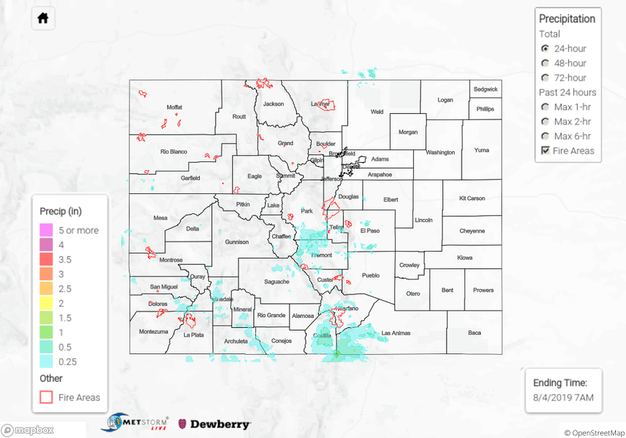
Summary:
The Wet Mountains (a portion of the Southeast Mountains) are holding up to their name this season. More moderate to heavy rain over the area caused multiple Areal Flood Advisories to be issued yesterday afternoon and early evening. Flash flooding was reported to the NWS over the Spring Creek burn area, with a rock slide closing CR 572. Heavy rainfall of 1.07 inches fell over 70 minutes near Crestone in eastern Saguache County. Multiple CoCoRaHS stations reported up to 1.1 inches of rain in eastern Saguache and Alamosa Counties. Heavy rainfall avoided most of the other burn areas over the Southeast Mountains and San Juan Mountains. Up to 0.25 inches were reported over the northern edge of the 416 burn area, with most rainfall falling to the southeast in La Plata and Archulta Counties. 1.03 inches was recorded by a CoCoRaHS station to the east of Pagosa Springs. Radar derived up to 0.5 inches over the San Juan Mountains and Southwest Slope. Most other areas of the state remained dry, with trace amounts reported over the northern Front Range and Northwest Slope.
For a look at precipitation over your area, please visit the State Precipitation Map below.
Click Here For Map Overview