Issue Date: Monday, July 20th, 2020
Issue Time: 9:20AM MDT
— Flooding is NOT expected today
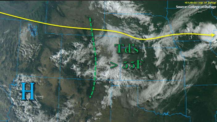
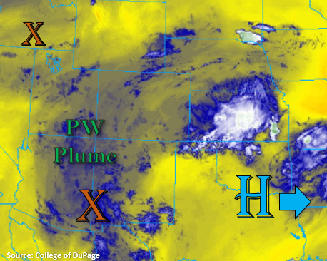
High dew points again to start the morning over eastern Colorado, and much drier conditions back to the west. Denver’s morning sounding showed PW decreasing (0.67 inches) with very shallow surface moisture again, so expecting afternoon storms to be high-based with gusty winds possible over the adjacent eastern plains and mountains today. Northerly surface winds along the northern, adjacent plains will keep the precipitation chances higher south of the Denver Metro area. However, the more northerly steering flow aloft could track a storm across the border that develops along the Cheyenne Ridge. Again, the main threat will be strong outflow winds.
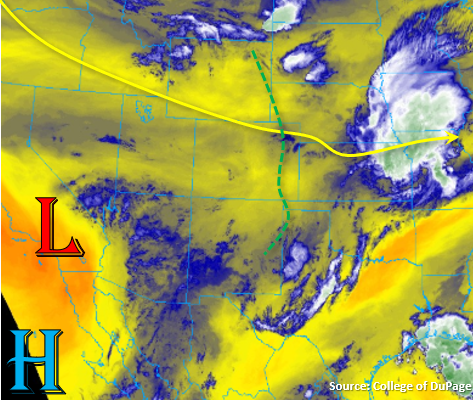
Best surface moisture will be east of the green line below on the eastern and northern side of a developing lee cyclone. So, expect additional, stronger storms over the far eastern plains to develop along a line of convergence associated with the surface low. Lack of shear this afternoon will keep the chances for severe thunderstorms lower than yesterday, but very strong outflow winds are still forecast. While rain rates are expected to intensify in the more moisture rich environment, storm cores should be smaller and rain rates should remain just under flood threat criteria. Therefore, no flood threat has been issued. Overnight, an MCS looks to develop near the NE/CO border, but the heavy rainfall looks to remain just east of the state. At this time, it does not look like this feature will build back to the west. If later runs show an increasing flood threat, an afternoon update will be issued.
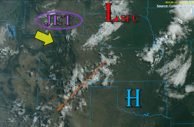
Over western Colorado, recycled moisture will produce another round of weak storms in similar fashion to yesterday. However, PW values have dropped off a bit, so storms are forecast to produce less rainfall. Large dew point depressions, as indicated by the Grand Junction sounding this morning, will cause the main threat from storms to be gusty outflow winds.
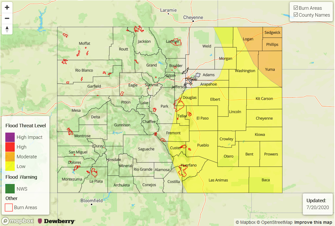
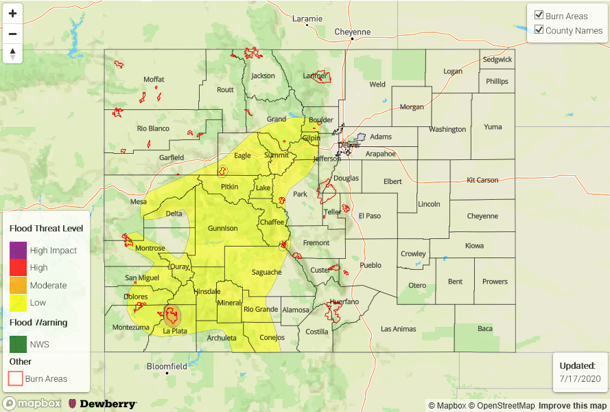
Today’s Flood Threat Map
For more information on today’s flood threat, see the map below. If there is a threat, hover over the threat areas for more details, and click on burn areas to learn more about them. For Zone-Specific forecasts, scroll below the threat map.

Zone-Specific Forecasts:
Front Range, Southeast Mountains, Urban Corridor, Palmer Ridge, Raton Ridge, Southeast Plains, & Northeast Plains:
Over the eastern mountains, storms should start to form by early afternoon favoring the southern Front Range, northern Southeast Mountains, and Palmer Ridge for development. Coverage of storms will be less today, and max 1-hour rain rates will drop to 0.25 inches. There’s an isolate chance for a max 1-hour rain rate of 0.50 inches over the adjacent plains along the Urban Corridor. Flooding is not expected.
Additional storms will form over the far southeast plains. Max 1-hour rain rates up to 1.40 inches will be possible, but small storm cores should limit the heavy rainfall threat. Thus, no flood threat has been issued. The main threat from storms will be small hail and very strong outflow winds with the larger dew point depression today (up to 60 mph). An MCS looks to form near the CO/NE border, but heaviest rainfall looks to remain east of the state. If this feature looks like it will build back to the west by this afternoon, an update will be issued.
Primetime: 1PM to 11PM
San Juan Mountains, Central Mountains, Northern Mountains, Northwest Slope, Grand Valley, San Luis Valley, & Southwest Slope:
Outside of some scattered convection over the San Juan Mountains and Central Mountains, it should remain dry this afternoon. Storms will favor areas along and near the Continental Divide and be capable of producing some strong outflow winds (40 to 50 mph). Max 1-hour rain rates up to 0.20 inches will be possible with morning totals up to 0.40 inches possible over the southern San Juan Mountains from a couple rounds of rain. Flooding is not forecast.
Primetime: 1PM to 8PM