Issue Date: Monday, August 29th, 2022
Issue Time: 10:30 AM MDT
— Flooding is NOT expected today
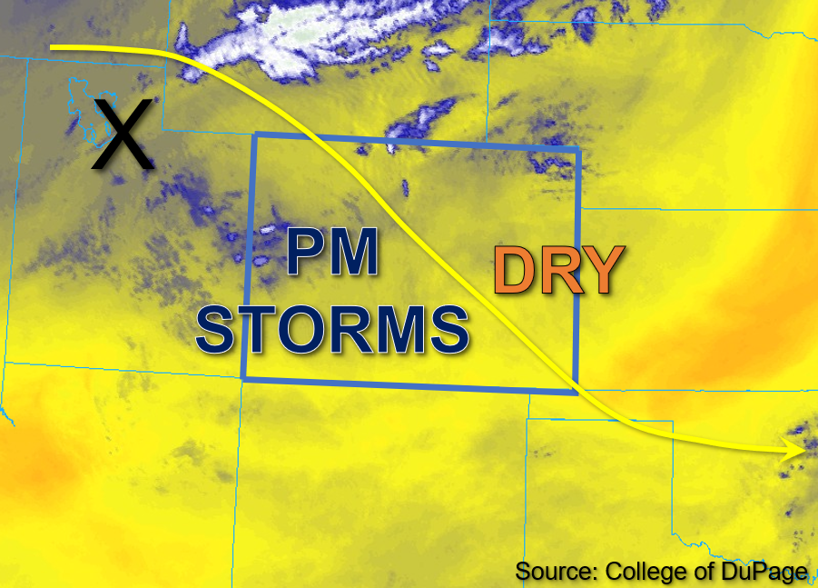
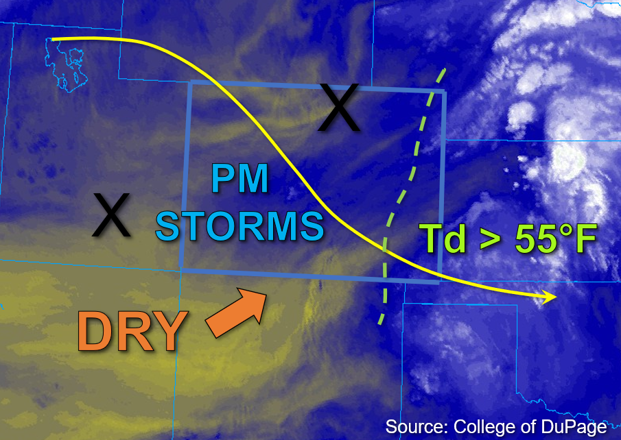
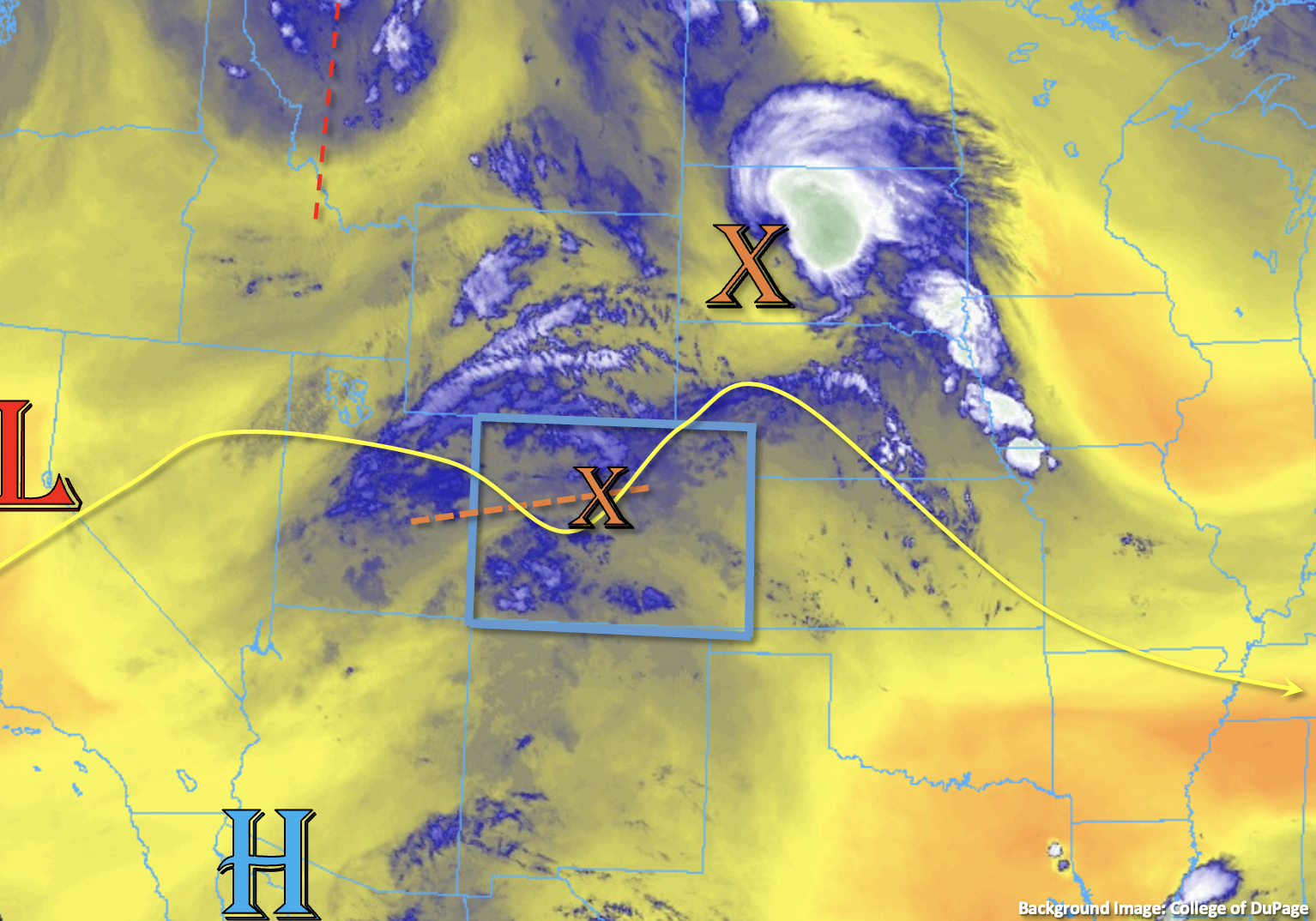
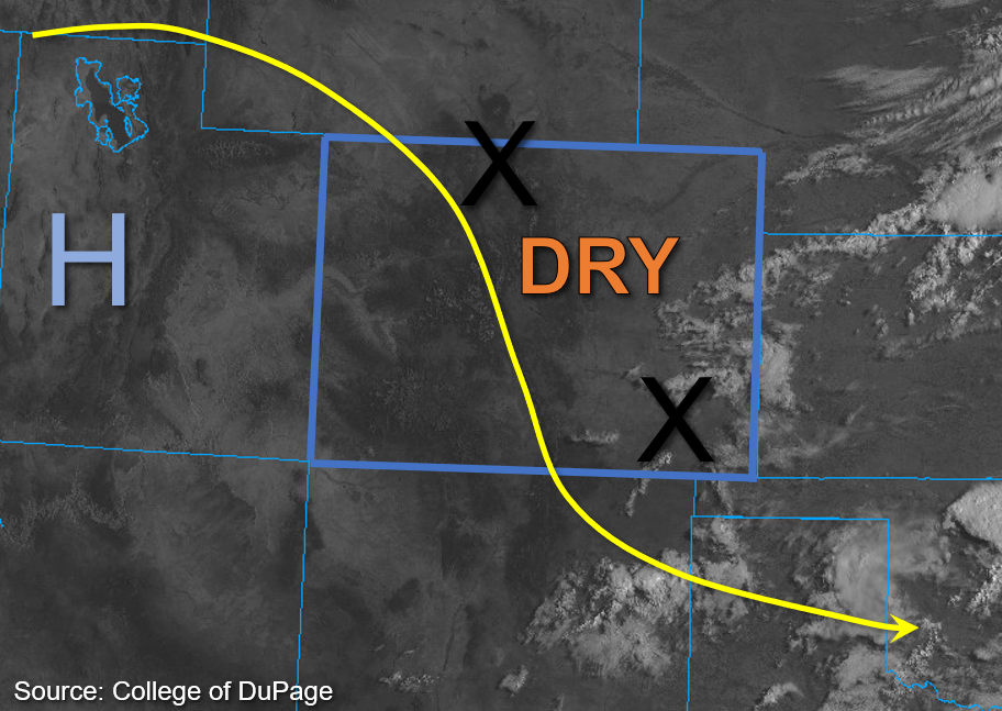
A ridge of high pressure is currently situated over western Utah this morning and is continuing to wrap drier air into Colorado with northwest flow. A few weak impulses are noted in the flow and are marked by the “X’s” in the visible satellite image below. The southeastern impulse that is responsible for this morning’s light showers over the plains will continue to move out of the state, and will be followed by another weak impulse to the north. As the northern impulse moves through the flow, it may trigger an isolated storm or two over the high terrain south. However, rising pressure across the state should promote subsidence, helping to limit rainfall chances. Moisture is also expected to be quite limited today, as in prior days, with Grand Junction measuring PW of 0.67 inches and Platteville measuring PW of 0.56 inches this morning. Dew points are typically in the mid-30s in the mountains and upper 40s°F across lower elevations, with low to mid-50s°F noted over the far eastern plains this morning. Later today, instability is forecast to be highest across the southeastern border counties with values ranging from 750-1000 J/kg of CAPE forecast this afternoon. With northerly steering flow and warmer temperatures aloft, along with marginal boundary layer moisture, any storms that can develop should be of low intensity. In addition to producing brief rainfall, storms may produce lightning and gusty winds. NO flooding is expected today.
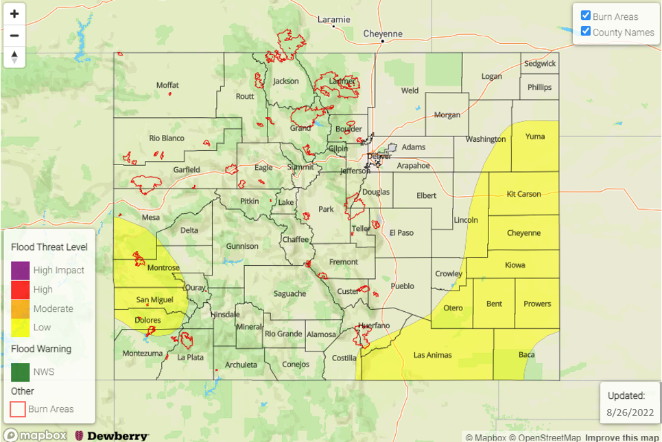
Today’s Flood Threat Map
For more information on today’s flood threat, see the map below. If there is a threat, hover over the threat areas for more details, and click on burn areas to learn more about them. For Zone-Specific forecasts, scroll below the threat map.

Zone-Specific Forecasts:
Front Range, Urban Corridor, Northeast Plains, Palmer Ridge, Southeast Mountains, Raton Ridge, & Southeast Plains:
Slightly cooler temperatures are forecast today behind the passage of a weak cold front. This afternoon, isolated storms may develop over the southern Southeast Mountains and adjacent plains producing light to moderate rain rates up to 0.25 inches over a 30-to-45-minute span. Over the far southeast border counties of the Southeast Plains, where slightly higher moisture may exist, rain rates up to 0.6 inches over the same time span may be possible. However, subsidence is strong today, so storm potential is low and those that can develop shouldn’t last long. Elsewhere, clear skies and mainly dry conditions should be predominant for eastern Colorado today and NO flooding is expected.
Primetime: 2PM to 7PM
Southwest Slope, San Juan Mountains, San Luis Valley, Grand Valley, Central Mountains, Northern Mountains & Northwest Slope:
A few stray high clouds were noted across portions of the Southwest Slope and mountains this morning, otherwise the clear and dry conditions should continue. Given the negligible moisture and increasing subsidence, storms are unlikely for western Colorado and NO flooding is expected today.