Issue Date: Friday, August 26th, 2022
Issue Time: 10:05AM MDT
— A LOW flood threat has been issued for the Southwest Slope, Raton Ridge, Southeast Plains, and portions of the Palmer Ridge, Southeast Mountains and Northeast Plains
— Fire-Burn Forecast Summary: 1 burn area under MODERATE threat, 8 burn areas under LOW threat; click HERE for more info
The water vapor imagery below shows the breakdown of the ridging pattern as several shortwaves continue to move through the flow. A weaker shortwave (smaller orange “X”), which helped produce the more numerous showers and storms yesterday, is forecast to move eastward into the plains today. Currently, it is helping to produce lots of cloud cover across the state and showers over the mountains. In response to the shortwave, a surface trough is forecast to develop over the adjacent plains, which should pull in a decent amount of moisture over the eastern plains with southerly surface flow. As the storms spillover into the adjacent plains with the eastward movement of the mid-level dynamics, upscale growth of the storms is expected with enhanced lift and higher instability over the area. Thus, an uptick in rainfall activity is anticipated today. It should be a bit quieter of over the northern portion of the state (north of I-70) with only isolated mountain storms forecast later this afternoon and evening thanks to increased subsidence behind the departing trough and slight drying of the atmosphere.
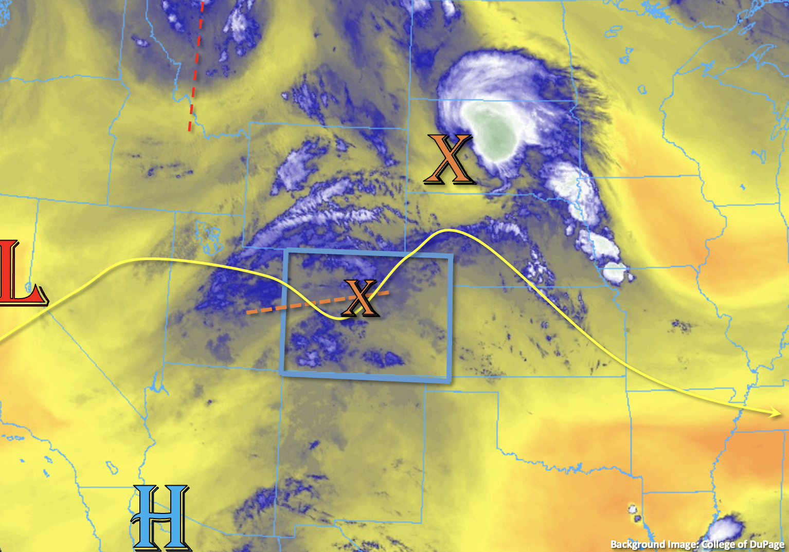
PW at Grand Junction was measured at 1.07 inches this morning and 0.83 inches at Platteville with values estimated around 1 inch across the southern border and the far eastern plains. So, it’s clear that the monsoon moisture is still overhead, which will be recycled today and potentially produce some higher rainfall rates. One limiting factor to the heavy rainfall threat, especially over the mountains, is the ongoing showers and cloud cover. It’s likely that this will limit the amount of instability that can build causing storms to be more stratiform in nature, which will reduce the flood threat. Visible satellite shows some drier air moving across portions of the southwest border, which will likely allow for moderate instability to build by early afternoon and increase the threat for convective storms over the high terrain in this area. A LOW flood threat has been issued. There has also been a LOW flood threat issued for portions of the eastern plains where convective storms will be more likely to develop this afternoon and evening. With the low-level jet kicking in this evening, it’s likely that rainfall will continue overnight for the plains.
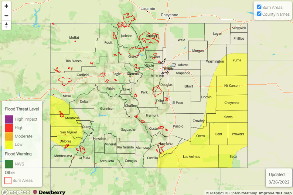
Today’s Flood Threat Map
For more information on today’s flood threat, see the map below. If there is a threat, hover over the threat areas for more details, and click on burn areas to learn more about them. For Zone-Specific forecasts, scroll below the threat map.
Zone-Specific Forecasts:
Southeast Mountains, Front Range, Raton Ridge, Urban Corridor, Palmer Ridge, Northeast Plains & Southeast Plains:
Over the mountains more scattered storm activity is forecast today with max 30-minute rain rates up to 0.4/0.6 inches (north/south) and isolated storm totals up to 0.9 inches (south) possible. Numerous to widespread showers are forecast by afternoon and into the evening as storms move off the higher terrain into the adjacent plains. Isolated max 1-hour rain rates up to 2.25 inches will be possible, so a LOW flood threat has been issued. In addition to heavy rainfall, the more intense thunderstorms will likely produce strong outflow winds and perhaps isolated hail. Rainfall will likely continue overnight, but the flood threat should end just after sundown.
Primetime: 12PM to 1AM
Central Mountains, Southwest Slope, Northwest Slope, Northern Mountains, Grand Valley, San Juan Mountains & San Luis Valley:
Widespread, stratiform rainfall is expected over the central/southern mountain zones with totals up to 1.6 inches possible. Isolated convection could develop over the southwest high terrain near the western border by this afternoon. Max 30-minute/1-hour rain rates up to 1/1.3 inches will be possible if stronger storms develop where there are breaks in cloud cover, so a LOW flood threat has been issued.
Primetime: 12PM to 9PM