Issue Date: Monday, August 17th, 2020
Issue Time: 09:50AM MDT
— Flooding is NOT expected today
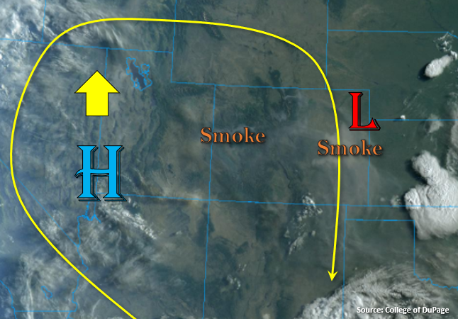
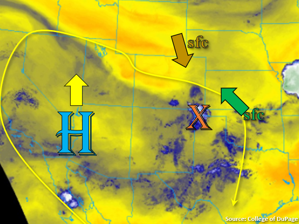
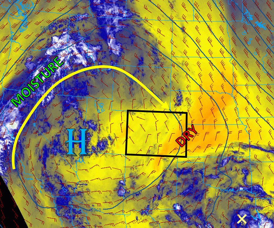
Colorado is still positioned on the eastern side of a highly amplified high pressure ridge, which is centered over southeast Nevada/southwest Utah (see image below). This ridge is keeping moisture well west of Colorado, over northern California and eastern Oregon, and will continue to circulate drier air over eastern Colorado (see image below). This drier air will mix out some leftover low-level moisture over the plains, where dew points are in the 50Fs this morning, which will lower the dew points and decrease the chances for storms today over the plains. Some mid-level moisture has pushed into the central and southern mountains, which will keep rainfall in the forecast today. Weak mid- and upper-level winds, as well as the absence of any significant shortwaves, will favor slow-moving, isolated thunderstorms over the mountains. These storms will drift south during the day due to the northerly upper-level winds, but high bases mean less rainfall and more wind, so no flooding is expected today.
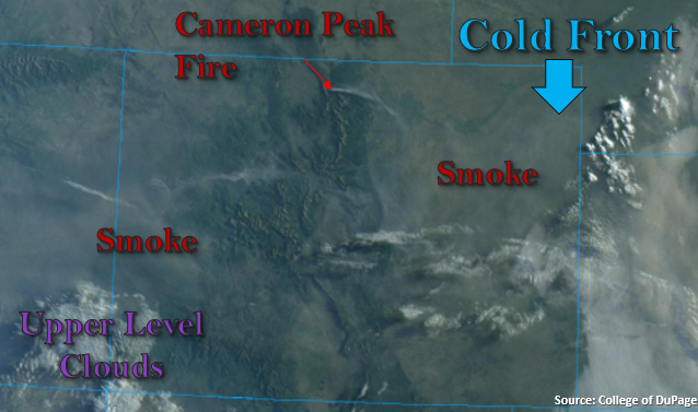
Wildfire smoke is expected to continue to impact much of the state again today as smoke is transported south by the northerly winds. An air quality alert has been re-issued by the National Weather Service for much of the Grand Valley, Central & Northern Mountains, and Front Range/Urban Corridor. Hot and dry conditions are expected once again over the west/northwest part of the state today, which will not help with mitigating the fire danger.
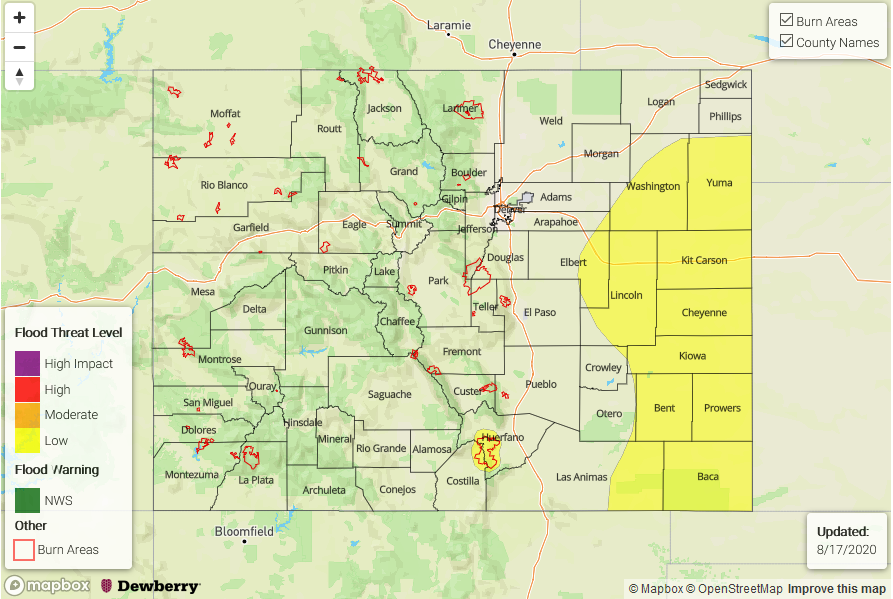
Today’s Flood Threat Map
For more information on today’s flood threat, see the map below. Hover over the threat areas for more details, and click on burn areas to learn more about them. For Zone-Specific forecasts, scroll below the threat map.

Zone-Specific Forecasts:
Northeast Plains, Urban Corridor, Front Range, Palmer Ridge, Raton Ridge, Southeast Mountains, & Southeast Plains:
Today will be another day with above average temperatures, with highs in the low to mid 90Fs for much of the plains. Some leftover moisture will allow some isolated storms to form over the higher terrains first this afternoon, which should dissipate if they move into lower-elevation regions as they move south. Max rain rates from these isolated storms should stay below 0.5 in/hr. Although convection should remain limited farther east over the plains, some storms may be able to track through the northeast corner of the state after firing over the Cheyenne Ridge to the north. Max rain rates from these discrete storms should stay below 0.7 in/hr if they are able to fire, so no flooding is expected.
Primetime: 1PM to 10PM
Grand Valley, Northwest Slope, Northern Mountains, Central Mountains, Southwest Slope, San Juan Mountains, & San Luis Valley:
Smokey skies and hot today for the Northwest Slope, Grand Valley, and Southwest Slope. Moderate chances exist for high-elevations storms to fire over the Central & San Juan Mountains. Max rain rates from these storms should stay below 0.3 in/hr as moisture is limited to the mid and upper levels. No flooding is expected today. Air quality will be an issue for many locations as wildfire smoke continues to stream south over the area.
Primetime: 1PM to 10PM