FTB 08-21-2020: Heat & Smoke

Issue Date: Friday, August 21st, 2020
Issue Time: 9:15AM MDT

— Flooding is NOT expected today

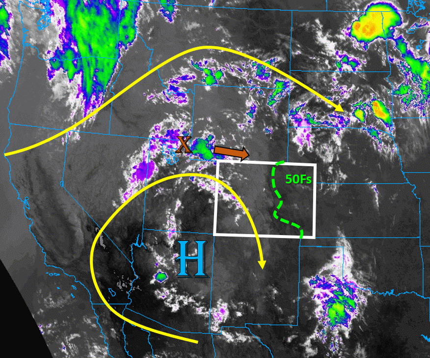
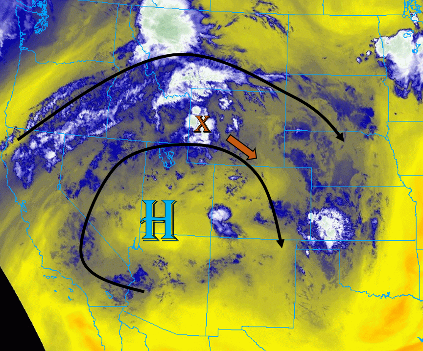
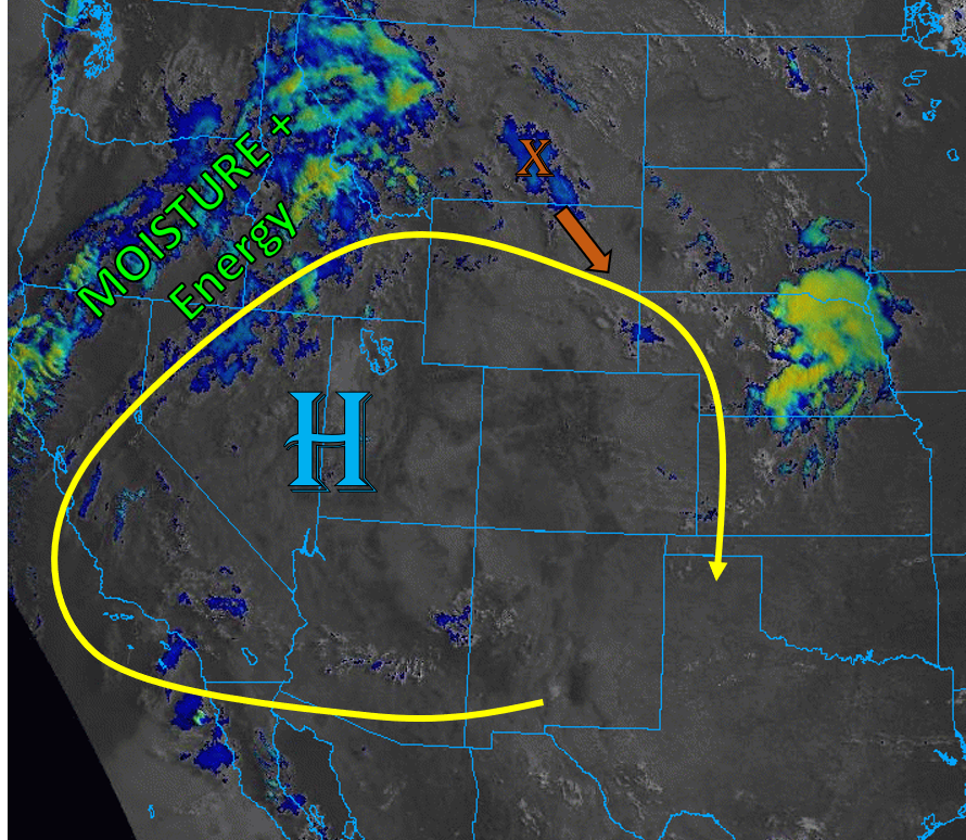
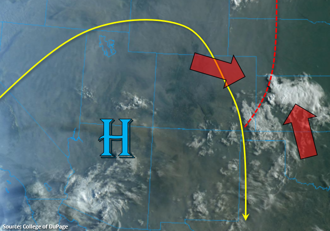
The gray hue in the visible satellite image below is actually smoke from all the wildfires that are currently burning over the western US. In total, there are about 75 large wildfires with 5 of those large fires burning in Colorado. Marked in red is a departing trough, which is causing the cloudiness over SE Colorado and rain over Kansas. Today, the High will start to strengthen and northerly flow will pull in a drier air mass into the state. With weak upslope flow anticipated this afternoon in a drying environment, little to no rainfall is expected over the mountains. Best chance for measurable rain will be if the cap over the eastern plains can break. Without a lot of upper support to help with lift, not thinking this this is too likely. However, if does occur, the weak thunderstorms should be fairly isolated. Flooding is not expected today.

Hot temperatures are also forecast with mid to upper 90Fs along the I-25 Corridor, upper 80Fs for the mountain valleys, and 100F over the Grand Valley/lower elevations of western CO. Calmer surface winds means there’s no Red Flag Warning issued today, but if some mid and upper level moisture can spark a weak storm over the mountains, brief windy conditions may be possible.

Today’s Flood Threat Map

For more information on today’s flood threat, see the map below. If there is a threat, hover over the threat areas for more details, and click on burn areas to learn more about them. For Zone-Specific forecasts, scroll below the threat map.

Zone-Specific Forecasts:

Front Range, Southeast Mountains, Urban Corridor, Palmer Ridge, Raton Ridge, Northeast Plains, Southeast Plains, & San Luis Valley:

High temperatures will be on the rise today, but an increase in cloudiness back to the west will help provide some respite from the heat this afternoon. Looking a little too dry today for afternoon storms over the mountains, but a few sprinkles are still possible along and near the Continental Divide and southern Southeast Mountains. Storms may produce some brief windy conditions, but large damaging gusts are not currently forecast.

There’s also a slight chance for some weak thunderstorms to pop over the eastern plains (along a convergence boundary), but equal chance that there isn’t quite enough lift to get these going. If storm do break the cap, they should be fairly isolated and produce more wind than rain. Max 1-hour rain rates up to 0.45 inches will be possible, so flooding is not forecast.

Primetime: 1:30PM to 8PM

Northern Mountains, Central Mountains, San Juan Mountains, Southwest Slope, Northwest Slope, & Grand Valley:

Chances for afternoon and evening rainfall decreases today, but that also means less chance for windy conditions with the dry boundary layer. A few high-based storms could still initiate over the southern San Juan Mountains, but only trace amounts of rainfall are forecast. Highs will likely hit the 100F tick over the lower elevations of the Grand Valley and Southwest Slope again, so above average heat remains in the forecast. Not much change in the near surface smoke conditions, and an increase in smoke expected over the Northwest Slope.

FTB 08-20-2020: Widespread Showers and Storms Increase Chances for Rain & Wind

Issue Date: Thursday, August 20th, 2020
Issue Time: 10:30AM MDT

— Flooding is NOT expected today

Colorado’s weather is once again dominated by the persistent high pressure ridge, which has shifted its center slightly southeast into northern Arizona today (see image below). The trough over the Pacific Northwest continues to squish the amplified ridge south, which will cause more westerly upper-level flow over western Colorado today. A piece of shortwave energy is circulating around the high pressure, currently over northern Utah (“X” in IR satellite image below), which will work its way into northern Colorado today. This mid-level energy will help storms to fire over the northern tier of the state this afternoon, finally increasing chances for some rainfall over the parched Northwest Slope. Upper-level flow is quite strong over northern and eastern Colorado today, so storms should move fairly quickly today, reducing the chances for flooding.

This morning’s soundings show that plenty of mid-level moisture is still present over the state, but surface moisture is limited. The highest surface moisture is over the plains of eastern Colorado this morning, where most locations are seeing dew points in the 50Fs, as indicated on the image below. However, weak upslope flow today will not reinforce this moisture for all but the southeast corner of the state. In fact, northerly surface winds along the Urban Corridor and southeasterly surface winds over the Southeast Plains will favor a convergence zone along the Palmer Divide today. With the passage of the shortwave, storms will initially fire over the high terrains and northwest corner of the state. Storms are likely to fire across most mountain regions of western Colorado, but the Southwest Slope will see the lowest chances for storms. Storms will then move east into the plains, where stronger upper-level flow and better surface moisture could allow some storms to grow more up-scale, especially near the expected Palmer Ridge convergence zone. The storms over the plains have the highest chances of dropping wetting rainfall, but fast storm motions will keep the flood threat reduced. No flooding is expected today.

Diurnal heating today will again mix out the limited surface moisture, which will cause inverted V profiles and increase chances for strong outflow winds with storms. This will increase the fire danger today, as these winds could cause more rapid spread of the current wildfire boundaries, like what happened to the Williams Fork and Pine Gulch fires yesterday. A Red Flag Warning is in place across all of western Colorado and even the Front Range for today because of the chance of dry lightning and gusty storm outflow winds.

Today’s Flood Threat Map

For more information on today’s flood threat, see the map below. Hover over the threat areas for more details, and click on burn areas to learn more about them. For Zone-Specific forecasts, scroll below the threat map.

Zone-Specific Forecasts:

Northeast Plains, Urban Corridor, Palmer Ridge, Raton Ridge, & Southeast Plains:

Storms should move off the higher terrain into the plains regions by early afternoon, causing brief heavy downpours and gusty outflow winds up to 60 mph. Storms may grow larger in scale as they work their way southeast. The highest chances for storms are over the southern Urban Corridor and Palmer Ridge, where a convergence boundary is likely to set up today. The highest rain rates will likely be over this area and into the Southeast Plains, where up to 0.8 inches of rain could fall in an hour. Storms should move fairly quickly to the southeast at 20-30 mph, so no flooding is expected from these storms. Showers and storms could linger well into the night.

Primetime: 1PM to 2AM

Grand Valley, Northwest Slope, Northern Mountains, Front Range, Central Mountains, Southwest Slope, San Juan Mountains, Southeast Mountains, & San Luis Valley:

Numerous high-based thunderstorms will develop over the high terrains this afternoon and quickly move east/southeast. A passing shortwave over northern Colorado will increase chances for storms over the Northwest Slope today, which has seen little rainfall lately. Rain rates from these high-based storms should stay below 0.3 in/hr for western regions, but rain rates up to 0.5 in/hr are possible over the southern Front Range, where increased moisture exists. Limited surface moisture and fast storm motions (20-30 mph) means flooding is not expected today. However, a strong storm moving over a burn scar could still cause issues, so be cautious.

The larger threats are the strong outflow winds up to 55 mph and dry lightning possible with these storms, as weak surface moisture will favor plenty of sub-cloud evaporation. This will increase the fire danger today. A Red Flag Warning is in place for all regions, except for the Southeast Mountains and San Luis Valley. Additionally, the Southwest Slope and Grand Valley will once again see very warm temperatures near the century mark, potentially breaking records for a third day in a row for Grand Junction.

Primetime: 12PM to 12AM

FTB 08-19-2020: Increased Chances for Storms and Strong Winds

Issue Date: Wednesday, August 19th, 2020
Issue Time: 10:00AM MDT

— Flooding is NOT expected today

Today the strong upper-level ridge will become less amplified and shift slightly south with the incoming trough over the Pacific Northwest. This will allow some mid-level energy and moisture associated with a shortwave to move into northern Colorado early this afternoon (orange “X”). This morning’s water vapor imagery also shows some mid-level moisture trapped under the ridge (blue on image below). These two sources of moisture, along with some extra lift, will help create high-based showers and storms over much of the eastern two-thirds of Colorado today.

Surface moisture remains highest over the eastern plains (50Fs dew points), and a lee surface low is expected to develop over southeast Colorado. This will provide weak easterly upslope flow on its north side and keep moisture a little higher over the eastern border with more southerly surface flow. So as storms develop and move into the plains, expect some upscale growth with the main threat being damaging outflow winds. Fast storm motion and only moderate moisture means there will be no flood threat issued, although storms could produce a quick 0.4 inches of rain in 30 minutes.

Back to the west, large dew point depressions will create an inverted-V profile, so there’s a threat for strong outflow winds where storms develop. This includes all of the higher terrains, where increased surface winds and only minimal moisture has caused NWS to issue Red Flag Warnings. A better chance for wetting rain exists over the Front Range and Eastern Mountains where moisture is a bit higher, but dry lightning is a concern today. Storm motion should be quick enough over the Southeast Mountains and coverage isolated enough that burn scar flooding is not anticipated, but as always, use caution if a storm tracks over any of the burn areas.

Today’s Flood Threat Map

For more information on today’s flood threat, see the map below. Hover over the threat areas for more details, and click on burn areas to learn more about them. For Zone-Specific forecasts, scroll below the threat map.

Zone-Specific Forecasts:

Northeast Plains, Urban Corridor, Palmer Ridge, Raton Ridge, & Southeast Plains:

Storms will fire over the higher terrain and northern border first and work their way south/southeast during the afternoon and evening. A band of more organized storms should form by early afternoon along the northern areas of the Urban Corridor and Northeast Plains as a passing shortwave moves over Colorado and enhances lift. This band of storms over the plains will quickly move south/southeast and could produce strong winds (up to 60 mph). Hail is less of a concern, but some severe hail cannot be ruled out. Max rain rates up to 0.8 in/hr are possible with these stronger storm cores, but due to fast storm motions, flooding is not expected.

Primetime: 2PM to 12AM

Grand Valley, Northwest Slope, Northern Mountains, Front Range, Central Mountains, Southwest Slope, San Juan Mountains, Southeast Mountains, & San Luis Valley:

High-based thunderstorms are likely for most mountain locations, with increased chances for measurable rainfall over the eastern mountains. Strong gusty winds up to 50 mph are possible with the stronger storms that develop, which is not good for the ongoing fires. Dry lightning is also a concern with the dry fuels across the state. Max 1-hour rain rates up to 0.1 in/hr (west) and 0.4 in/hr (east) will be possible. No flooding is expected today, but a Red Flag Warning is in place over much of the Northern, Central, and Front Range mountains, and a statewide fire ban is in place.

The Grand Valley and Southwest Slope will be the driest and hottest locations in Colorado today, with high temperatures likely exceeding 100F for locations within the Grand Valley once again. This is very impressive that temperatures are reaching this high with the thick smoke. A Heat Advisory is in effect for parts of the Colorado River valley, so keep yourself hydrated. Near-surface smoke will continue to be pushed south from the fires keeping air quality low.

Primetime: 1PM to 11PM

FTB 08-18-2020: High-Based Storms with Little Rainfall

Issue Date: Tuesday, August 18th, 2020
Issue Time: 10:00AM MDT

— Flooding is NOT expected today

This morning’s visible + IR satellite image (see below) shows very little clouds over Colorado as most of the moisture and energy is being circulated around an amplified high pressure ridge and directed into the Northwest US. Mid-level and upper-level flow is stronger near the yellow line in the graphic below, with weak steering flow on the interior of this ridge. This is causing very weak winds and no upper-level energy to impact western Colorado today. Far eastern Colorado is just barely being grazed by stronger mid- and upper-level flow, and weak upper-level energy over eastern Montana should rotate around the high pressure ridge and cause some extra lift over the plains.

Surface dew points are in the 30Fs and 40Fs for most plains locations in eastern Colorado this morning, and PW has decreased slightly in the Denver sounding, so thinking this mid-level energy will produce only mid to upper level cloud cover and little rainfall. Better low-level moisture will be to our east where more southerly surface winds will be located. With limited moisture, strong diurnal heating, and limited cloud cover today, temperatures will rise to near record values for most plains locations. The high-based storms that form today should mainly fire over the higher terrain, but all storms that develop will produce more wind that rainfall. Flooding is not expected with today’s storms.

Today’s Flood Threat Map

For more information on today’s flood threat, see the map below. Hover over the threat areas for more details, and click on burn areas to learn more about them. For Zone-Specific forecasts, scroll below the threat map.

Zone-Specific Forecasts:

Northeast Plains, Urban Corridor, Palmer Ridge, Raton Ridge, & Southeast Plains:

Mostly sunny skies will allow temperature to soar to near record values, likely approaching the century mark. Weak storms may dissipate over the Urban Corridor as they drift off the higher terrain to the west, but no rain accumulation is expected, likely just some gusty winds up to 45 mph. Additionally, some weak storms may move into the Northeast Plains and fire over portions of the eastern Palmer Ridge and eastern Colorado border with upper level support. These eastern storms could have rain rates up to 0.3 in/hr if they’re able to break the fairly strong cap in place. No flooding is expected from these storms, but some gusty outflow winds are likely.

Primetime: 1PM to 9PM

Northern Mountains, Front Range, Central Mountains, San Juan Mountains, San Luis Valley, & Southeast Mountains:

Clouds and storms will form over the high terrain this afternoon and drift south, but rainfall will likely only be able to make it to the ground over the higher elevations. Higher moisture exists in the southern mountains, where dew points are in the 30Fs and 40Fs. Lower moisture exists in the northern mountains. Max rain rates with these high-based storms over the northern mountain regions will stay below 0.1 in/hr, with rain rates up to 0.2 in/hr in the southern mountain regions. Some gusty outflow winds are possible with the stronger storm cores, but no flooding is expected.

Primetime: 1PM to 9PM

Grand Valley, Northwest Slope, & Southwest Slope:

It will remain hot and dry today, with no precipitation expected. High temperatures will approach record levels with abundant daytime heating. Expect continued wildfire smoke to impact air quality and potentially prevent record temperatures for locations under the thickest smoke.