Issue Date: Wednesday, August 19th, 2020
Issue Time: 10:00AM MDT
— Flooding is NOT expected today
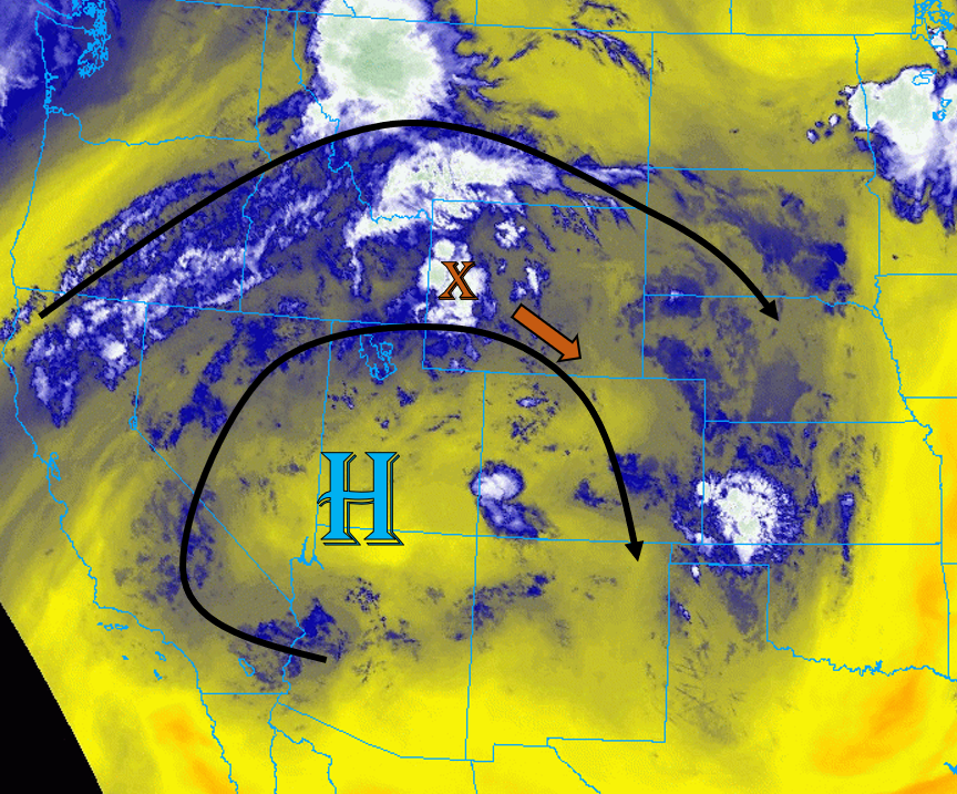
Today the strong upper-level ridge will become less amplified and shift slightly south with the incoming trough over the Pacific Northwest. This will allow some mid-level energy and moisture associated with a shortwave to move into northern Colorado early this afternoon (orange “X”). This morning’s water vapor imagery also shows some mid-level moisture trapped under the ridge (blue on image below). These two sources of moisture, along with some extra lift, will help create high-based showers and storms over much of the eastern two-thirds of Colorado today.
Surface moisture remains highest over the eastern plains (50Fs dew points), and a lee surface low is expected to develop over southeast Colorado. This will provide weak easterly upslope flow on its north side and keep moisture a little higher over the eastern border with more southerly surface flow. So as storms develop and move into the plains, expect some upscale growth with the main threat being damaging outflow winds. Fast storm motion and only moderate moisture means there will be no flood threat issued, although storms could produce a quick 0.4 inches of rain in 30 minutes.
Back to the west, large dew point depressions will create an inverted-V profile, so there’s a threat for strong outflow winds where storms develop. This includes all of the higher terrains, where increased surface winds and only minimal moisture has caused NWS to issue Red Flag Warnings. A better chance for wetting rain exists over the Front Range and Eastern Mountains where moisture is a bit higher, but dry lightning is a concern today. Storm motion should be quick enough over the Southeast Mountains and coverage isolated enough that burn scar flooding is not anticipated, but as always, use caution if a storm tracks over any of the burn areas.
Today’s Flood Threat Map
For more information on today’s flood threat, see the map below. Hover over the threat areas for more details, and click on burn areas to learn more about them. For Zone-Specific forecasts, scroll below the threat map.

Zone-Specific Forecasts:
Northeast Plains, Urban Corridor, Palmer Ridge, Raton Ridge, & Southeast Plains:
Storms will fire over the higher terrain and northern border first and work their way south/southeast during the afternoon and evening. A band of more organized storms should form by early afternoon along the northern areas of the Urban Corridor and Northeast Plains as a passing shortwave moves over Colorado and enhances lift. This band of storms over the plains will quickly move south/southeast and could produce strong winds (up to 60 mph). Hail is less of a concern, but some severe hail cannot be ruled out. Max rain rates up to 0.8 in/hr are possible with these stronger storm cores, but due to fast storm motions, flooding is not expected.
Primetime: 2PM to 12AM
Grand Valley, Northwest Slope, Northern Mountains, Front Range, Central Mountains, Southwest Slope, San Juan Mountains, Southeast Mountains, & San Luis Valley:
High-based thunderstorms are likely for most mountain locations, with increased chances for measurable rainfall over the eastern mountains. Strong gusty winds up to 50 mph are possible with the stronger storms that develop, which is not good for the ongoing fires. Dry lightning is also a concern with the dry fuels across the state. Max 1-hour rain rates up to 0.1 in/hr (west) and 0.4 in/hr (east) will be possible. No flooding is expected today, but a Red Flag Warning is in place over much of the Northern, Central, and Front Range mountains, and a statewide fire ban is in place.
The Grand Valley and Southwest Slope will be the driest and hottest locations in Colorado today, with high temperatures likely exceeding 100F for locations within the Grand Valley once again. This is very impressive that temperatures are reaching this high with the thick smoke. A Heat Advisory is in effect for parts of the Colorado River valley, so keep yourself hydrated. Near-surface smoke will continue to be pushed south from the fires keeping air quality low.
Primetime: 1PM to 11PM