Issue Date: Thursday, September 10th, 2020
Issue Time: 10:00AM MDT
— Flooding is NOT expected today
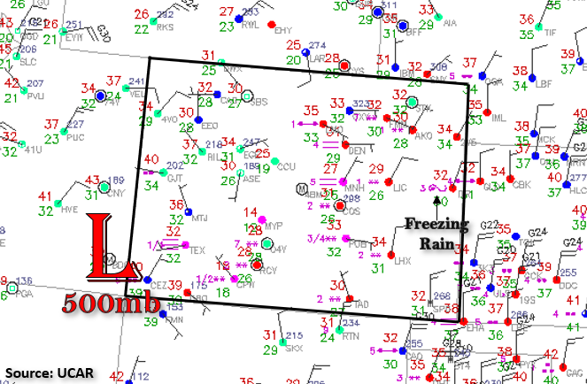
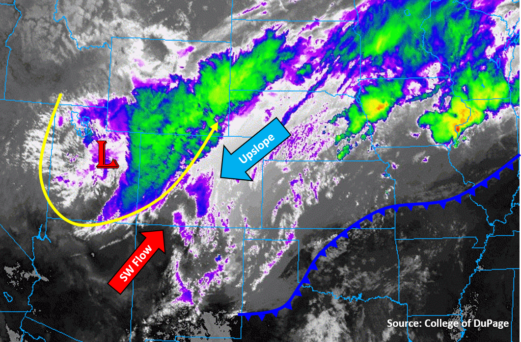
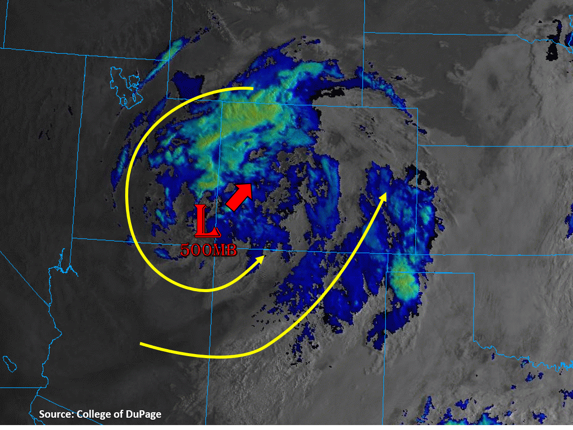
Today the upper-level low pressure system that has been spinning around the Four Corners region (see satellite image below) will begin to work its way northeastward across Colorado, which will continue to generate light, scattered precipitation across the state. Most of this precipitation should fall as snow over the high mountain terrain (over 10,000 ft), but it should stay mainly rain for valley and plains locations. Some of this rain could fall on snow that has accumulated over the last couple days, which could create heavier runoff with added snowmelt. However, rain rates should be light enough and flows low enough that riverine flooding should be avoided. Temperatures will remain well below average across the state today, but slightly warmer than the last couple days, with high temperatures reaching into the 50Fs for lower elevations. As the Low shifts northeast, precipitation should shift from the southern half of the state this morning and early afternoon to the northern half later this evening and overnight. Most mountain regions should see precipitation today, with some ongoing rainfall over the far eastern plains. Some weak instability may be able to develop over the mountain regions, creating more scattered showers rather than broad stratiform precipitation. However, rain rates with these cold showers should remain low enough that flooding is not expected today.
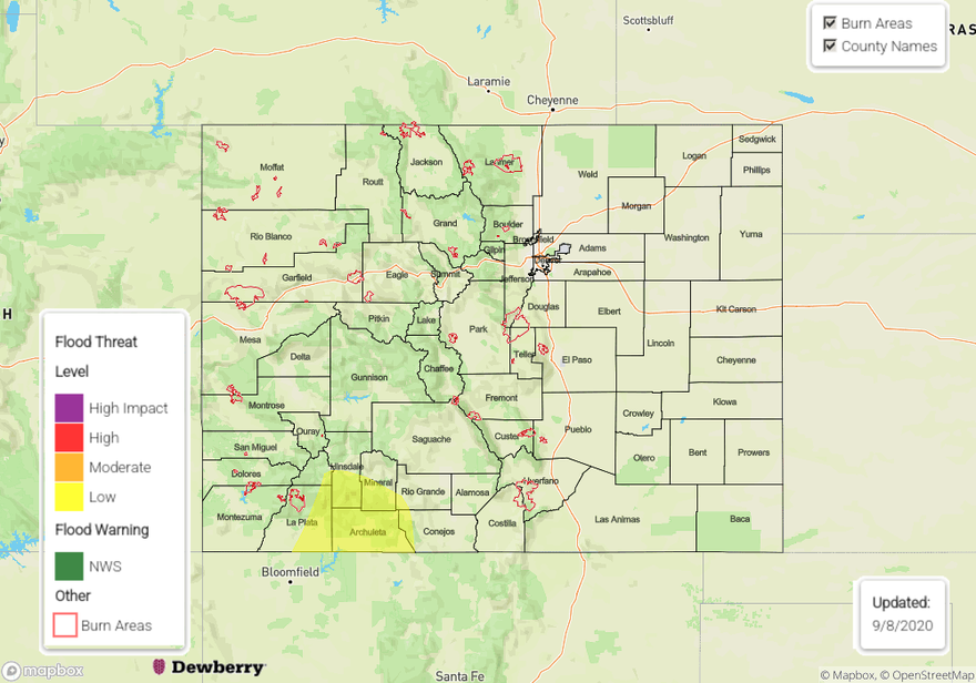
Today’s Flood Threat Map
For more information on today’s flood threat, see the map below. Hover over the threat areas for more details, and click on burn areas to learn more about them. For Zone-Specific forecasts, scroll below the threat map.

Zone-Specific Forecasts:
Northeast Plains, Urban Corridor, Palmer Ridge, Raton Ridge, & Southeast Plains:
Light rain will likely continue to fall along eastern portions of the Southeast and Northeast Plains caused by upper-level lift along the eastern edge of the upper-level low. Rain rates with these weak showers should stay below 0.3 in/hr, so flooding is not expected. Total precipitation accumulations should stay below 0.5 inches. Little to no precipitation is expected over the northern Palmer Ridge, western Northeast Plains, and Urban Corridor due to downslope flow. Temperatures should remain above freezing during the day and likely even overnight due to the high humidity and dew points above freezing, so freezing road surfaces should not be much of an issue for all but maybe some higher elevation spots of the Palmer Ridge.
Primetime: ongoing
Grand Valley, Northwest Slope, Northern Mountains, Central Mountains, Front Range, Southwest Slope, San Juan Mountains, Southeast Mountains, & San Luis Valley:
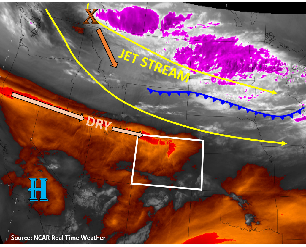
Numerous ongoing showers will continue over the mountains as the upper-level low creates lift and convergence along southwestern slopes. With some limited daytime heating through the clouds, some weak instability could develop to make more popcorn-like showers. However, rain rates should remain below 0.4 in/hr under these weakly convective showers, so flooding is not expected. 24-hour precipitation accumulations up to 1 inch are possible over isolated higher elevation mountain locations. Precipitation should fall as snow above 10,000 ft, where up to a foot of new snow could fall. The snowfall should reduce the threat of rapid runoff along steep terrain at high elevation, and showers will likely move off quickly under the stronger mid-level flow around the low pressure system. However, rain on current snowpack at lower elevations could increase runoff in creeks and low-lying areas, but flooding is not expected. As the Low moves northeastward during the day today, the focus for precipitation should shift from the southern mountains this morning and early afternoon to the northern mountains later this afternoon and overnight. Temperatures will get up into the 50Fs for valley locations, maybe even close to 60F in the Grand Valley and Southwest Slope, so any precipitation should fall as rain over the lower elevations.
Primetime: ongoing