Issue Date: Wednesday, September 9th, 2020
Issue Time: 8:50AM MDT
— Flooding is NOT expected today
It’s not often that you get the first snow of the season in early September. The downside is more stress to the crops and a likely end to the growing season, but the upside is increased wildfire containment and less smoke. It’s a cold start to the day with temperatures shown in red below. Most of the precipitation this morning is over the eastern plains with some lingering snowfall and rain over the southern mountains and near the Grand Valley. The stratiform (low intensity) precipitation over the eastern plains will continue to move slowly to the northeast and should clear the border by mid-afternoon. Slick road conditions are likely with freezing rain being reported.
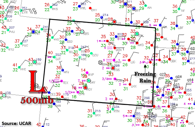
Today the 500mb high will linger around the four corner regions, which will keep showers and snowfall ongoing over the southwest corner. Flow around the Low will pull some additional moisture northward for some more snowfall over the southern and central mountains from late this afternoon into the overnight hours. This precipitation will likely spill into the southern I-25 corridor early tomorrow morning before spreading northeastward into the Southeast Plains. That means additional, heavy snow is expected over the southern mountains with a rain/snow mix over the lower elevations. Freezing rain may be an issue over the adjacent plains, so be sure to keep track of the icy roads by following CDOT. Freezing temperatures are likely overnight once again, so stay tuned to your local NWS office for the latest on those warnings. As anticipated, flooding is not forecast today with the stratiform precipitation and snowfall.
Today’s Flood Threat Map
For more information on today’s flood threat, see the map below. If there is a threat, hover over the threat areas for more details, and click on burn areas to learn more about them. For Zone-Specific forecasts, scroll below the threat map.

Zone-Specific Forecasts:
Southwest Slope, San Juan Mountains, Central Mountains, & San Luis Valley:
Ongoing precipitation is forecast over the southwest corner of the state today. For 24-hour totals, isolated areas of the western San Juan Mountains could see just under 2 inches. This could be another foot to foot and a half of snow over the south facing slopes at the highest elevations. Generally, additional snow totals between 6-12 inches are expected. The Southwest Slope could see totals up to 1.25 inch (south) and 0.75 inches (north), which would be great for the drought-stricken area even if this isn’t a drought buster. Most of this precipitation will fall as rain unless it’s over an elevated region. Further north in the south Central Mountains, additional snowfall between 2-5 inches is possible. As for the SLV, expect totals up to 0.25 inches over the edges of the valley with slightly less precipitation in the central valley. Rain may cross over to snow overnight as temperatures drop. The Freeze and Winter Storm Warnings continue through tomorrow for these zones, and more details can be found from your local NWS office.
Primetime: ongoing
Front Range, Urban Corridor, Palmer Ridge, Raton Ridge, Southeast Mountains, Southeast Plains, & Northeast Plains:
Best chance for more snowfall is over the Southeast Mountains and southern Front Range later today and overnight. Further south, totals by morning between 4 and 6 inches will be possible with totals north between 2 and 4 inches possible. The Palmer and Raton Ridge may see another 1 to 2 inches. The big concern is the potential for freezing rain at the lower elevations tonight into tomorrow morning. Please stay tuned to your local NWS office and CDOT for the latest.
The eastern plains are going to get some mixed precipitation this morning through mid-afternoon. Higher totals from the stratiform precipitation are expected further south with 24-hour totals just under 1 inch possible. Further north, near the Kansas/Nebraska border, totals up to 0.30 inches will be possible. Flooding is not expected, but freezing rain may cause some slick roads.
Primetime: ongoing
Grand Valley, Northern Mountains, & Northwest Slope:
An additional dusting of snow can be expected over the Northern Mountains early today with just some flurries for the northwest corner of the state. Over the Grand Valley, pockets of precipitation up to 0.50 inches will be possible (south) with more general totals in the 0.10 to 0.25 inch range. The next wave of precipitation is expected to arrive tomorrow morning and work it way northward from the south. So today, expect more isolated precipitation with the best chances for accumulation over the Grand Valley. Gusty surface winds and sustained winds in the 15 to 25 mph range over the northwest corner will likely cause a bit of a wind chill. There’s a good chance that most of these regions (excluding the Grand Valley) will experience another night of freezing temperatures. Stay tuned to your local NWS office for the latest.
Primetime: ongoing