Issue Date: Wednesday, May 19th, 2021
Issue Time: 9:40AM MDT
— A NWS Flood Warning has been issued for the Arkansas River at Avondale
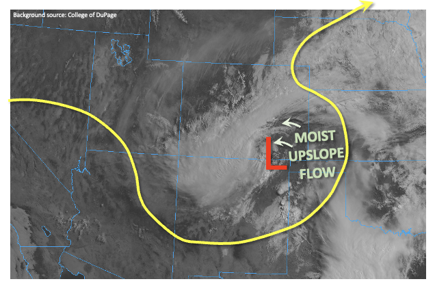
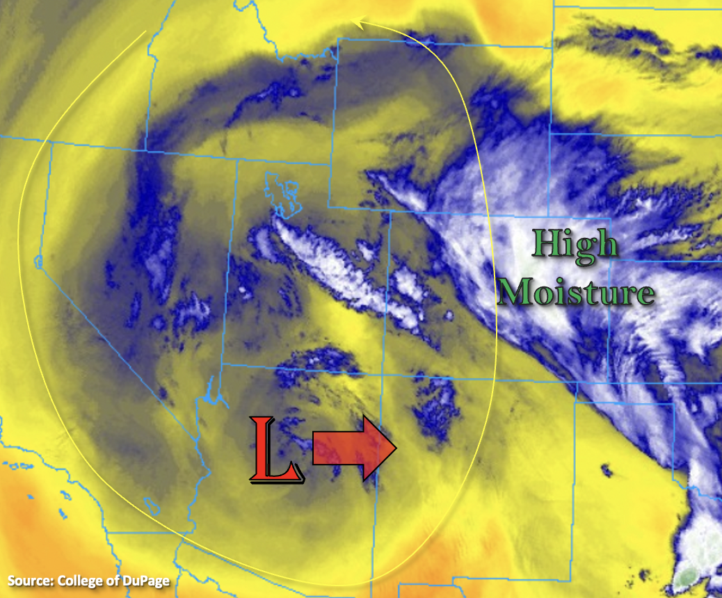
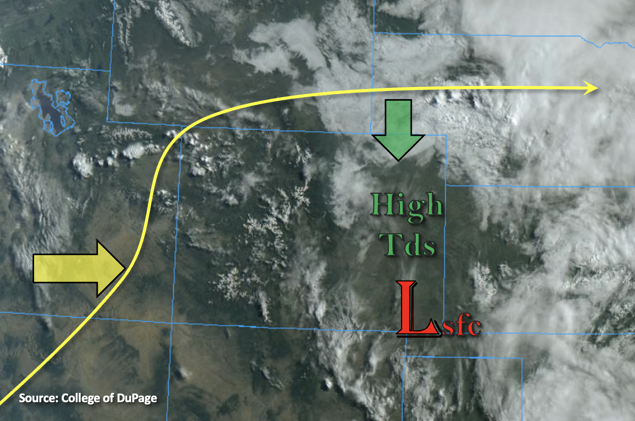
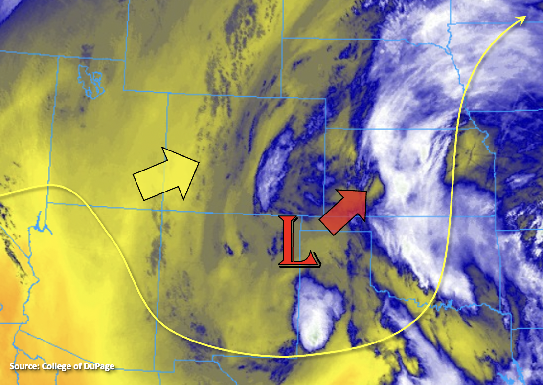
The upper Low will begin to weaken and move to the northeast throughout the day. That means that flow aloft will turn from northerly to more westerly by this evening and then southwesterly by tomorrow morning, which will start to entrain a drier air mass from west to east (yellow shades). There should be enough residual moisture (blue/gray shades) for scattered storms to develop over the mountains as the upslope flow kicks in this afternoon. Since widespread lift and moisture will be decreasing, storms are expected to be more scattered than widespread in nature with accumulation mostly occurring over the eastern mountains. Slow south and southeast movement of storms along with subsidence over the adjacent plains should anchor the scattered storms to the high terrains. With portions of the Southeast Mountains and Raton Ridge receiving between 3 to 5 inches over the last 3 days (saturated soils), increased runoff is expected with storms that develop over these areas. However, rain rates are forecast to decrease, so flooding issues should be avoided. Additional weak thunderstorms may form over the far eastern board with the main threats being small hail and outflow winds. Flooding is NOT forecast today.
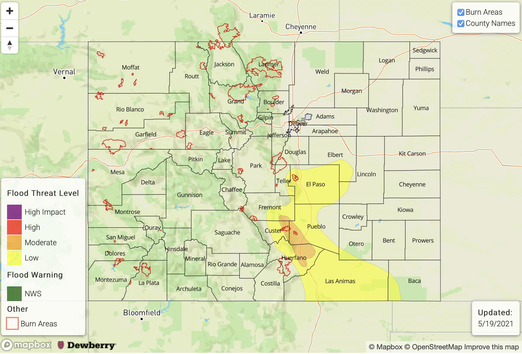
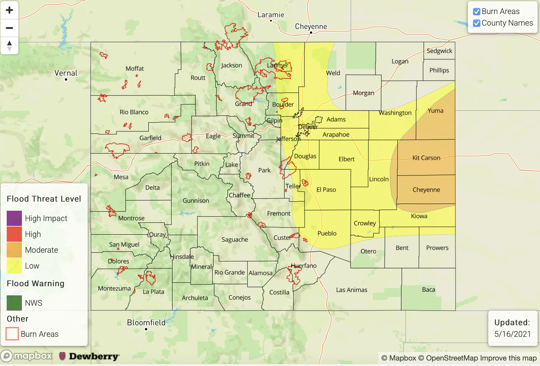
Today’s Flood Threat Map
For more information on today’s flood threat, see the map below. If there is a threat, hover over the threat areas for more details, and click on burn areas to learn more about them. For Zone-Specific forecasts, scroll below the threat map.
Zone-Specific Forecasts:
Raton Ridge, Palmer Ridge, Front Range, San Juan Mountains, Southeast Mountains, Northern Mountains & Central Mountains:
Scattered storms are possible over the high terrains again this afternoon with the residual moisture hanging around. To the west, accumulation will be favored over the southern/eastern San Juan Mountains where rain rates up to 0.25 inches per hour will be possible. Over the eastern mountains, max 1-hour rain rates up to 0.5 inches per hour will be possible. This could cause some excessive runoff further south and east where rainfall has been falling the last few days. However, flooding is NOT anticipated.
Primetime: 1PM to 10PM
Southeast Plains, Northeast Plains & Urban Corridor:
The Urban Corridor should stay dry this afternoon with storms anchored to the high terrains. A couple scattered thunderstorms may be possible over the central, eastern border counties as the Low lifts to the northeast. The main threats from thunderstorms that develop will be small hail and gusty outflow winds. Rain rates up to 0.75 inches per hour may be possible, so flooding is NOT forecast.
Primetime: Noon to 6PM
Northwest Slope, Grand Valley, Southwest Slope & San Luis Valley:
A beautiful day is ahead with a couple scattered storms possible this evening over the Northwest Slope. Wind from storms that develop will be more of a threat than rainfall, but isolated totals up to 0.20 inches will be possible. The San Luis Valley should also get some more rainfall with 24-hour totals around 0.25 inches possible. Flooding is NOT forecast.
Primetime: 5:30PM to 10PM