Issue Date: Thursday, May 27th, 2021
Issue Time: 8:25AM MDT
— Flooding is NOT expected today
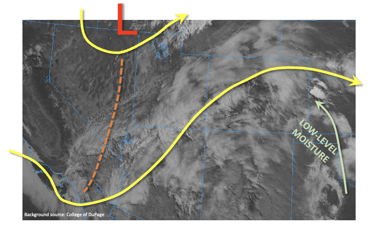
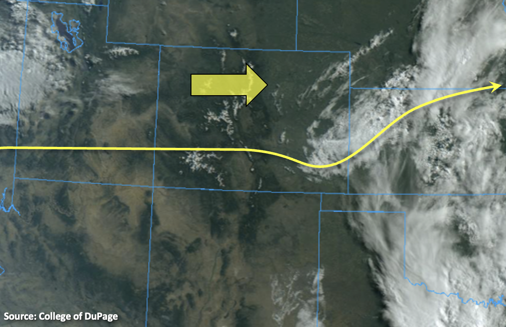
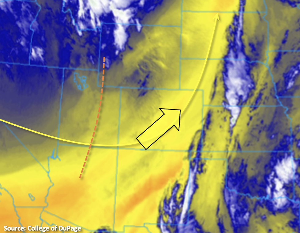
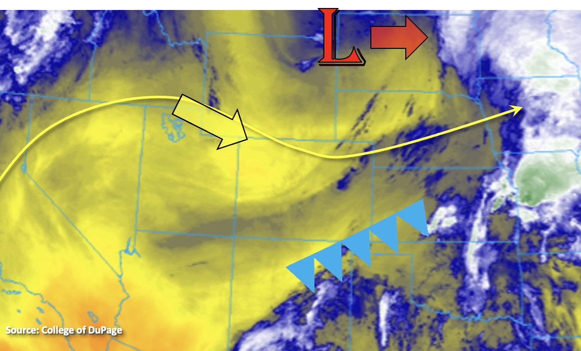
The Low that brought a couple severe thunderstorms to the Northeast Plains yesterday also dropped a weak cold front across eastern Colorado. There was some surface moisture return behind the front, which is helping produce fog and cloud cover over the eastern central plains this morning. As the Low/trough continues to move eastward throughout the day, subsidence and northwesterly flow from a transient ridge will move over the state. This northwesterly flow will be dry and help to mix out this morning’s moisture return over eastern Colorado. With PW expected to drop from 0.57 inches at Denver and 0.43 inches at Grand Junction, storms that develop this afternoon will be sparse and high-based making more of a wind threat with only light rainfall forecast. This is especially true across the San Juan and southern Southeast Mountains where some mid-level energy working through the flow will help spark some high-based storms. Best chance for measurable rainfall will be over the southern high terrains and along the Palmer and Raton Ridge this evening, but only light accumulation is forecast. Therefore, flooding is not forecast today.
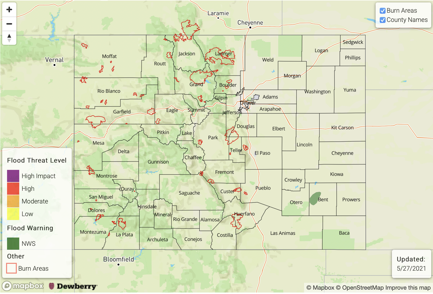
Today’s Flood Threat Map
For more information on today’s flood threat, see the map below. If there is a threat, hover over the threat areas for more details, and click on burn areas to learn more about them. For Zone-Specific forecasts, scroll below the threat map.
Zone-Specific Forecasts:
San Juan Mountains, Central Mountains, Northern Mountains, Northwest Slope, Grand Valley & Southwest Slope:
Temperatures will remain above average across all regions today and the valley locations may reach up to 10F above average today (central, north). Surface winds will pick up over the higher terrains again this afternoon but are not forecast to be widespread or as high as yesterday. This should help limit fire danger. Weak mid-level energy will move across the southern border this afternoon, which will likely help to spark some high-based showers over the San Juan Mountains. More wind than rainfall is forecast, but areas near and along the Continental Divide could see isolated totals up to 0.15 inches. Flooding is not forecast.
Primetime: 1PM to 8PM
Front Range, Southeast Mountains, San Luis Valley, Urban Corridor, Southeast Plains, Raton Ridge, Northeast Plains & Palmer Ridge:
Temperatures should be around normal this afternoon thanks to the weak cold front that moved through yesterday. More cloud cover and wind, rather than rainfall, is expected with storms that develop today due to moisture being confined to the mid-layers of the atmosphere. Best chance for accumulation and storms will be across the elevated Ridges and Wet Mountains. Isolated totals up to 0.20 inches will be possible.
Primetime: 3PM to 9PM