Issue Date: Wednesday, May 26th, 2021
Issue Time: 9:30AM MDT
— Flooding is NOT expected today
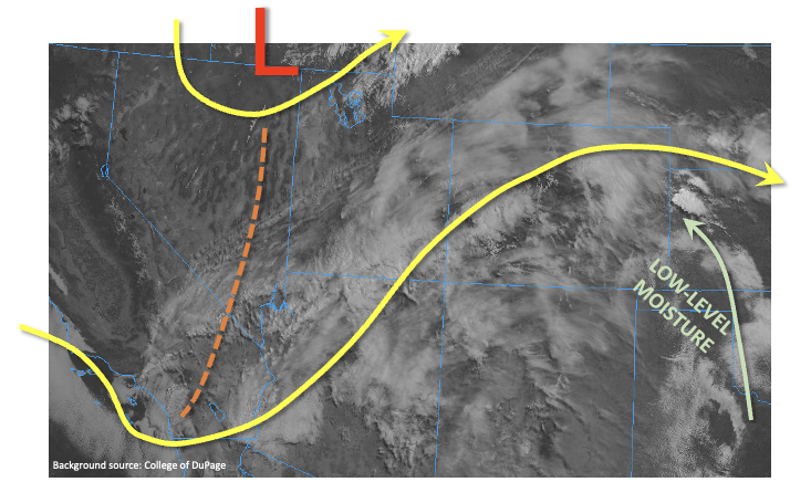
As shown in the visible satellite image, below, a potent trough is centered over the Great Basin and will race eastward across Colorado through the day today. An accompanying surface low pressure is located over far northwest Colorado and will intensify while moving eastward through the day as well. This will also drag a cool front across the state later today, mostly noticeable with a wind shift as opposed to precipitation. Although dynamics are impressive, moisture is lacking. This morning’s PW at Grand Junction was a measly 0.32 inches, and even most of that was in the mid and upper levels of the atmosphere. Denver’s PW was 0.54 inches, close to normal for this time of year. However, much drier air was located across southwest Colorado and will overtake most of the state once again throughout the day.
The only area of concern today is the Northeast Plains, where a moist, low-level flow will contribute to push PW near 1.0 inch by this evening. In fact, this is already noticeable this morning with elevated convection causing large hail just across the KS border. With the aforementioned cool front boundary in place this afternoon, severe thunderstorms are likely along the NE and KS borders. Large hail, damaging winds and tornadoes will be possible with the strongest cells. Short-term heavy downpours will be likely as well, but prolonged heavy rainfall is unlikely given the relatively fast steering flow along with winds turning more westerly with time. Thus, flooding is NOT expected today.
Switching topics, it appears that the Purgatoire River has crested overnight near Las Animas. A Flood warning is still in effect, but without precipitation, the river will quickly fall below flood stage.
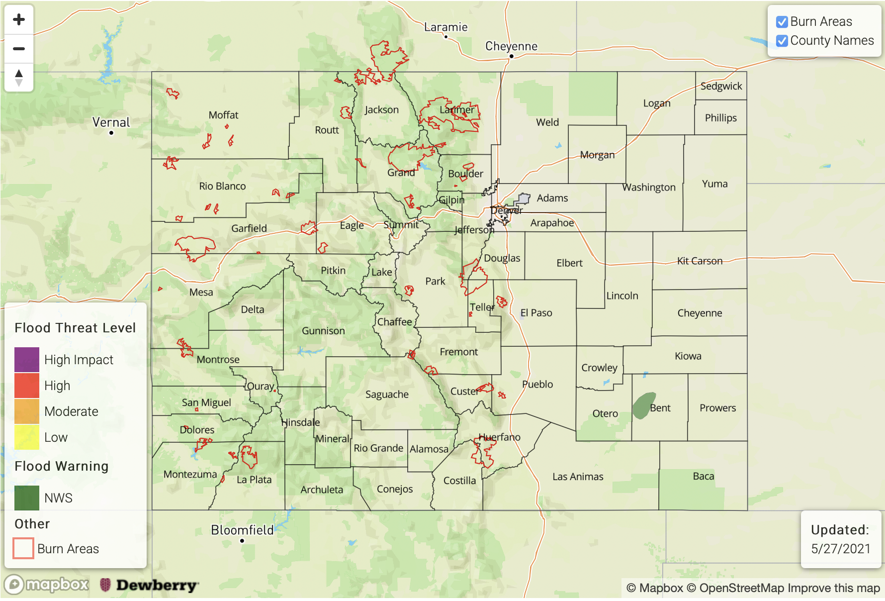
Today’s Flood Threat Map
For more information on today’s flood threat, see the map below. If there is a threat, hover over the threat areas for more details, and click on burn areas to learn more about them. For Zone-Specific forecasts, scroll below the threat map.
A NWS Flood Warning is ongoing for the Purgatoire River near Las Animas through Wednesday afternoon. However, the river has crested and flow should quickly recede later today.
Zone-Specific Forecasts:
Northeast Plains, Southeast Plains
Isolated to scattered showers and thunderstorms this afternoon and into early evening. The biggest threat will be large hail, damaging winds and tornadoes as opposed to heavy rainfall. Max 1-hour rain up to 1.3 inches will be possible. Isolated nuisance street and field flooding will be possible.
Primetime: 12PM through 9PM
Front Range, Urban Corridor, Southeast Mountains, Raton Ridge, Palmer Ridge:
Variable cloudiness with an isolated shower or weak storm possible for northern areas. Max 1-hour rainfall up to 0.4 inches. Flooding is NOT expected today.
Primetime: 12PM through 6PM
Grand Valley, Southwest Slope, San Luis Valley, San Juan Mountains, Central Mountains, Northern Mountains and Northwest Slope:
Partly cloudy with gusty winds developing this afternoon. Isolated to scattered rain and high-elevation snow showers are possible this evening and overnight mainly in the Central and Northern Mountains. Flooding is NOT expected today.