Issue Date: Monday, May 31st, 2021
Issue Time: 9:30AM MDT
— Flooding is NOT expected today
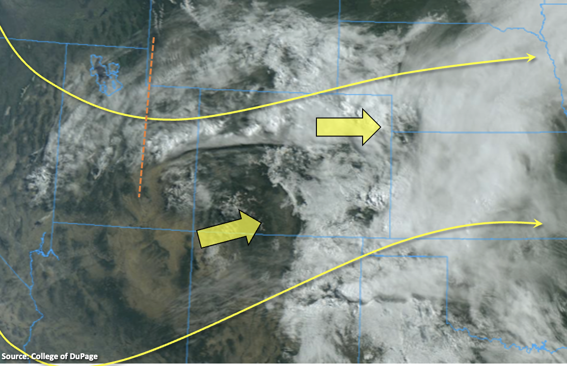
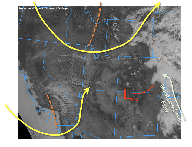
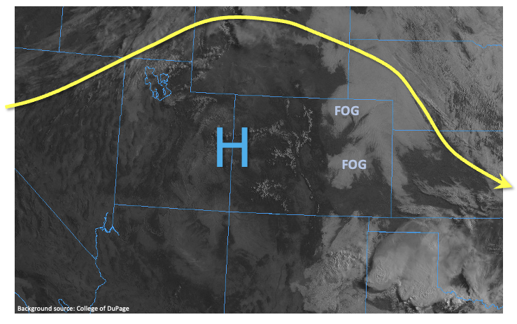
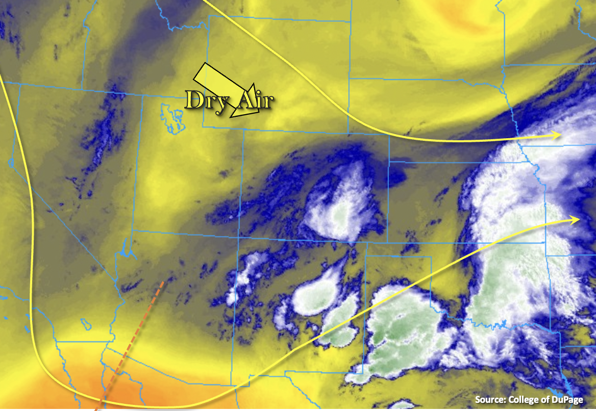
Unsettled and cool weather will continue for most this Memorial Day. Currently, there is ample cloud cover over eastern Colorado and the mountains along with fog, rain showers and snow at the highest elevations. It’s sunny over the western half of Colorado, especially north where dry northwesterly flow has started to decrease the available moisture in the mid and upper levels of the atmosphere. This split flow pattern, the intrusion of dry air and general subsidence behind yesterday’s trough is forecast to continue throughout the day over the northern portion of the state. This will drop off the chances for rainfall north of I-70, although some weak showers maybe possible over the mountains (near the Continental Divide) with residual moisture.
Further south, the trough to the southwest, will continue to help re-enforce the moisture across south, central Colorado seen above (blue/white shades). As the upslope flow kicks in this afternoon with mid-level energy moving through across the state, widespread storms are forecast to develop across the Central, Southeast East, San Juan and southern Front Range Mountains (snow above ~11K feet). With cooler temperatures east, more stratiform rainfall with embedded, moderate convection is likely. Some spill over into the adjacent, eastern plains and ridges is possible late this afternoon/evening with the southeast moving storms. Over the western high terrains (south), rainfall totals should slightly increase from yesterday due to a slight increase in PW (0.56 inches at Grand Junction) and more moist boundary layer. Stronger storms that develop this afternoon will likely produce lightning, wind gusts and moderate rainfall with slow steering flow. With the southeast movement of storms, the San Luis Valley should also record measurable rainfall for the second day in a row. Rain rates are gradual enough today, thanks to limited instability, that flooding is NOT forecast.
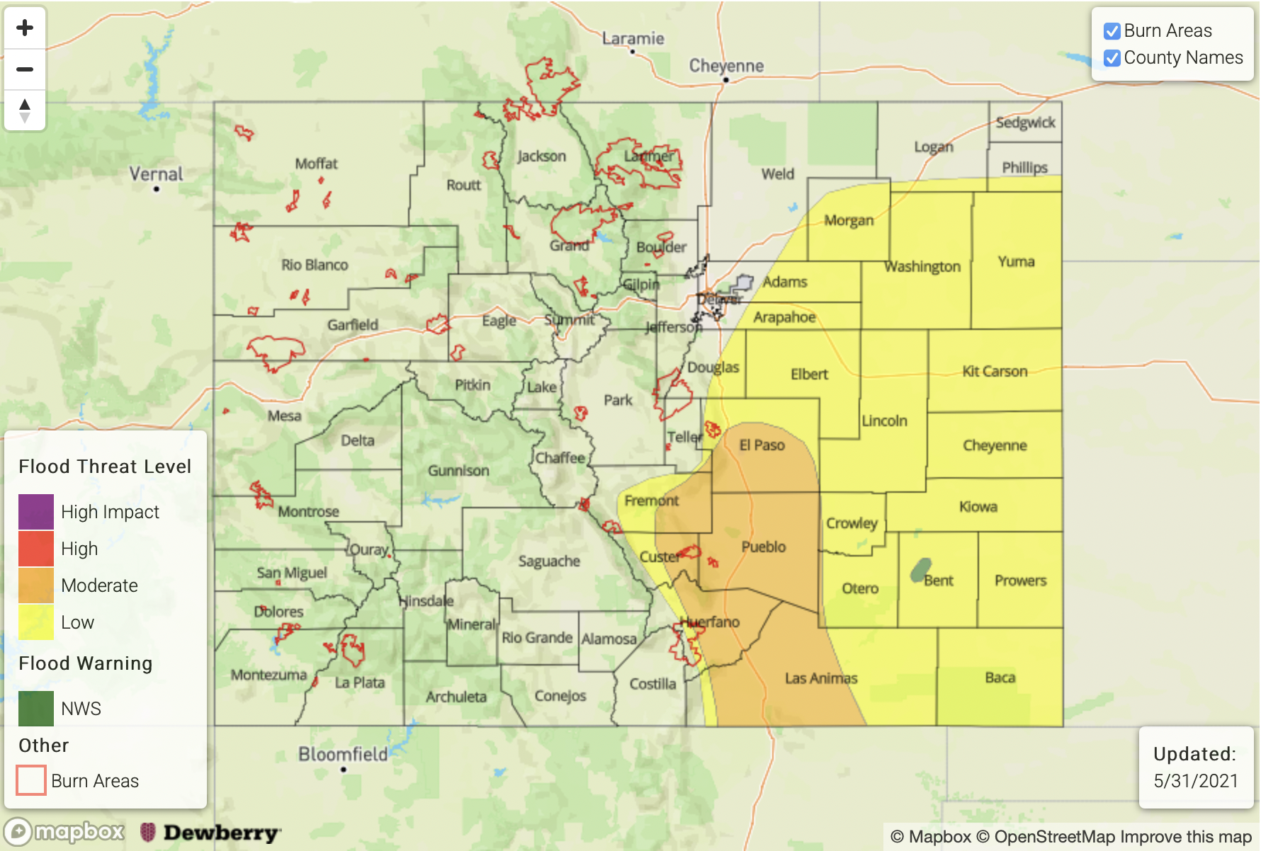
Today’s Flood Threat Map
For more information on today’s flood threat, see the map below. If there is a threat, hover over the threat areas for more details, and click on burn areas to learn more about them. For Zone-Specific forecasts, scroll below the threat map.
Zone-Specific Forecasts:
Southeast Plains, Raton Ridge, Palmer Ridge, & Southeast Mountains:
Gradual rainfall due to cooler temperatures should accompany the numerous storms that develop over the mountains this afternoon. Max 1-hour rain rates up to 0.60 inches over the mountains with isolated 24-hour totals up to 1 inch are possible. Rain should start to cross over to snow again at the higher elevations by this evening ending the flood threat for the higher elevation burn areas. Southeast movement of storms will spill rainfall into the adjacent plains and ridges late this afternoon. Max 1-hour rain rates up to 0.25 inches will be possible. Flooding is NOT forecast today.
A Flash Flood Watch has been re-issued by NWS Pueblo for the burn areas over the Southeast Mountains. Head on over to the FBF for our burn area forecast for today.
Primetime: 1PM to 10PM
Central Mountains, San Juan Mountains, Southwest Slope & San Luis Valley:
Numerous storms will develop over the high terrains this afternoon with decent moisture, mid-level lift and upslope flow. I’m sure everyone is looking forward to the widespread, measurable rainfall for the mountains. A couple stronger storms may be possible south (initially) with the main threats being outflow winds, lightning and small hail. Moderate rainfall with 1-hour rain rates up to 0.60 inches will be possible. Isolated totals over the eastern San Juan Mountains could reach around 0.75 inches by late this evening. As storms move southeast with the steering flow, showers will likely spill into the San Luis Valley. Totals up to 0.75 inches will be possible by morning around the southern tier of the valley. Flooding is NOT forecast.
Primetime: 11AM to 10PM
Front Range, Urban Corridor, Northeast Plains, Northwest Slope, Northern Mountains & Grand Valley:
Dry air and subsidence will limit the chances for rainfall this afternoon over these regions. A couple showers will likely still develop over the mountains with the residual moisture, but 1 hour rain rates should remain around 0.15 inches. Cloudy conditions will persist over the Urban Corridor this morning along with weak showers as well with temperatures remaining below average this afternoon. Over the northwest corner of the state, sunny skies with temperatures slightly above normal are forecast.