Issue Date: Sunday, June 20th, 2021
Issue Time: 9:10AM MDT
— Flooding is NOT expected today, but moderate rainfall is expected overnight mainly over northeast Colorado
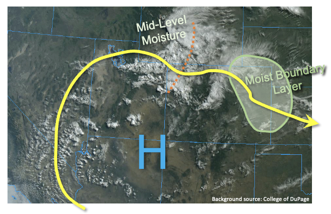
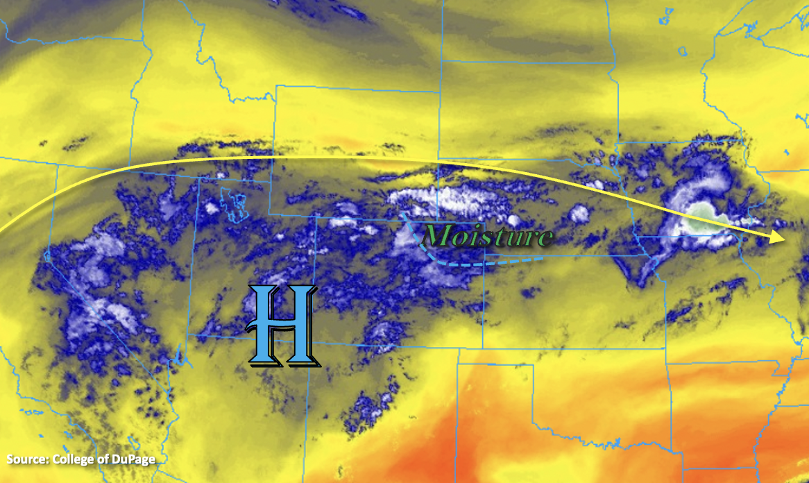
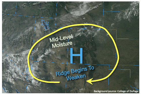
The summer solstice will occur at 9:31PM MDT tonight, and will ironically be accompanied by a very strong cool front moving in from the north. In fact, an initial cool front, seen primarily by a wind shift, has already moved into northeast Colorado this morning. This will knock down afternoon high temperatures by 5F or so across the Northeast Plains. However, the stronger cool front, accompanied by a moisture surge and notable synoptic scale forcing in the middle and upper atmosphere, will approach the WY/CO border right around sunset. Until then, we expect mostly sunny to partly cloudy conditions across the state. The highest chances of rain during the afternoon and early evening will be over the Raton Ridge, Southeast Mountains and San Juan Mountains, though only widely scattered coverage of weaker thunderstorms is expected.
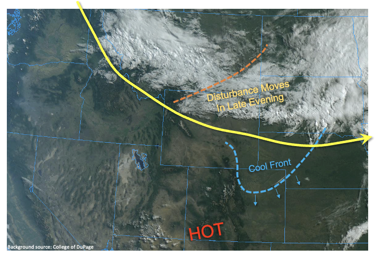
As the strong cold front approaches this evening, instability will be generally lacking but moisture will be plentiful. This morning’s PW at Denver was only 0.48 inches, but is expected to spike to near 1.0 inch overnight with the frontal passage. With limited instability, we expect more of a widespread, moderate-intensity type rainfall over a 3-6 hour duration for most locations of northeast Colorado. Thus, flooding is NOT expected.
West of the Continental Divide, it will continue to be windy and very dry today, maintaining an elevated wildfire threat through this evening. Stay tuned to local National Weather Service office Red Flag Warnings for more information. Unfortunately, the cold front will not make much progress west of the Continental Divide.
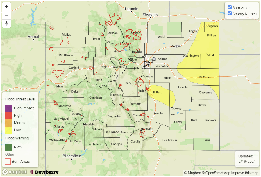
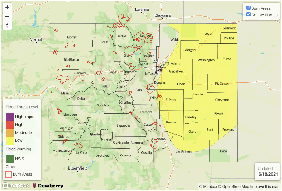
Today’s Flood Threat Map
For more information on today’s flood threat, see the map below. If there is a threat, hover over the threat areas for more details, and click on burn areas to learn more about them. For Zone-Specific forecasts, scroll below the threat map.

Zone-Specific Forecasts:
Northeast Plains, Front Range, Urban Corridor, Palmer Ridge:
Becoming partly cloudy and slightly cooler today with isolated afternoon showers and weak storms possible over the higher terrain. A stronger cool front moves in around sunset, generating widespread shower and thunderstorm activity, with higher rainfall intensity for eastern areas. Max 1-hour rainfall up to 1.1 inches (east), and 0.7 inches (west) with max 3-hour rainfall up to 2.2 inches possible for far eastern areas. However, flooding is NOT expected today.
Primetime: 7PM through 6AM
Raton Ridge, Southeast Mountains, Southeast Plains, San Luis Valley and San Juan Mountains:
Partly cloudy and continued hot with isolated to widely scattered showers and thunderstorms this afternoon and evening. Max 1-hour rainfall up to 0.8 inches (below 5,500 feet) and 0.5 inches (above 5,500 feet). Flooding is NOT expected today.
Primetime: 12PM through 8PM
Grand Valley, Southwest Slope, Northwest Slope, Central Mountains and Northern Mountains:
Mostly sunny and continued hot, with windy conditions developing this afternoon. An isolated shower or weak storm is possible for the highest elevations, but max 1-hour rainfall limited to 0.4 inches. Flooding is NOT expected today. A Red Flag Warning has been issued for parts of the region, so stay tuned to local National Weather Service offices for updates.
Primetime: 12PM through 6PM