Issue Date: Monday, June 28th, 2021
Issue Time: 9:40AM MDT
— A LOW flood threat has been posted for parts of the Front Range, Palmer Ridge, Central Mountains, San Juan Mountains and Southeast Mountains
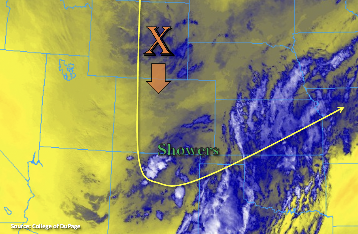
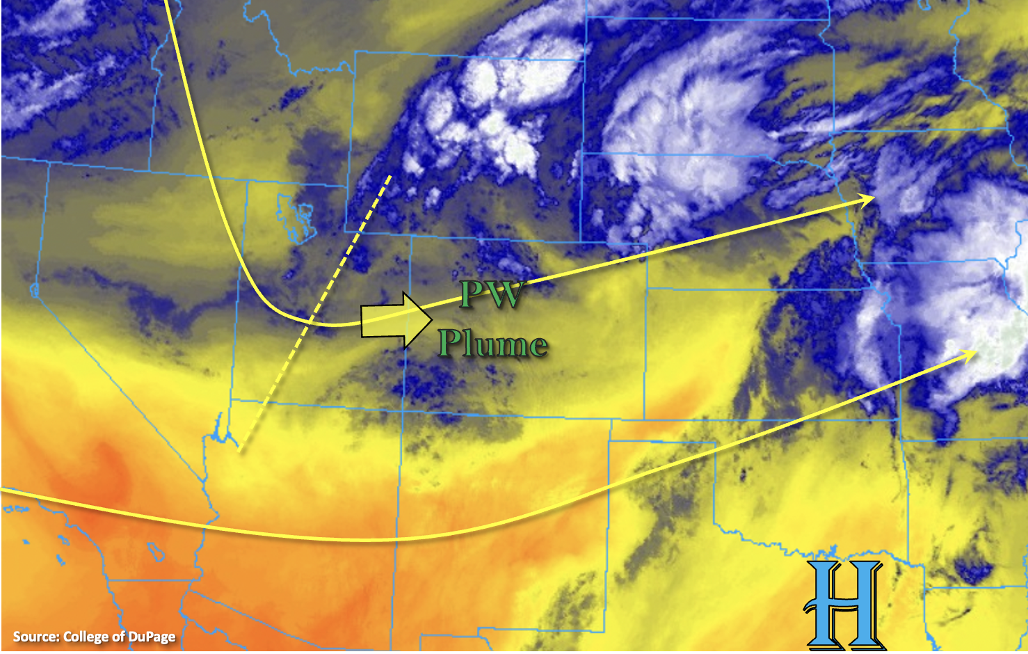
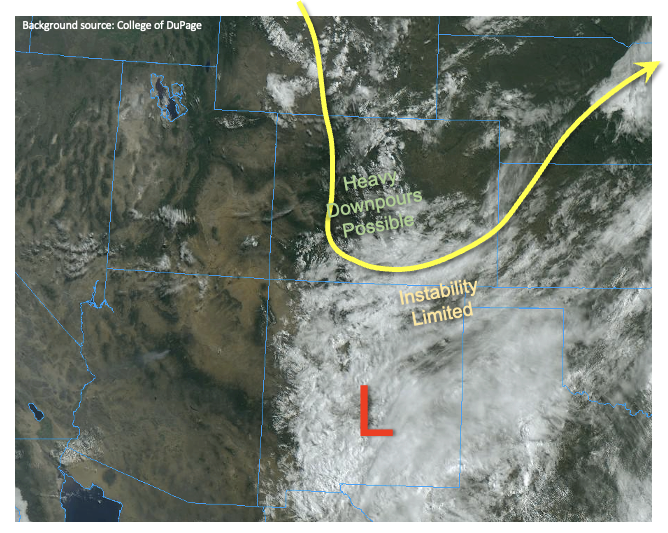
A persistence-type weather pattern continues over Colorado for today. The trough of low pressure has moved only slightly eastward over the past 24 hours, and near-surface and column moisture remains virtually unchanged. This morning’s PW at Denver dropped slightly from 0.72 to 0.69 inches, while Grand Junction stayed unchanged at 0.64 inches. The main difference in today’s weather setup is the presence of more widespread cloud cover over southeast Colorado due to a cut-off low over New Mexico. This will tend to suppress heavy rainfall over the southern portion of the Southeast Mountains today. However, aside from that, the persistence pattern warrants the continuation of a Low flood threat over the higher terrain of southern and central Colorado. A moist atmospheric column, instability up to 700J/kg and sufficient southerly wind shear will support 30-60 minute bursts of heavy rainfall up to 1.0 inch per hour. This is capable of causing isolated flash flooding, debris flows and mud slides over steeper terrain. East of the Continental Divide, away from the higher terrain, a slight decrease in rainfall activity is expected due to weak subsidence to the west of the low pressure trough.
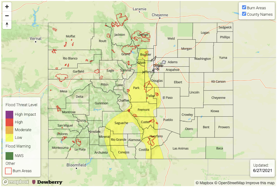
Today’s Flood Threat Map
For more information on today’s flood threat, see the map below. If there is a threat, hover over the threat areas for more details, and click on burn areas to learn more about them. For Zone-Specific forecasts, scroll below the threat map.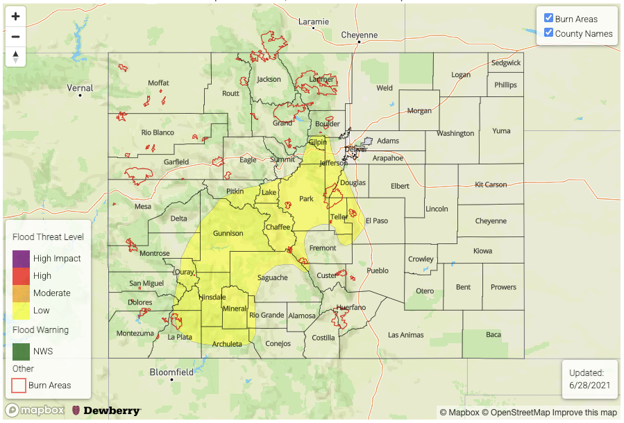
Zone-Specific Forecasts:
Southeast Mountains, Front Range, San Juan Mountains, Central Mountains & San Luis Valley:
Becoming mostly cloudy with scattered to numerous showers and thunderstorms increasing in coverage this afternoon. Max 30-minute rainfall up to 0.7 inch, with max 1-hour rainfall up to 1.0 inch. A Low flood threat has been posted over the region for isolated flash flooding, debris slides and mud flows mainly over steeper terrain.
Primetime: 11:30AM through 9PM
Urban Corridor, Raton Ridge, Palmer Ridge, Northeast Plains & Southeast Plains:
Mostly sunny early then turning mostly cloudy with scattered showers and thunderstorms, mainly limited to the higher terrain and adjacent foothills. Max 30-minute rainfall up to 0.5 inches and max 1-hour rainfall up to 0.8 inches. Flooding is NOT expected today, but nuisance urban street ponding is possible under stronger storm cores.
Primetime: 12PM through 8PM
Northern Mountains, Grand Valley, Northwest Slope & Southwest Slope:
Mostly sunny early then isolated to scattered showers and weak thunderstorms possible this afternoon. Max 30-minute rainfall up to 0.4 inches possible. Flooding is NOT expected today.
Primetime: 12PM through 7PM