Issue Date: Saturday, June 26th, 2021
Issue Time: 9:45AM MDT
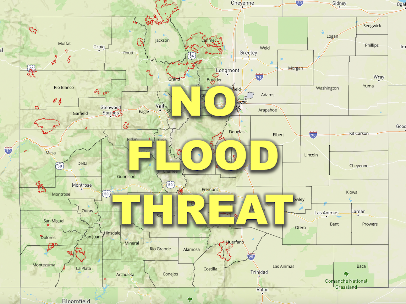
— Flooding is NOT expected today
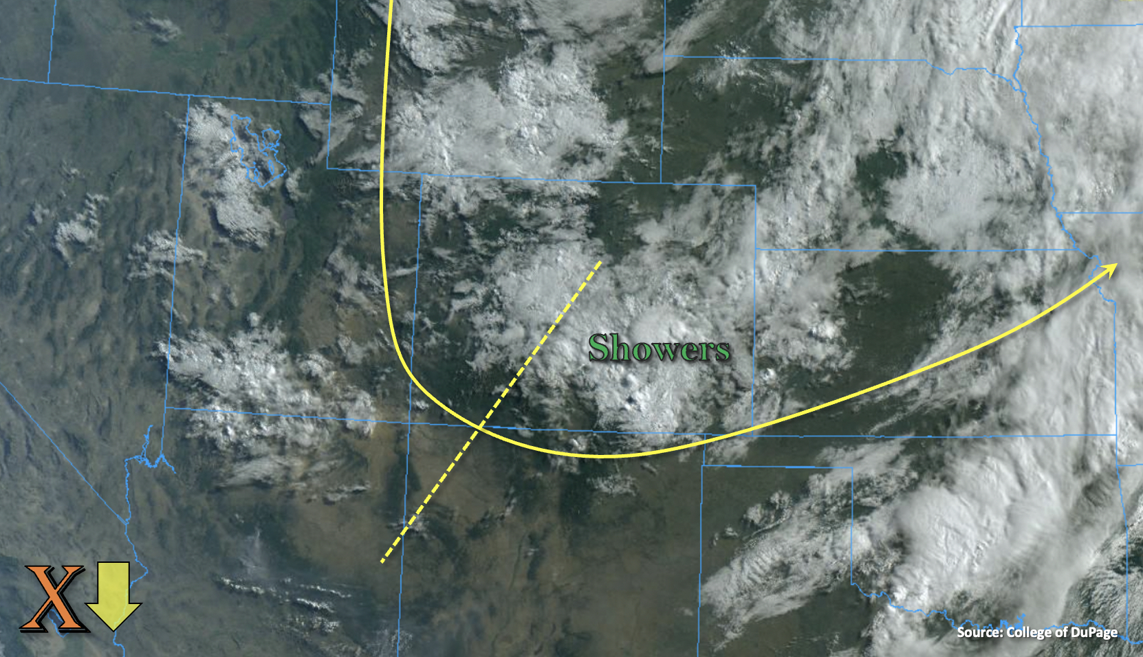
Cloudy start to the morning with mid-level energy and moisture over the state. The visible satellite imagery below also shows some ongoing showers from last night that are making their way south across the western Southeast Plains and Southeast Mountains. Today, the positively tilted trough is forecast to sit overhead as a vorticity maximum (orange “X”) digs SSE, which will produce northerly and NNW flow aloft over most of the state. Those ongoing showers will likely dissipate over the adjacent plains throughout the morning but increase over the Southeast Mountains with a little daytime heating. Not much instability will be able to build due to the cold cover and cooler temperatures, so more stratiform rain with a little embedded convection is forecast. This is expected to produce a nice soaking for the area with the continued elevated moisture.
As upslope flow and mid-level lift organize with a little daytime heating, additional scattered storms are expected to pop over the mountains around noon or shortly after. The northerly steering flow should help keep storms over the mountains and elevated ridges through mid-afternoon. Then, a more westerly component to the steering flow is expected push the rainfall into the immediate, adjacent eastern plains. While moderate rainfall accumulations are forecast along and near the Continental Divide (north) and Southeast Mountains/southern Front Range (south) rainfall should be gradual enough that only nuisance flooding issues such as runoff and light ponding are forecast. Storms will start to diminish after the sunset from north to south, but some lingering showers are possible over the Southeast Mountains and San Luis Valley through tomorrow morning. Flooding is NOT forecast.

Today’s Flood Threat Map
For more information on today’s flood threat, see the map below. If there is a threat, hover over the threat areas for more details, and click on burn areas to learn more about them. For Zone-Specific forecasts, scroll below the threat map.

Zone-Specific Forecasts:
Southeast Mountains, Palmer Ridge, San Luis Valley & Raton Ridge:
Storms will start to pick up over the Southeast Mountains and additional storms will form over the elevated ridges (west) by noon. Over the ridges (especially north) a little convection may occur with max 1-hour rain rates up to 0.50 inches possible. Continuous rainfall over the Southeast Mountains could produce a couple storm totals around 1.50 inches near the Wet Mountains with many areas receiving an inch of rainfall. Overnight showers will likely linger over the mountains. Rainfall should be gradual enough that flooding is NOT expected outside of some nuisance ponding and runoff. The San Luis Valley should also get some measurable rainfall today, and the interior valley could receive around 0.40 inches by morning.
Primetime: Continuous
Front Range, Central Mountains, Northern Mountains & San Juan Mountains:
Scattered storms are forecast to form over the mountains by early afternoon and move south. Training and stationary storms are expected to produce higher accumulations long and near the Continental Divide (east). Rainfall should be gradual enough that flooding issues will be avoided outside of some nuisance ponding and runoff. Max storm totals up to 1.50 inch (Front Range), 0.60 inches (Central/Northern) and 0.60 inches (San Juans) will be possible. Flooding is NOT forecast.
Primetime: 11AM to 11PM
Urban Corridor, Northeast Plains & Southeast Plains:
Showers currently occurring over the Southeast Plains will gradually end throughout the morning. Storm activity that begins over the mountains and ridges is forecast spill into the adjacent plains this afternoon. Max 1-hour rain rates up to 0.50 inches will be possible over the Urban Corridor. Some of this rainfall will likely move into the western Southeast Plains later today, but without much instability being able to build, severe storms are unlikely. Max 1-hour rain rates up to 0.60 inches will be possible. No rainfall is forecast for the Northeast Plains, and flooding is NOT expected.
Primetime: 3PM to 10PM
Grand Valley, Northwest Slope & Southwest Slope:
It should stay dry today with the more northerly steering flow over western Colorado keeping storms over the mountains. A couple storms could move off the San Juan Mountains into the eastern Southwest Slope and produce some light accumulations. Highs will be in the 80Fs for the valley locations, so it will be a beautiful day ahead. Flooding is NOT forecast.