Issue Date: Tuesday, July 6th, 2021
Issue Time: 9:50AM MDT
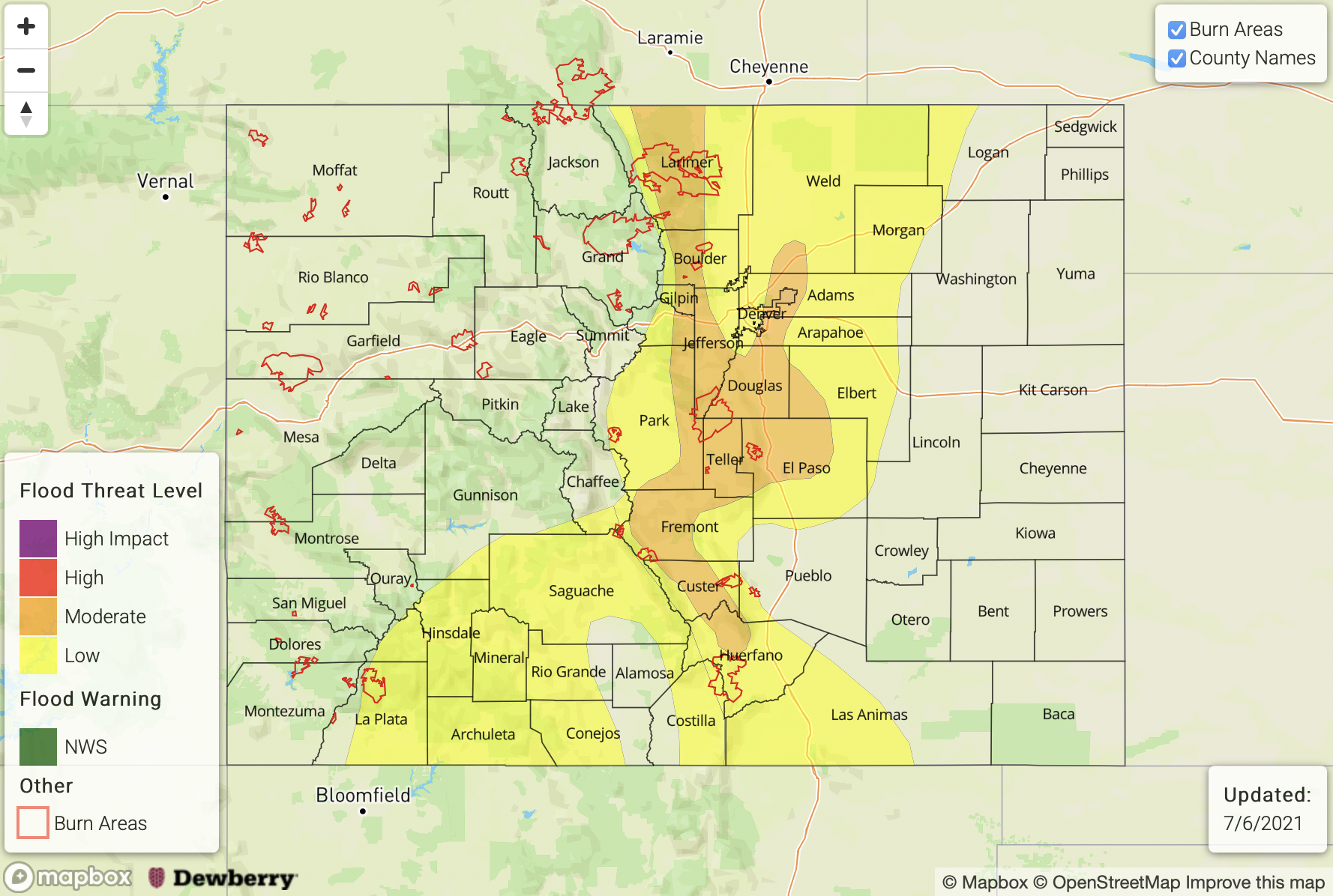
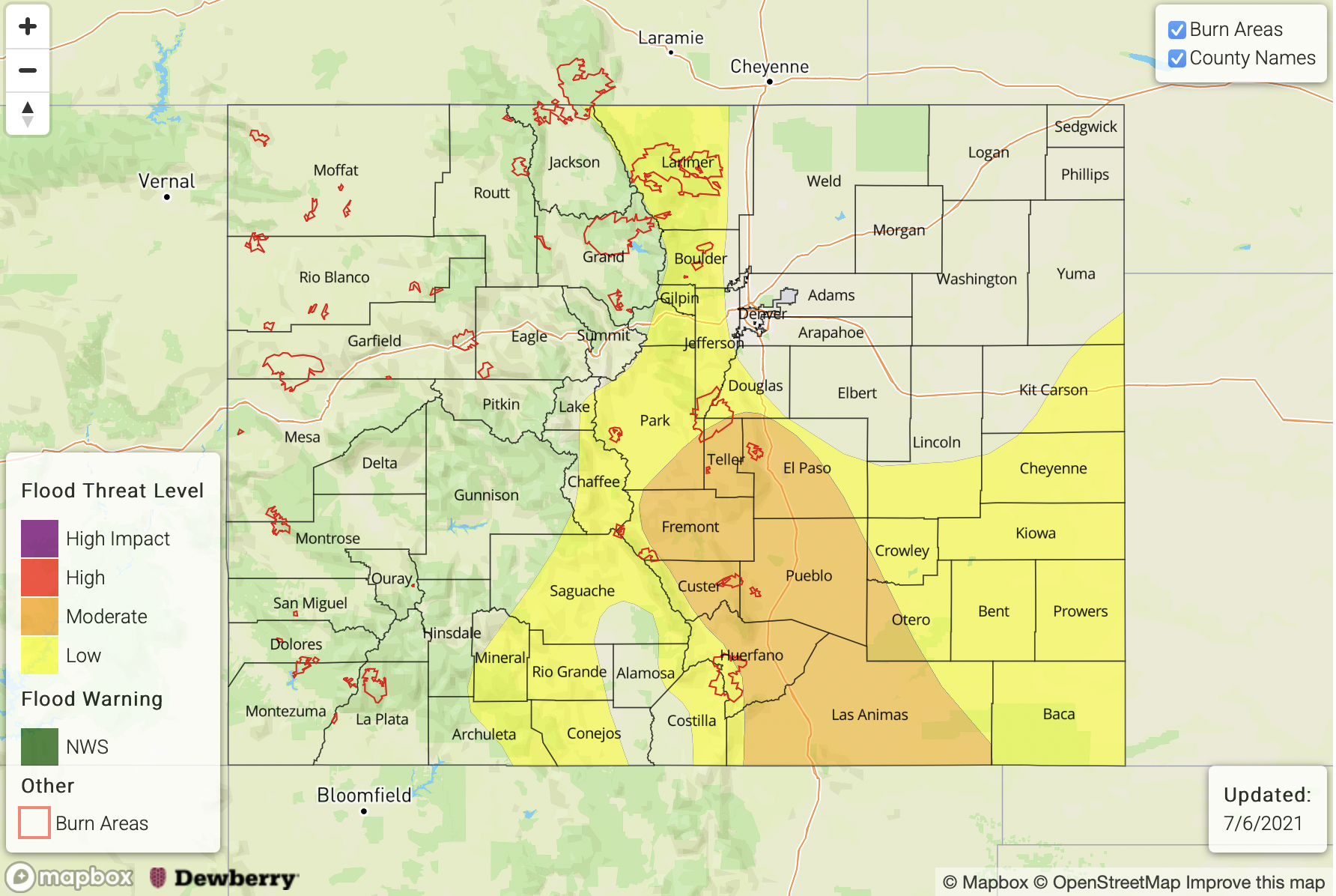
— A MODERATE flood threat has been issued for the Raton Ridge and portions of the Front Range, Urban Corridor, Southeast Mountains, Palmer Ridge and Southeast Plains
— A LOW flood threat has been issued for the Central Mountains and San Juan Mountains
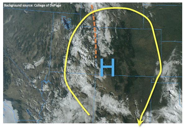
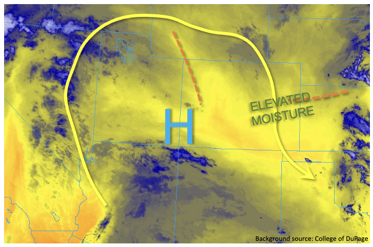
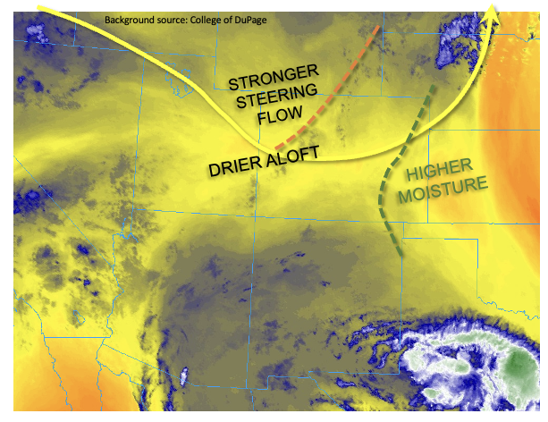
It is quite moist this morning over eastern Colorado with the moisture plume still overhead. Dew points east of the green dashed line below are greater than 55F, and PW at Denver was measured at 1.09 inches despite a very dry layer around 300mb. This value is close to the maximum moving average for this point in the season (!), which means storms that develop (east) are expected to have very efficient rain rates. Northwest steering flows also remain weak, and paired with training storms over the mountains, heavy rainfall accumulations are anticipated once again. Also marked below is a shortwave (orange dashed line) that will rotate around the building Great Basin High today. In addition to providing enhanced lift over the southern portion of the eastern mountains and western San Juan Mountains for storm development this afternoon, this feature will help set up a southwest to northeast boundary over the Southeast Plains this afternoon. A handful of low-end severe storms may develop along this line, which will be capable of producing severe hail, strong outflow winds and perhaps a weak tornado. A Moderate/Low flood threat has been issued for eastern Colorado. Flood threats for today include excessive runoff (particularly over the saturated soils west), mud flows/debris slides (mountains), road flooding and field ponding.
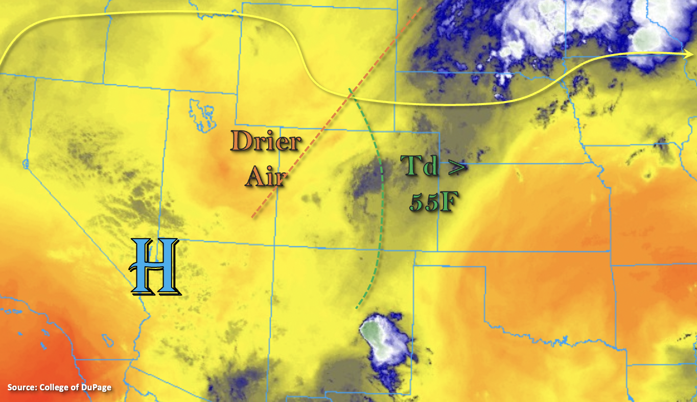
Over western Colorado, a drier air mass (marked above) has moved over the Northern Mountains, Northwest Slope, Grand Valley and northern Central Mountains. Better moisture remains south, so storm development this afternoon is forecast to be focused over the eastern San Juan Mountains and south Central Mountains. Storms will be capable of producing a quick 0.60 inches, which over semi-saturated soils and steep terrain may cause excessive runoff and an isolate debris flow. The Low flood threat has been extended over this region for that reason.
Today’s Flood Threat Map
For more information on today’s flood threat, see the map below. If there is a threat, hover over the threat areas for more details, and click on burn areas to learn more about them. For Zone-Specific forecasts, scroll below the threat map.
Zone-Specific Forecasts:
Front Range, Southeast Mountains, Raton Ridge & Urban Corridor:
Storms should kick off by early afternoon with upslope flow and enhance lift from the incoming shortwave over the mountains. The southern Front Range and Southeast Mountains are expected to see the bulk of the storm activity today. Max 1-hour rain rates up to 1.10 inches over the mountains and 1.50 inches over the adjacent plains are possible. Storm totals will likely be greatest near the Raton Ridge with a couple rounds of rainfall forecast, and isolated storm totals up to 2.25 inches will be possible. Rainfall this afternoon and evening could lead to road flooding, local stream/creek flooding and field ponding under the stronger storm cores. Over steeper terrains, saturate soils mean excessive runoff will be possible along with mud flows and debris slides. A Moderate/Low flood threat have been issued.
Primetime: 12:30PM to 11PM
Northeast Plains, Palmer Ridge & Southeast Plains:
A couple severe storms are possible over the plains today along a boundary that sets up. The main threats will be severe hail, strong outflow winds and heavy rainfall. A weak tornado may also be possible. Max 1-hour rain rates up to 2.25 inches will be possible and isolated storm totals up to 2.75 inches could occur. Threats include local stream, road and arroyo flooding along with field ponding.
Primetime: 2PM to Midnight
Central Mountains, San Luis Valley & San Juan Mountains:
A quick 0.60 inches from storms over the eastern/southern San Juan and Central Mountains will be possible this afternoon and early evening. With spotty, decent rainfall accumulations over the last few days, increased runoff may be possible over the saturated areas along with mud flows and debris slides. Northwesterly steering flow may push some storms into the San Luis Valley again, and isolated totals up to 0.50 inches will be possible along the valley edges. A Low flood threat has been issued for the steeper terrains.
Primetime: 1PM to 8:30PM
Northern Mountains, Grand Valley, Northwest Slope, & Southwest Slope:
With the drying trend beginning over these regions, not much (if any) rainfall is forecast. There may be a stray storm or two north near the Continental Divide, but only light totals are forecast. Afternoon high temperatures will reach the upper 90Fs with the warmest temperatures over the Grand Valley. Flooding is NOT forecast.