Issue Date: Sunday, July 18th, 2021
Issue Time: 9:20AM MDT
— A LOW flood threat has been posted for parts of the San Juan Mountains
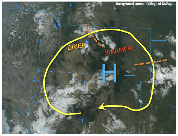
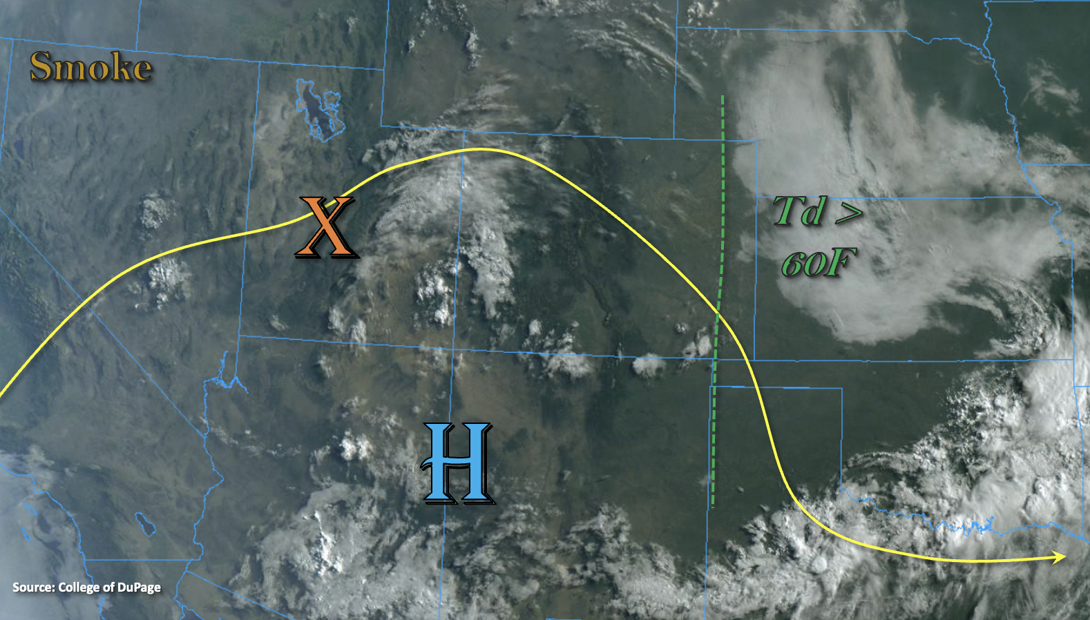
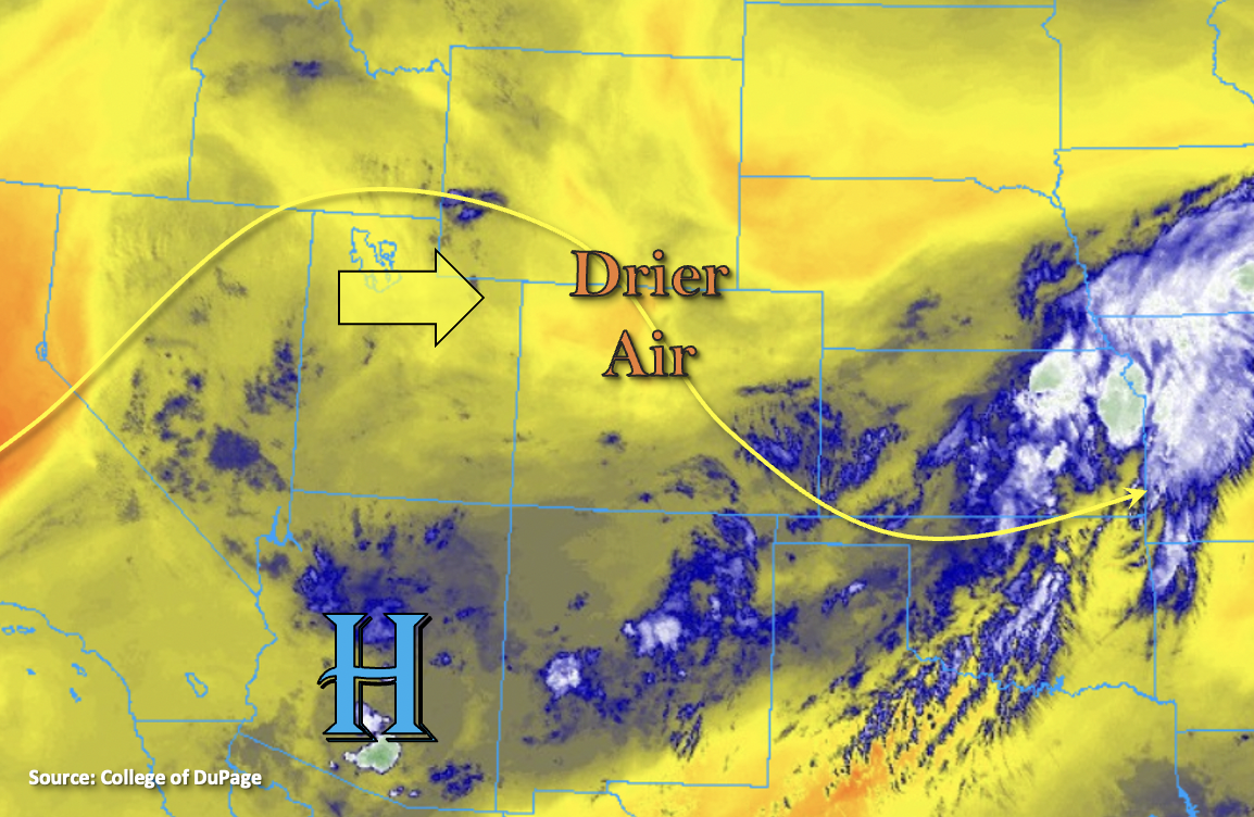
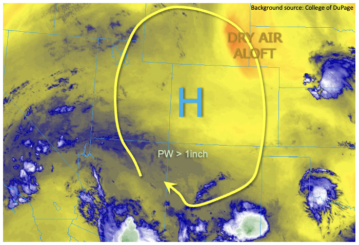
As shown in the water vapor image, below, an upper-level ridge has strengthened significantly over the past 24 hours and is now positioned over western Colorado. Plenty of moisture is still “stuck” underneath the ridge with morning radiosonde PW coming in at 0.91 inches at Grand Junction and 0.82 inches at Denver. However, a notable area of subsidence and upper-level drying was noted along the WY/NE border today so PW should slightly decrease through the day over the eastern half of Colorado. On the other hand, PW at Albuquerque came in at an impressive 1.21 inches, with a moist adiabatic type sounding profile indicating very efficient rain rates are possible. A simple interpolation between Albuquerque and Grand Junction implies the southwest part of Colorado currently has PW at or around 1.0 inch, which is significantly above normal for this time of year. Despite the warm mid-level temperatures we expect scattered to numerous showers and thunderstorms again for the southern high terrain. However, today, the LOW flood threat will be limited to just the climatologically favored San Juan Mountains where E/ENE steering flows of 10-15mph along with instability up to 800 J/kg will support heavy rainfall cores. Elsewhere, lower rainfall coverage is expected. However, isolated strong-to-severe thunderstorms will once again be possible over the Northeast and Southeast Plains, though steering flow of 25mph+ will limit point rainfall to below flood threat thresholds.
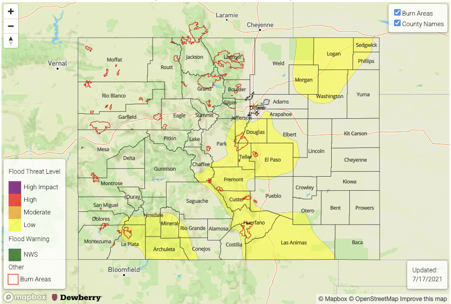
Today’s Flood Threat Map
For more information on today’s flood threat, see the map below. If there is a threat, hover over the threat areas for more details, and click on burn areas to learn more about them. For Zone-Specific forecasts, scroll below the threat map.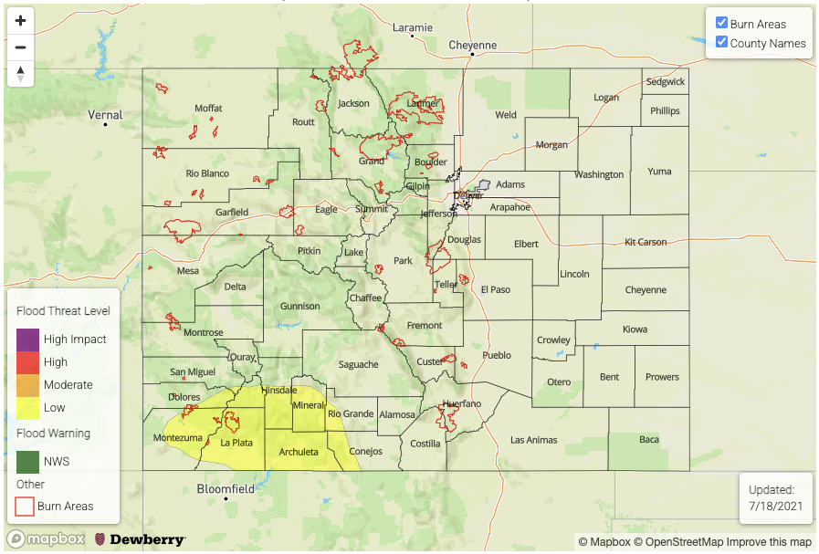
Zone-Specific Forecasts:
San Juan Mountains, Southwest Slope, San Luis Valley, Southeast Mountains, and Raton Ridge:
Scattered to numerous showers and thunderstorms especially over the higher terrain of the San Juan Mountains where max 30-min rainfall up to 0.7 inches and max 1-hour rainfall up to 1.2 inches is expected. A LOW flood threat has been posted for the San Juans for isolated flash flooding, debris slides and mud flows. Elsewhere, isolated to widely scattered storm coverage is expected with max 1-hour rainfall up to 0.8 inches.
Primetime: 12PM through 10PM
Northeast Plains, Palmer Ridge and Southeast Plains:
Hot with isolated to widely scattered showers and thunderstorms possible this afternoon and evening. Max 1-hour rainfall up to 0.9 inches (west) and 1.5 inches (east), which is just below flood threat thresholds. However, nuisance street/field ponding is possible under the strongest cells. Severe weather, in the form of large hail and damaging winds, will also be possible especially in eastern areas along the KS and NE borders.
Primetime: 2PM through 11PM
Northwest Slope, Grand Valley, Northern Mountains, Central Mountains, Front Range and Urban Corridor:
Hot with an isolated shower or storm possible especially over the higher terrain. Max 1-hour rainfall up to 0.6 inches possible. Flooding is NOT expected today.
Primetime: 1PM through 9PM