Issue Date: Monday, July 26th, 2021
Issue Time: 9:30AM MDT
— A MODERATE flood threat has been posted for parts of the San Juan Mountains
— A LOW flood threat has been posted for parts of the Southeast Plains, Raton Ridge, Southeast Mountains, Central Mountains and Southwest Slope
— An afternoon forecast update is possible today for the Southeast Plains
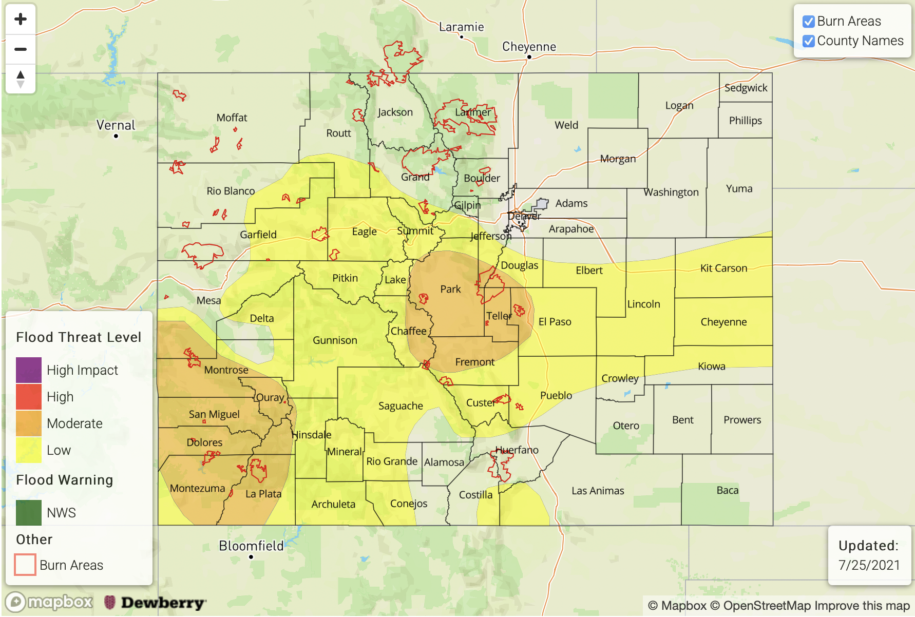
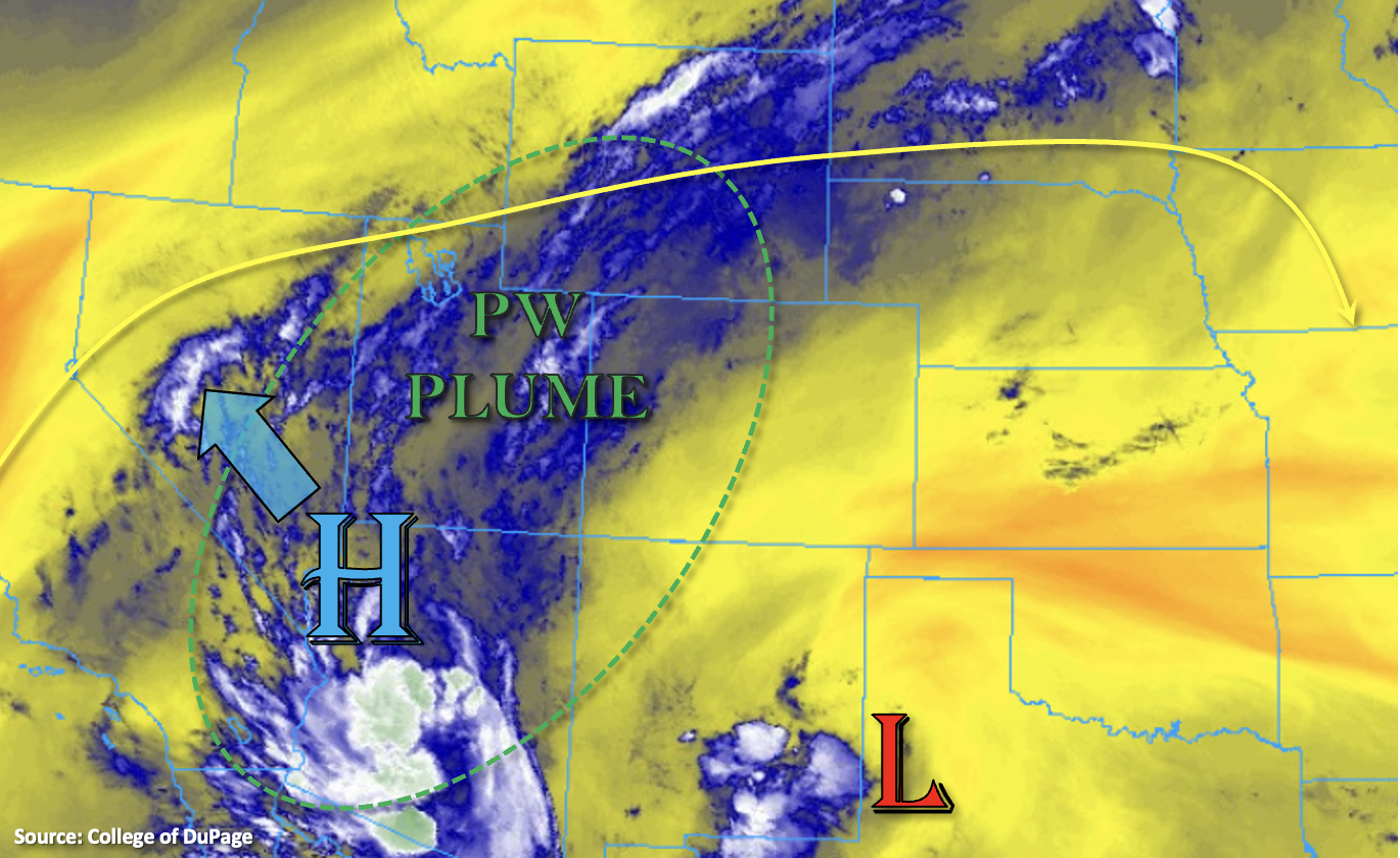
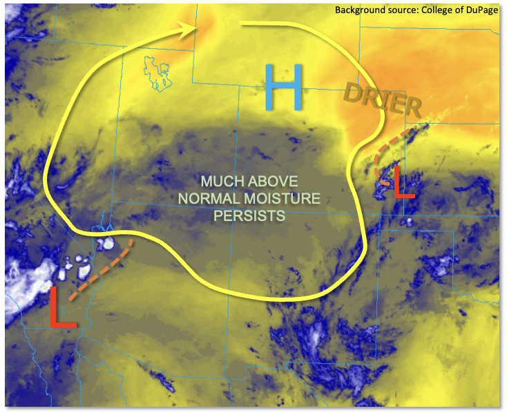
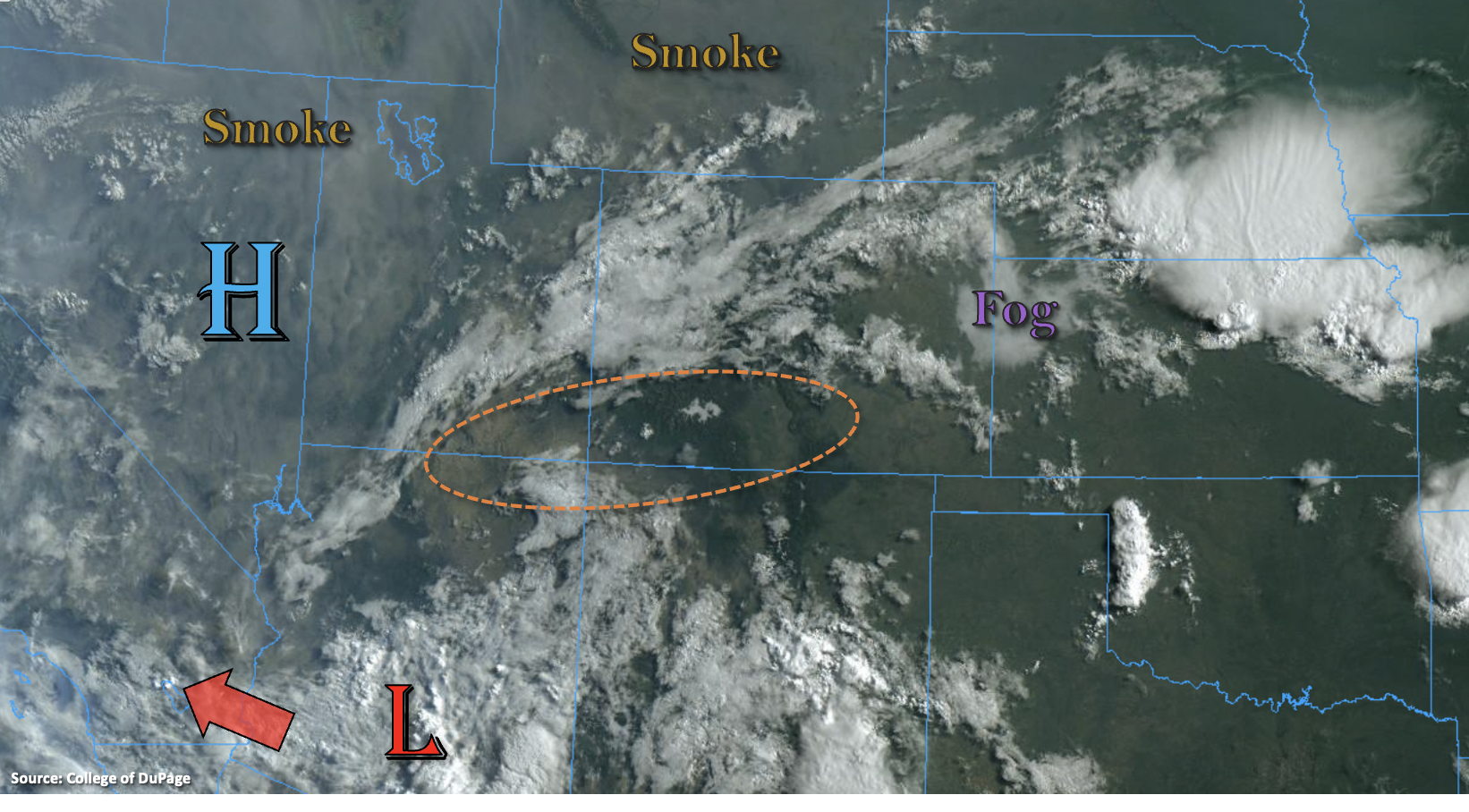
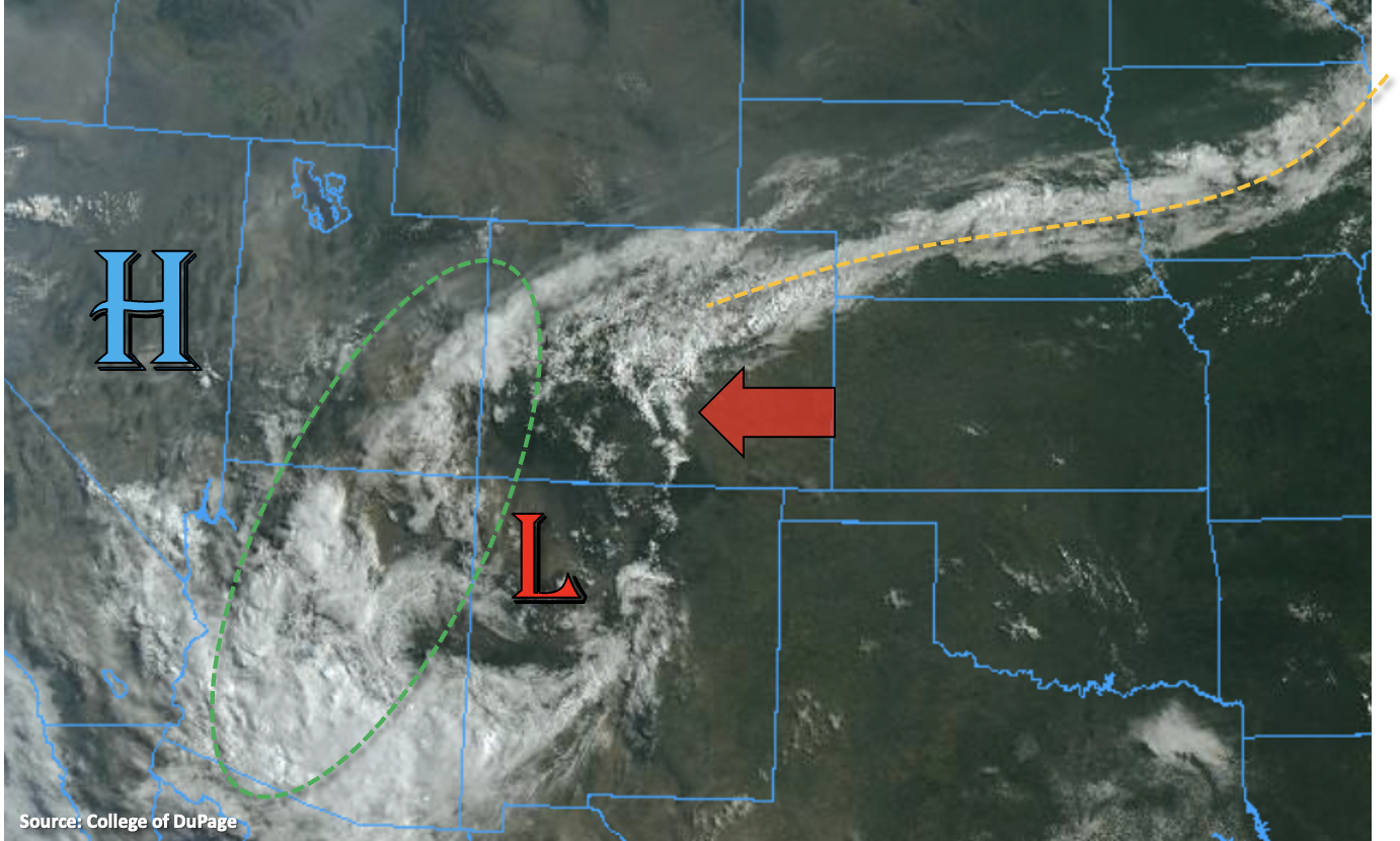
As shown in the water vapor image below, a notable area of dry air is working into northeast Colorado from the northeast. Denver’s PW this morning dropped to 0.79 inches and could drop a little more during the day. A distinct dry layer was noted on the North Platte (NE) morning sounding, which implies little to no rainfall coverage over northeast Colorado today. Moving southward, a marked disturbance was noted over southeast Colorado, just south of the dry air. With only weak steering flow from the north, this disturbance is expected to setup a moisture convergence zone over the Southeast Plains today that could produce very heavy rainfall rates. This is partially mitigated by the relatively low precipitation chances (50-60%) and scattered coverage of the storms. Nonetheless, a LOW flood threat is warranted here. Moving west, plenty of moist air remains over southern and southwestern Colorado with the Grand Junction morning PW coming in at 1.08 inches, along with a surface dewpoint of 61F, very high even for this time of year. Some drying will occur along the Continental Divide as the aforementioned dry layer spills over the higher terrain. Nonetheless, we expect numerous thunderstorms again along the climatologically favored San Juan Mountains as well as the Elk Mountains. A MODERATE flood threat has been posted for the western San Juans, mainly for the higher probability of multiple heavy rainfall cores. In surrounding regions, a LOW flood threat has been posted.
Today’s Flood Threat Map
For more information on today’s flood threat, see the map below. If there is a threat, hover over the threat areas for more details, and click on burn areas to learn more about them. For Zone-Specific forecasts, scroll below the threat map.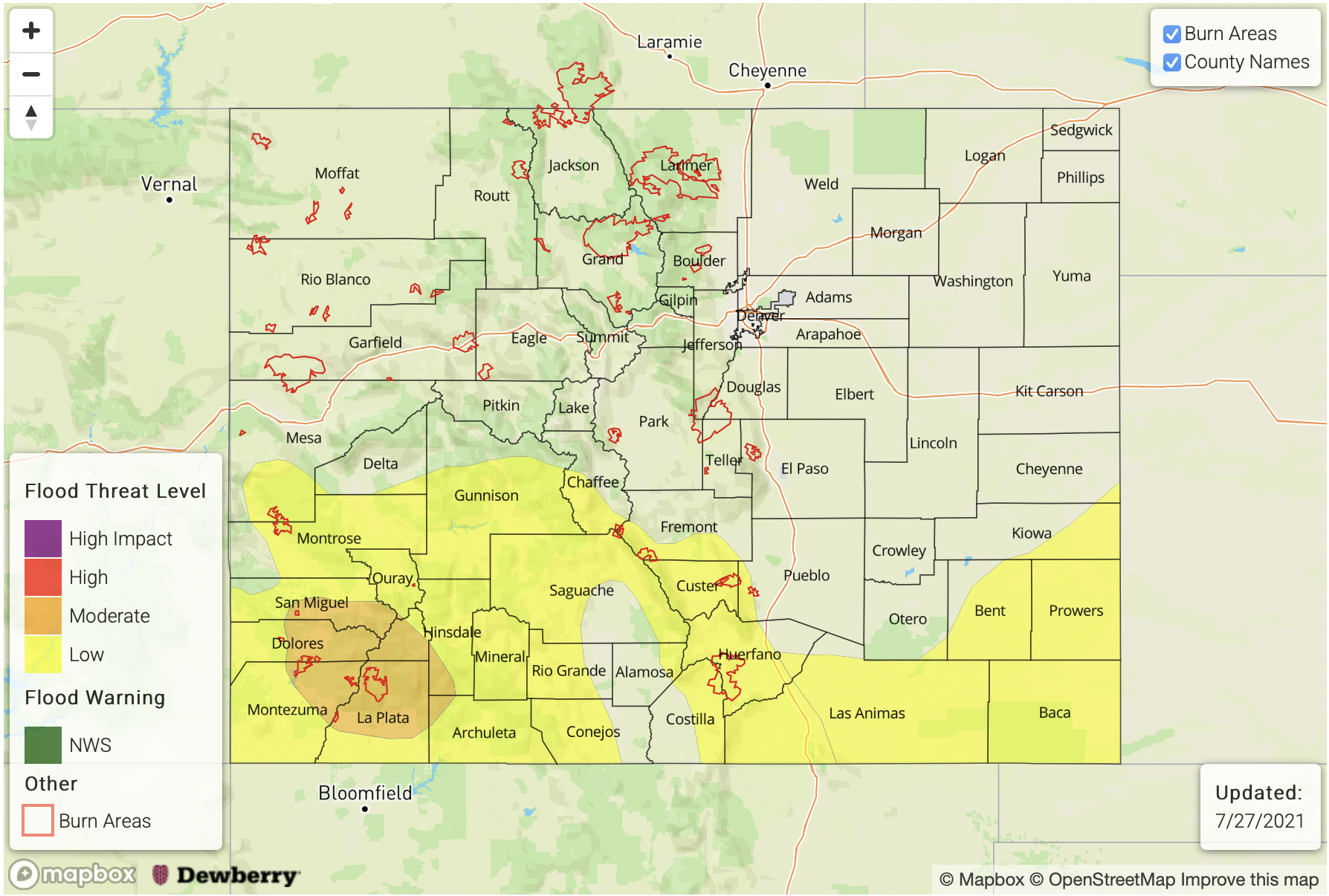
Zone-Specific Forecasts:
Southeast Plains:
Scattered thunderstorms likely this afternoon with the highest coverage in the far southeast, along the Kansas border. Max 1-hour rainfall up to 3.0 inches possible, which could produce isolated flash flooding. A LOW flood threat has been posted for parts of the region. The threat of heavy rainfall will persist into the late evening and possibly early overnight hours. An afternoon forecast update is possible, if a higher threat appears warranted.
Primetime: 3PM through 2AM
San Juan Mountains, Southwest Slope, Grand Valley, Central Mountains, Raton Ridge, San Luis Valley and Southeast Mountains,:
Numerous showers and thunderstorms again today, with the highest coverage over the San Juan Mountains, Elk Mountains as well as southern parts of the Sangre de Cristo mountains. Max 1-hour rainfall up to 1.3 inches possible, with max 24-hour totals up to 2.2 inches especially over the San Juans. A MODERATE flood threat has been posted for the San Juans with a LOW flood threat in surrounding areas. Threats include isolated flash flooding, debris slides and mud flows. With consistent precipitation over the recent days, base river flows have increased so small creek and tributary flooding will also be possible today.
Primetime: 12PM through 11PM
Northwest Slope, Northern Mountains, Urban Corridor, Northeast Plain, Palmer Ridge and Front Range:
Generally drier today, but isolated to widely scattered showers and thunderstorms possible in the afternoon and evening especially over the higher terrain and foothills. Max 1-hour rainfall up to 1.0 inch (east of Continental Divide) and 0.8 inches (west of Continental Divide). Flooding is NOT expected today, but nuisance street ponding is possible.
Primetime: 12PM through 9PM
 \
\