Issue Date: Saturday, August 7th, 2021
Issue Time: 9:05AM MDT
— Flooding is NOT expected today
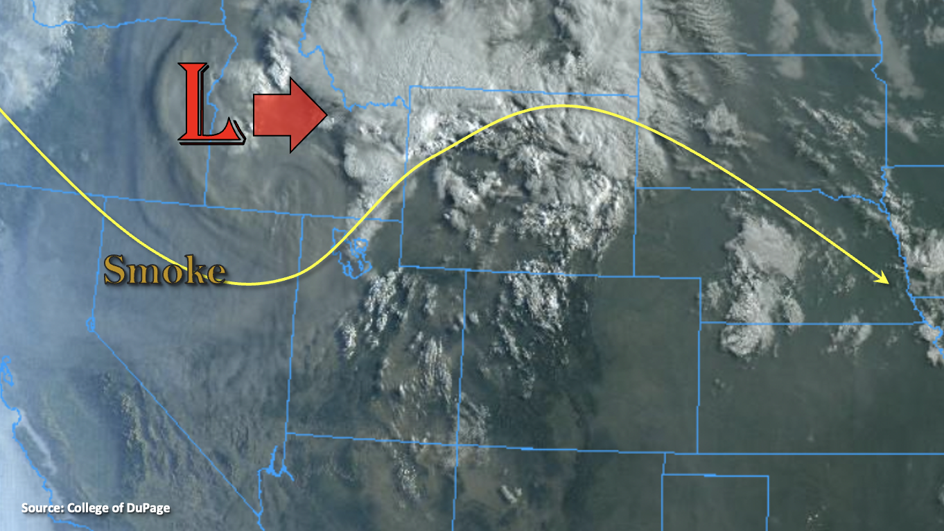
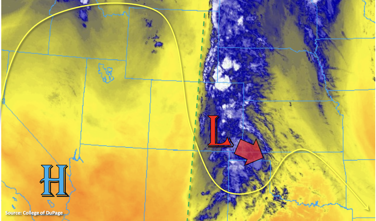
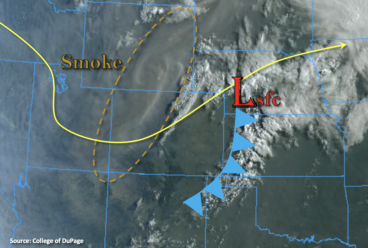
The trough will be overhead today and associated westerly flow aloft has started to push a thick smoke plume into the state (dashed oval below). Smoky conditions have caused a statewide Air Quality Alert to be issued, and smoke is expected to be thickest in the valley locations. A cool front has dropped through the state, which paired with the incoming smoke will bring slightly cooler conditions to the northern portion of eastern Colorado this afternoon. Finally, there’s some morning cloud cover along the northeast border associated with some mid-level lift out in front of the trough.
As far as rainfall chances today, it should stay dry across the majority of the state. PW at Grand Junction has fallen to 0.40 inches, and PW at Denver (0.72 inches) will continue to drop with the dry, westerly flow ramping up. There’s still a chance for an isolated storm or two over the northern Front Range and Southeast/San Juan Mountain intersect, but only light rainfall and cloud cover is anticipated. Best chance for seeing measurable rainfall this afternoon will be over the Palmer Ridge and over the far northeast and southeast corners of the state. With only moderate max 1-hour rain rates forecast, flooding is NOT expected today.
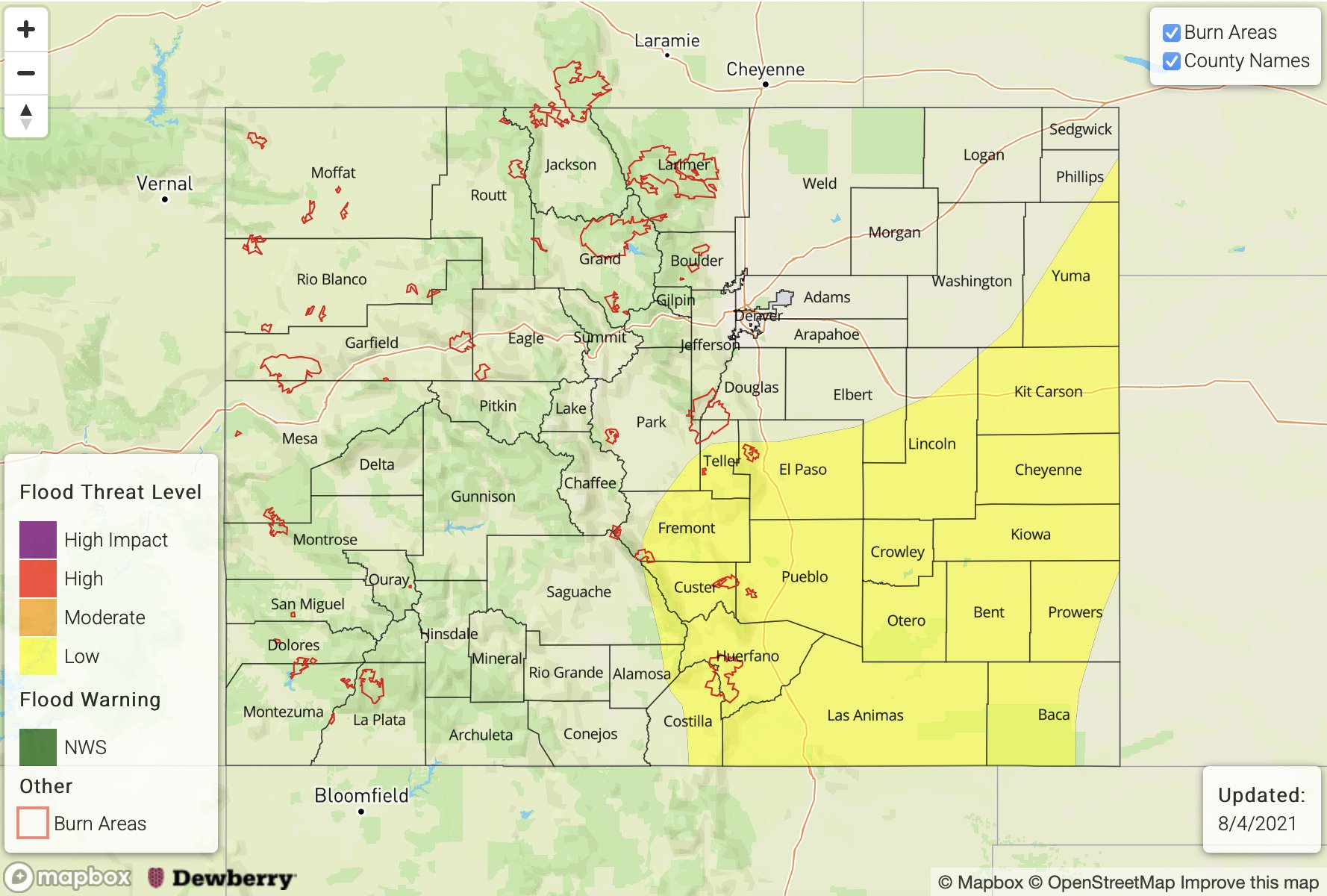
Today’s Flood Threat Map
For more information on today’s flood threat, see the map below. If there is a threat, hover over the threat areas for more details, and click on burn areas to learn more about them. For Zone-Specific forecasts, scroll below the threat map.

Zone-Specific Forecasts:
Northeast Plains, Raton Ridge, Palmer Ridge & Southeast Plains:
A few isolated storms may form over the elevated ridges this afternoon, but quick E/SE movement of the storms, small storm cores and high cloud bases will limit the flood threat. The main storm threats will be lightning and gusty outflow winds up to 60 mph. As the storms move eastward, outflow boundaries may help initiate a few more storms over the Southeast Plains. Additional storms may track into the northeast corner of the state this evening. Max 1-hour rain rates up to 1 inch are possible, so flooding is NOT expected.
Primetime: 12PM to 9PM
Southeast Mountains, San Juan Mountains, Front Range & Urban Corridor:
A few isolated, weak storms may form along and near the Continental Divide (northern Front Range) or south near the Southeast/San Juan Mountain intersect. Storms will likely only produce a few sprinkles and maybe a little lightning, but more just cloud cover. Any accumulations should remain under 0.10 inches. Storms will likely dissipate as they move off the mountain, and a weak storm or two could develop over northern Weld County. Flooding is NOT forecast.
Primetime: 12PM to 5PM
Grand Valley, San Luis Valley, Northwest Slope, Northern Mountains, Central Mountains & Southwest Slope:
It will be quite smoky, but it should stay dry over these forecast zones today. An isolated storm may pop up near the Continental Divide, but cloud cover and some virga are the most likely outcome. The thick smoke will likely keep high temperatures a couple degrees cooler. Flooding is NOT forecast.