Issue Date: Friday, August 6th, 2021
Issue Time: 9AM MDT
— Flooding is NOT expected today
There’s a slight pattern change today as a quick-moving trough aids in shifting the ridge axis eastward. Not a ton of moisture is associated with this feature, but PW at Grand Junction has bounced up from 0.49 inches yesterday to 0.71 inches this morning. Moisture will likely rise a little more throughout the day as the feature moves east, so plenty for scattered storms to develop over the mountains with the diurnal flow and enhanced lift. However, with most of the moisture located in the mid-level of the atmosphere, the main threat from storms today will be strong outflow winds with the inverted-V profiles. High cloud bases and quick eastward movement of storms will also help to limit the rainfall threat. As the storms spill into the adjacent plains by early afternoon, with additional development of some storms over the Palmer Ridge, many will produce more virga and cloud cover than wetting rainfall. As anticipated, flooding is NOT expected today.
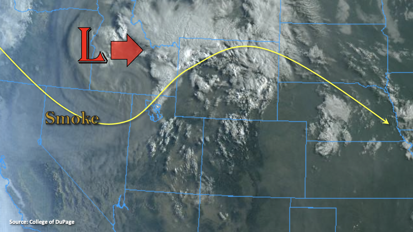
Accompanying the trough and more westerly flow will be some heavy smoke from the wildfires over the western US. The visible satellite imagery below shows a very thick smoke plume circulating around the Low. Higher near surface smoke looks to already have reached Utah, so the forecast for it to reach the western border by this evening looks on track. It is expected to begin to advect into eastern Colorado by tomorrow morning.
Today’s Flood Threat Map
For more information on today’s flood threat, see the map below. If there is a threat, hover over the threat areas for more details, and click on burn areas to learn more about them. For Zone-Specific forecasts, scroll below the threat map.

Zone-Specific Forecasts:
Northern Mountains, Southeast Mountains, Central Mountains, San Juan Mountains & Front Range:
There will be enough moisture for scattered storm development over the mountains this afternoon. Increased lift will help to expand the coverage of the scattered storms as well. Max 1-hour rain rates up to 0.25 inches will be possible for a few of the stronger storms that form along and near the Continental Divide. Training storms may allow for isolated totals up to 0.50 inches. The main threat from storms will be strong outflow winds, which could gust up to 50 mph. This will be most likely to happen over the central and northern high terrains this afternoon and evening. A second round of storms may develop over the Central Mountains tonight, which could help to increase local accumulations a bit. Flooding is NOT forecast.
Primetime: 1PM to 11PM
Northeast Plains, Urban Corridor, Raton Ridge, Palmer Ridge & Southeast Plains:
The quick easterly movement of storms will spill the mountain storm activity into the adjacent plains by early afternoon. There may be some additional storm development over the Palmer Ridge and areas south are expected to stay dry. Max 1-hour rain rates up to 0.25 inches will be possible with most storms producing only cloud cover and virga. If, and it’s a big if, storms can make it into the far Northeast Plains before falling apart, isolated totals up to 0.60 inches will be possible. Flooding is NOT forecast. A Red Flag Warning has been issued for Yuma County today from 1PM to 7PM.
Primetime: 2:30PM to 10:30PM
Grand Valley, San Luis Valley, Northwest Slope & Southwest Slope:
It should stay dry over the lower elevations of these regions though scattered storm development is still forecast over the elevated plateaus. More cloud cover and virga are expected than measurable rainfall today, so flooding is NOT forecast. A handful of storms could produce some brief, but strong outflow winds. The tightening pressure gradient is expected to increase the southwest surface winds over the Northwest Slope and Grand Valley with gusts up to 40 mph possible. Paired with low relative humidity values, a Red Flag Warning has been issued.