Issue Date: Wednesday, September 14th, 2022
Issue Time: 10:40AM MDT
— A LOW flood threat has been issued for the Southwest Slope, Grand Valley and Northwest Slope
— Fire-Burn Forecast Summary: 3 burn areas under MODERATE threat, 5 burn areas under LOW threat; click HERE for more info
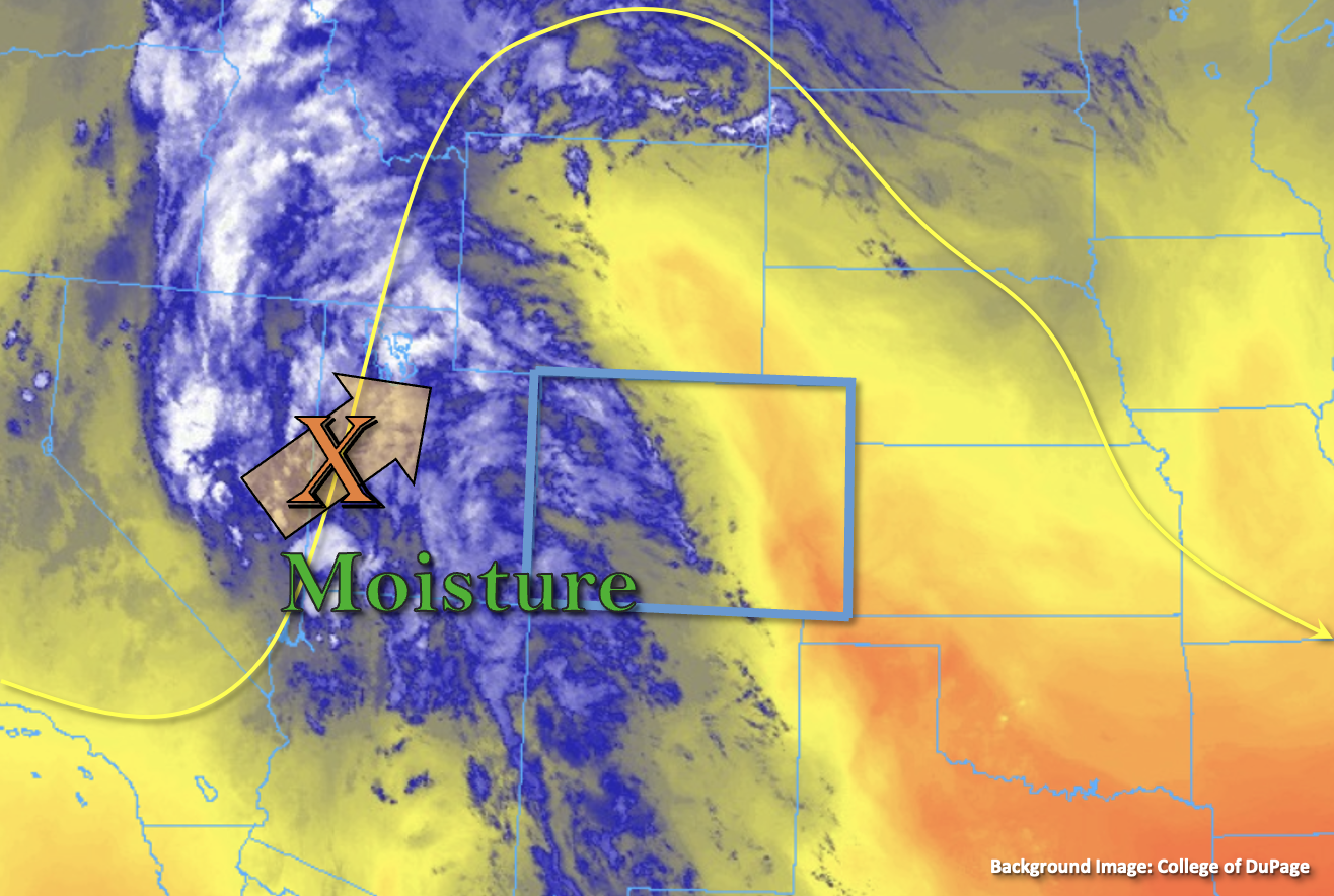
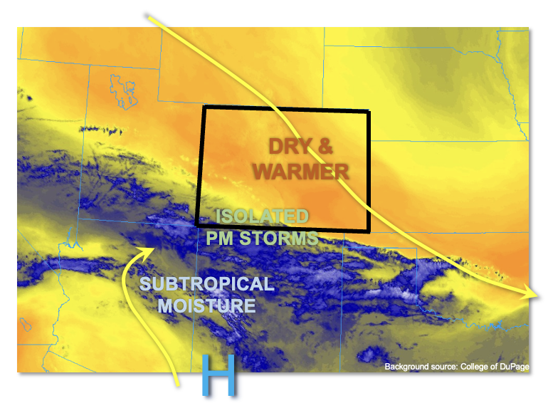
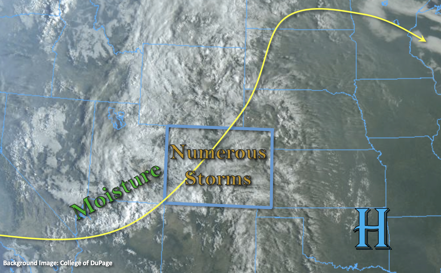
With subtropical moisture and mid-level lift overhead from the remnants of Kay, it’s a cloudy start to the day (see visible satellite imagery below) with widely scattered, light showers already occurring over portions of western Colorado, the mountains, and far eastern plains. The moisture is well reflected in morning PW values, which were measured at 0.98 inches and 0.58 inches at Grand Junction and Platteville, respectively. To put that in perspective, that’s about 175% greater than the daily mean for Grand Junction! PW is expected to continue to rise over eastern Colorado throughout the day, so over the last 24 to 48-hours, there has been a rapid increase in the available moisture over the state with this system. This means that as daytime heating continues, the ongoing showers are expected to expand in coverage and intensity producing numerous storms over the state by early this afternoon.
As far as the flood threat, over the mountains, fast southwest steering flows and cooler temperatures (minimal instability) should limit the chance for longer-duration heavy precipitation over the area. For eastern Colorado and the Front Range, a drier boundary layer combined with the quick SSW steering flows should limit the flooding potential from storms that develop. Both areas may see some brief moderate downpours, but flooding is NOT expected. There is one area of concern for isolated flooding issues today, which is over the high terrains along the western border. Training storms, moderate instability with breaks in the cloud cover and a higher quantity of surface moisture may cause a handful of storms that develop to produce higher rainfall rates with the decent warm layer depth. A LOW flood threat has been issued for isolated heavy rainfall potential.
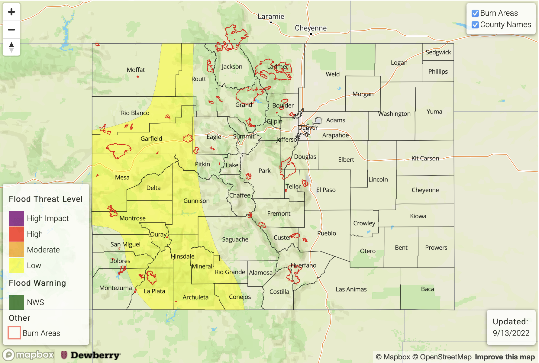
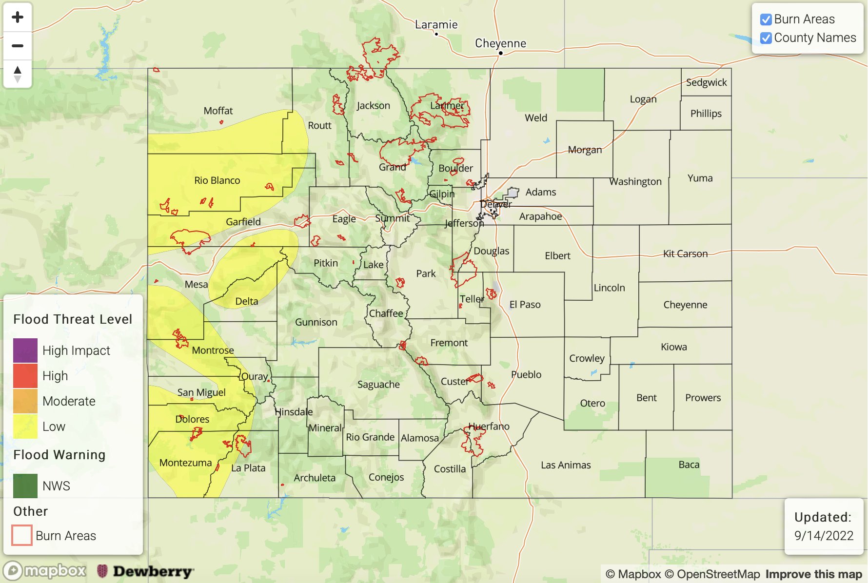
Today’s Flood Threat Map
For more information on today’s flood threat, see the map below. If there is a threat, hover over the threat areas for more details, and click on burn areas to learn more about them. For Zone-Specific forecasts, scroll below the threat map.
Zone-Specific Forecasts:
Southwest Slope, Grand Valley, Northwest Slope, Northern Mountains, San Juan Mountains, Central Mountains & San Luis Valley:
Isolated max 1-hour rain rates up to 1.25 inches and storm totals up to 1.9 inches may be possible where training storms develop in areas that receive breaks in cloud cover. This could cause isolated debris slides and mud flows over steeper terrain along with some road flooding and ponding in low-lying areas. A LOW flood threat has been issued. More stratiform and brief moderate rainfall is forecast for the mountain zones with storm totals just over an inch possible by tomorrow morning. Similar to yesterday, the flood threat should end by the evening hours, and widely scattered light precipitation will likely linger over the northern high terrain into tomorrow morning.
Primetime: 11:30AM to Ongoing
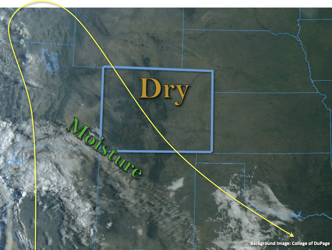
Southeast Mountains, Front Range, Raton Ridge, Urban Corridor, Palmer Ridge, Northeast Plains & Southeast Plains:
With the increase in moisture, there will be an uptick in the chance for precipitation today. Best chance for accumulation will be over the mountain zones and adjacent ridges. Max 30-minute rain rates up to 0.5 inches (west) and 0.75 inches (east) will be possible. As storms move off the high terrain, limited surface moisture is likely to cause storms to produce some gusty outflow winds. Flooding is NOT expected, and light showers will be likely over the Front Range tomorrow morning.
Primetime: 12PM to 8PM