Issue Date: Monday, August 23rd, 2021
Issue Time: 8:30AM MDT
— Flooding is NOT expected today
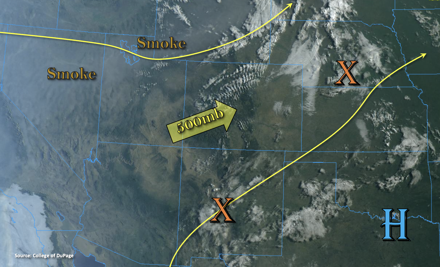
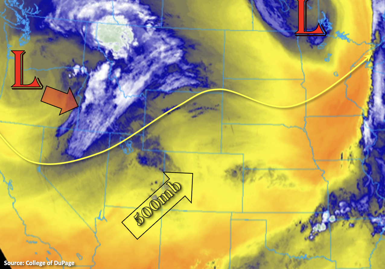
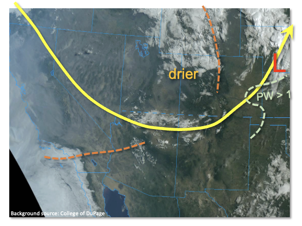
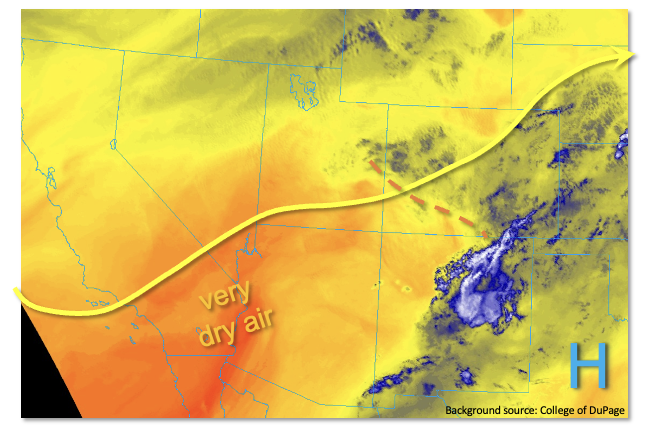
As shown in the water vapor image, below, relatively little change was observed in this morning’s atmospheric circulation compared to yesterday morning. The upper-level ridge to the southeast of Colorado has strengthened a bit, leading to a slightly stronger southwesterly flow over most of our state. Storm motions today will be 25mph or higher, which will limit point rainfall. A sprawled out, weak disturbance was noted over central Colorado, which will likely focus today’s rainfall a bit, especially on its moister northeast side. However, boundary layer moisture, a necessity for heavy rainfall, remains largely lacking. Although Grand Junction’s morning Precipitable Water (PW) has increased to a somewhat respectable 0.84 inches, the lower-levels are relatively dry. Furthermore, a strong warm “nose” of air remains in the upper levels and will be detrimental to building storm clouds, helping to limit rainfall. Additionally, much drier air resides just west of Colorado, so we expect steady or decreasing PW throughout the day especially along the UT border.
In all, with the slightly higher mid-level moisture, expect an increase in higher terrain storm coverage today into the scattered category. Highest coverage will be over the higher terrain, above 8,000 feet, but a few isolated storms will likely make it eastward into the Northeast Plains. Storms will produce light to possibly moderate rainfall over brief period, along with gusty winds. However, flooding is NOT expected today.
Today’s Flood Threat Map
For more information on today’s flood threat, see the map below. If there is a threat, hover over the threat areas for more details, and click on burn areas to learn more about them. For Zone-Specific forecasts, scroll below the threat map.

Zone-Specific Forecasts:
Northeast Plains, Southeast Plains, Palmer Ridge, San Luis Valley, Raton Ridge and Urban Corridor:
Seasonably hot today with isolated to widely scattered showers and weak storms this afternoon, mainly closer to the foothills. Max 1-hour rainfall up to 0.4 inches is possible with the strongest cells, along with gusty winds. Flooding is NOT expected today.
Primetime: 1PM through 9PM
Grand Valley, Northwest Slope, Central Mountains, Northern Mountains, San Juan Mountains, Southwest Slope, Southeast Mountains and Front Range:
Seasonably warm today with scattered showers and weak storms mainly over the higher terrain above 8,000 feet. Max 1-hour rainfall up to 0.5 inches is possible today, especially over northern areas towards the WY border. Flooding is NOT expected today. Gusty winds will also be possible with the stronger cells.
Primetime: 12PM through 9PM