Issue Date: Sunday, August 22nd, 2021
Issue Time: 8:50AM MDT
— Flooding is NOT expected today
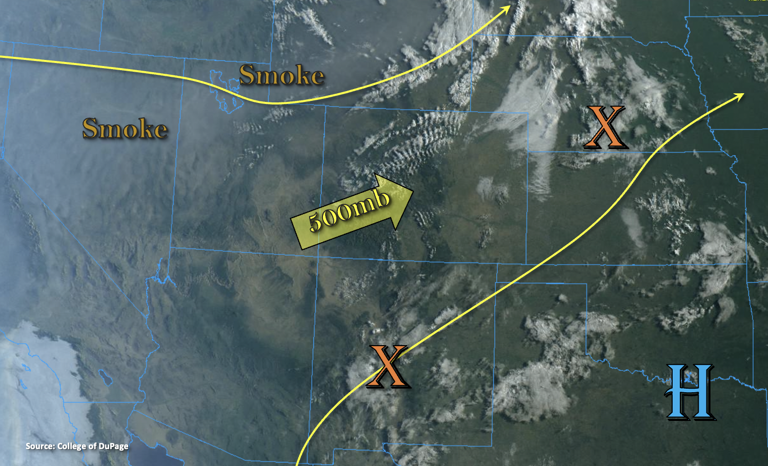
Colorado is sandwiched between a departing trough to our north and a building High pressure center to our southeast, which will produce a pretty benign weather pattern statewide today. Southwest and westerly flow aloft will continue to hold a drier air mass in place as indicated by PW at Denver and Grand Junction measured at 0.64 and 0.74 inches, respectively. With most of the moisture in the mid-levels, more cloud cover than wetting rainfall is forecast today with this residual moisture. There will be a couple weak disturbances that move through the flow, which could spark some isolated showers near the southern border. The best chance for wetting rainfall will be over the Southeast Plains; however, with better moisture to our east, only minor accumulations are expected. The passing trough is also expected to produce some breezy conditions at the surface over the mountains and adjacent plains. Overall, looking a beautiful day ahead with warming temperatures. As imagined, flooding is NOT forecast.
Today’s Flood Threat Map
For more information on today’s flood threat, see the map below. If there is a threat, hover over the threat areas for more details, and click on burn areas to learn more about them. For Zone-Specific forecasts, scroll below the threat map.
Zone-Specific Forecasts:
San Juan Mountains, Southwest Slope, Southeast Mountains, San Luis Valley, Raton Ridge & Southeast Plains:
Weak and isolated showers will be possible across the southern border high terrains and adjacent plains later this afternoon and evening. However, more cloud cover than wetting rainfall is forecast. Best chance for accumulation will be over the Southeast Plains and eastern Raton Ridge, but totals should remain under 0.50 inches. If showers can develop over the southern mountains, only light rainfall is forecast. High temperatures bounce back up to the 90Fs over the lower elevations with 80Fs forecast over the mountain valleys. Breezy southwest surface winds in the 10-15 mph range should be anticipated.
Primetime: 12PM to 8PM
Central Mountains, Grand Valley, Northwest Slope, Northern Mountains, Front Range, Palmer Ridge, Northeast Plains & Urban Corridor:
It should remain mostly dry today, although there’s a low chance for a sprinkle or two over the Palmer Ridge and mountains. High temperatures out east are forecast to reach 90F with 70’s and 80’s forecast west. Beautiful day ahead, but do expect westerly winds in the 15 to 20 mph range. The higher winds speeds are anticipated over the mountains.