Issue Date: Saturday, August 21st, 2021
Issue Time: 9:20AM MDT
— Flooding is NOT expected today
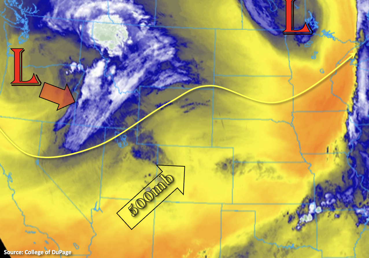
A cooler and less active weather pattern is forecast again today, although there is still some rainfall in the forecast. Overnight and early morning showers over the eastern plains (blue shades) will continue to break up and lift northward with the departing shortwave this morning. In the wake of these showers, cooler and more stable conditions are forecast across the plains, which will help to limit precipitation chances across the area. As for today, expecting southwest and westerly flow aloft to increase statewide as the next closed Low system digs southeast before moving east tomorrow. This flow will cause another couple of shortwaves to move across the state, which will help to generate storms over the Northwest Slope and across the Front Range, Central and Northern Mountains. The northeastward movement of the storms will likely cause some spillover into the Urban Corridor by mid-afternoon, which may produce some brief windy conditions along with light to moderate showers.
PW this morning was measured around 0.70 inches at Grand Junction and Denver. This should be plenty of moisture for scattered storms to develop, although a notable cap around 500mb will likely reduce the coverage of storms today. Quicker storm motions and higher storm bases should limit the flood threat, and anticipate the stronger storms that develop to produce some gusty outflow winds. Rainfall should end just after the sun sets; however, a second wave of overnight, light rainfall may be possible over the Northwest Slope. Flooding is NOT forecast today.
Today’s Flood Threat Map
For more information on today’s flood threat, see the map below. If there is a threat, hover over the threat areas for more details, and click on burn areas to learn more about them. For Zone-Specific forecasts, scroll below the threat map.

Zone-Specific Forecasts:
Central Mountains, Grand Valley, Northwest Slope, Northern Mountains, Front Range, Palmer Ridge & Urban Corridor:
Best chance for storms and accumulating rainfall today will be over these regions with much of the rainfall falling over the mountain forecast regions. Max 1-hour rain rates over the mountains up to 0.50 inches (central/south) and 0.35 inches (north) will be possible. Storms over the Northwest Slope may produce accumulations up to 0.40 inches. Higher storm bases with limited low-level moisture may allow the stronger storms that develop to produce gusty outflow winds this afternoon/evening along with normal threat of lightning. Overnight showers are possible over the Northwest Slope and Northern Mountains, but accumulations should be light with more cloud cover than rainfall forecast. Flooding is NOT expected today.
Primetime: 11AM to 9PM
San Juan Mountains, Southwest Slope, Southeast Mountains, San Luis Valley, Raton Ridge, Northeast Plains & Southeast Plains:
It should be a bit drier over these regions today, although some isolated light showers are still possible over the mountains. Storm totals should remain under 0.10 inches, so flooding is NOT expected. High temperatures will be on the cooler side as well with low to mid 80Fs for the valleys and 70Fs for the mountains.