Issue Date: Friday, August 27th, 2021
Issue Time: 9:35AM MDT
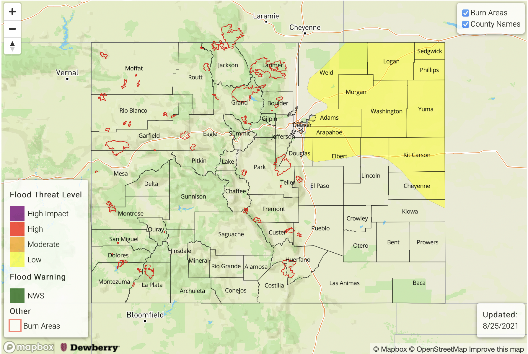
— A LOW flood threat has been issued for the Raton Ridge and Southeast Plains
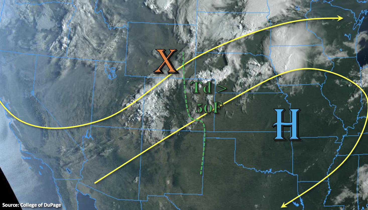
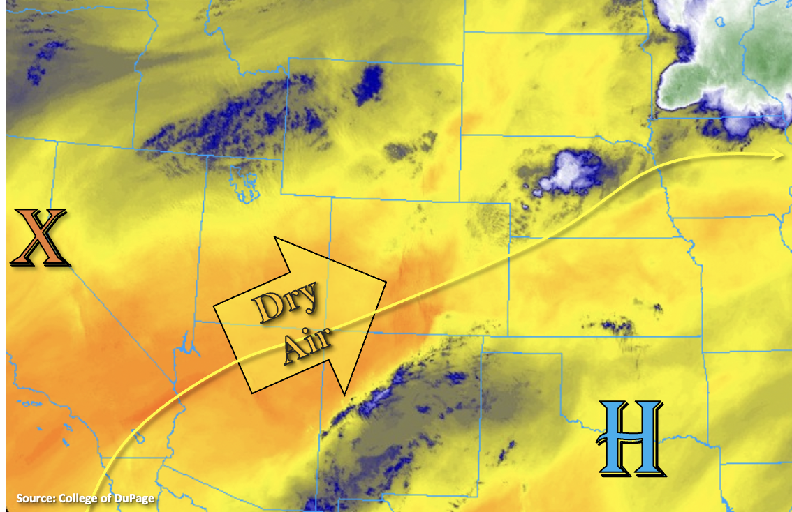
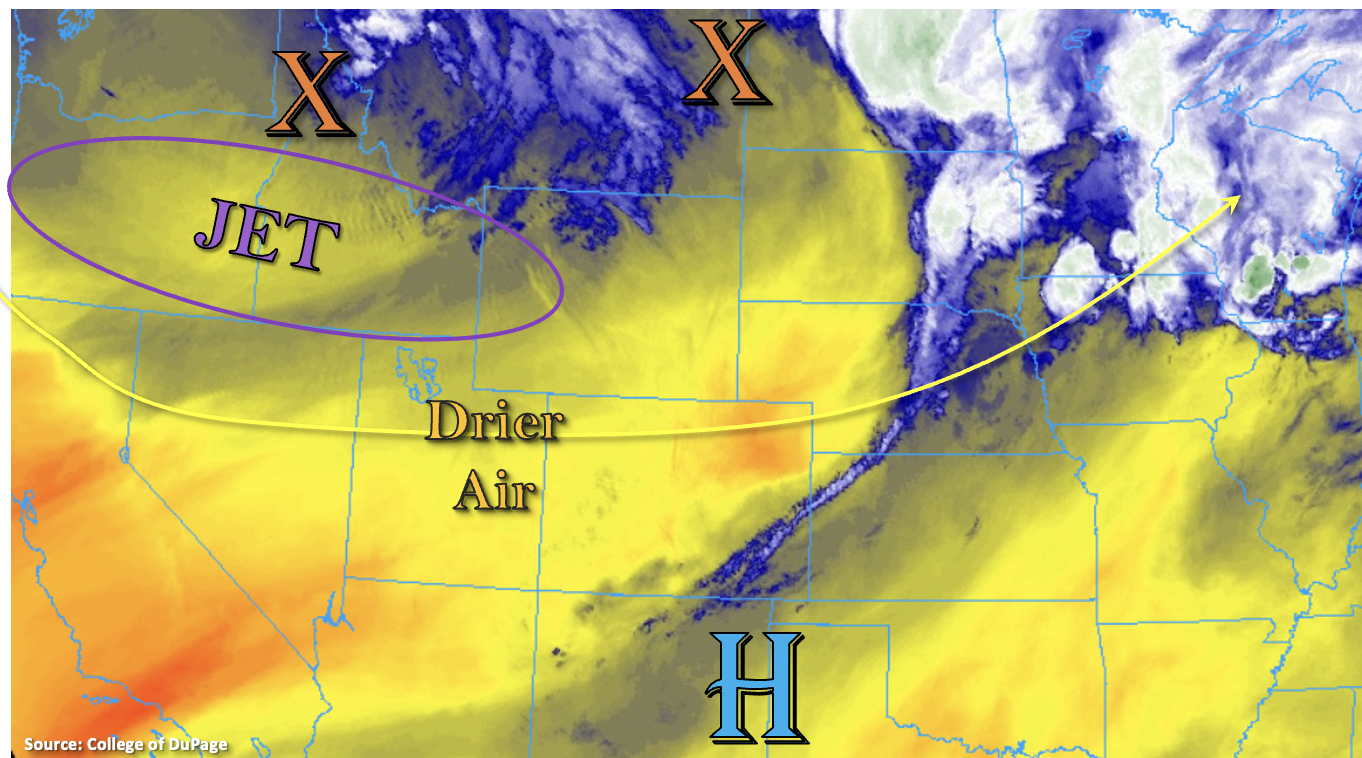
The large-scale trough will control our weather pattern today. West and northwest flow aloft has already begun to pull in the dry air mass marked below, which can be seen in both the Denver and Grand Junction soundings this morning. This will limit the chances for precipitation over the northern and central portions of the state today, although some isolated, weak storms may still be possible over the southern Front Range. An incoming jet to our north, associated with the base of the trough, will help to tighten the surface gradient over the northwest quadrant of the state. Breezy conditions should be expected this afternoon with westerly surface winds in the 15 to 25 mph range. A Red Flag Warning has been issued for Moffat County, so use caution with any activity that could cause a spark.
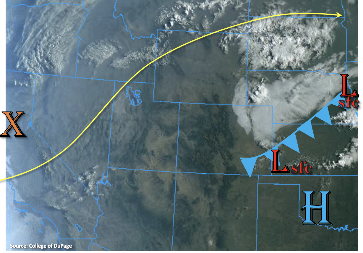
Further south, better moisture will likely hold on, which will be the focal point of scattered, mountain storms today. A drier surface layer is forecast over this region, which will make strong outflow winds and lightning the main threats from the storms that develop. This should also help to temper rainfall accumulations over the San Juan and Southeast Mountains, so only light to moderate rainfall totals are anticipated. Finally, the trough axis over the Raton Ridge and Southeast Plains (shown below) should help another round training storms to develop later this afternoon/evening. It will be a battle of southerly and southeasterly surface winds, trying to keep low-level moisture in place, and the incoming dry air aloft, trying to mix out this surface moisture. If the low-level moisture can hang on, storms may produce local, heavy rainfall, which may lead to some minor flooding issues. For this reason, a LOW flood threat has been issued. Storms should begin to wind down a couple hours after the sun sets and instability drops off.
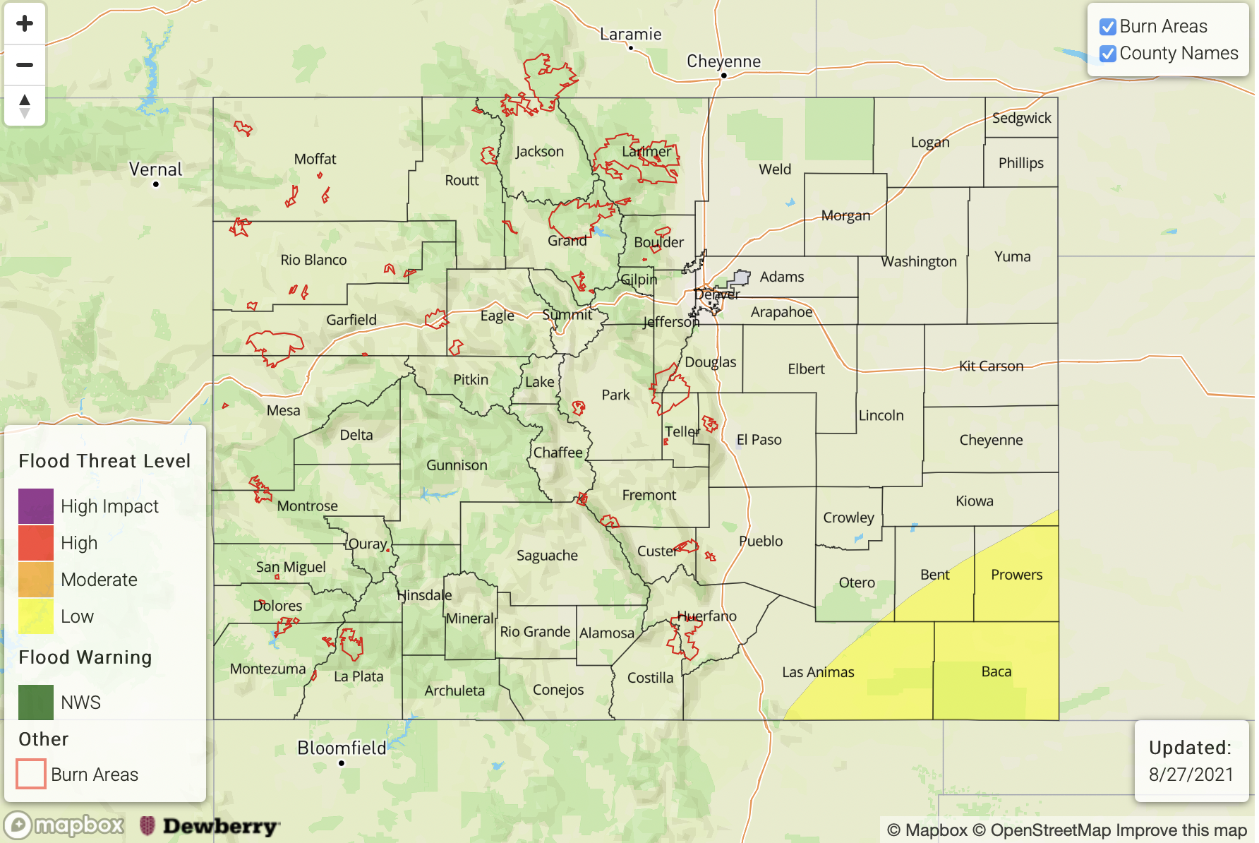
Today’s Flood Threat Map
For more information on today’s flood threat, see the map below. If there is a threat, hover over the threat areas for more details, and click on burn areas to learn more about them. For Zone-Specific forecasts, scroll below the threat map.
Zone-Specific Forecasts:
San Juan Mountains, Southeast Mountains, Front Range, Southeast Plains & Raton Ridge:
Scattered storms should develop over the southern Front Range, Southeast Mountains and San Juan Mountains this afternoon. Better coverage of storms and slightly higher rain rates are expected south. Max 1-hour rain rates up to 0.50 inches (south) and 0.15 inches (north) will be possible. The dry surface layer will make strong outflow winds and lightning the main threats from the storms that develop. Flooding is NOT expected here.
Better surface moisture may be able to hang on over the Raton Ridge and Southeast Plains near the surface trough. If it can, training storms over the area would likely produce higher rain rates. Max 1-hour rain rates up to 1.75 inches with storm totals up to 2.75 inches would be possible over an isolated area. In addition to this, stronger storms may produce small hail and gusty outflow winds. A LOW flood threat has been issued for road, arroyo, field and small stream flooding from these storms.
Primetime: 3:30PM to 9:30PM
Palmer Ridge, Southwest Slope, Central Mountains, Northeast Plains, San Luis Valley, Urban Corridor, Grand Valley, Northwest Slope & Northern Mountains:
Dry conditions are expected over these forecast regions, especially west. A high-based storm or two may drop a few sprinkles over the Palmer Ridge, but that’s about it. Westerly surface winds are forecast to reach 15 to 25 mph over the Northwest Slope, Northern Mountains, Grand Valley and portions of the Central Mountains by this afternoon. Critical fire weather should be limited to Moffat County where a Red Flag Warning has been issued. Nonetheless, use caution with any activity that could cause a spark this afternoon.