Issue Date: Thursday, August 26th, 2021
Issue Time: 9:55AM MDT
— Flooding is NOT expected today
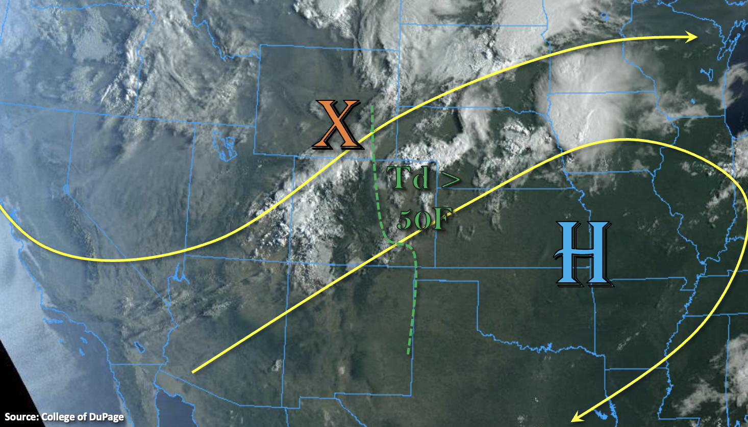
There’s finally a pattern shift today as the now elongated High is replaced by an approaching trough. Currently, there is still a line of thunderstorms over the Northeast Plains that has been ongoing overnight, which is producing moderate rainfall. These storms will likely continue throughout the morning, but they are expected to weaken and lift to the northeast by midday. In addition to that set of storms, lift out in front of the trough axis (orange “X”) is producing scattered, weak storms and showers across western Colorado this morning. Grand Junction’s sounding showed that PW has risen to 0.71 inches. However, most of this moisture is located around 500mb, which means the dry surface layer has helped to limit rainfall accumulation. A second round of rainfall is forecast to arrive to the area this afternoon, and storms should become more efficient rainfall producers by this evening with the moistening of the boundary layer. With faster storm motion today, due to the jet overhead, and limited surface moisture, flooding is not forecast for this area. Enjoy the widespread, beneficial rainfall and cooler temperatures as the storms arrive.
Lift is also forecast to increase over the eastern mountains and adjacent plains this afternoon with the incoming trough. This will help to return scattered storms to the area by mid-afternoon, and a couple rounds of rainfall are forecast through this evening. A couple rounds of rainfall could help to increase local accumulations for the lucky locations, but quick storm motion to the east should limit the flood threat from any individual storm today. While a quick 0.50 inches in a 15 to 30 minute span could cause some nuisance road ponding over more impervious areas, flooding is NOT forecast. Scroll down below to read more details about today’s rainfall.
Today’s Flood Threat Map
For more information on today’s flood threat, see the map below. If there is a threat, hover over the threat areas for more details, and click on burn areas to learn more about them. For Zone-Specific forecasts, scroll below the threat map.

Zone-Specific Forecasts:
San Juan Mountains, Central Mountains, Northern Mountains, Southwest Slope, San Luis Valley, Grand Valley & Northwest Slope:
Showers and weak storms have already begun with the first round of rainfall this morning. So far, accumulations have been on the lower-end (under 0.15 inches). Expect a second wave of scattered storms to arrive this afternoon/evening and favor the central and northern portions of these zones for more widespread accumulations. Decent rainfall is still expected over the San Juan Mountains, but is not forecast to be as widespread. The second wave of storms should produce higher rain totals over the mountains with max 1-hour rainfall accumulations up to 0.65 inches possible. Areas that receive multiple rounds of storms could reach localized totals just over an inch by morning. Stronger thunderstorms this afternoon and evening may also produce some damaging outflow winds and small hail under their cores. Due to the more gradual accumulation of rainfall with faster storm motions, flooding is NOT forecast today.
Primetime: Ongoing to Midnight
Southeast Mountains, Front Range, Raton Ridge, Palmer Ridge, Southeast Plains, Northeast Plains & Urban Corridor:
Scattered storms will return to the mountains and elevated ridges this afternoon. Additional develop of storms is likely over the adjacent plains. With quick steering flows from the west, storms are expected to spill into the adjacent plains by mid-afternoon. Moisture remains higher across the lower elevations, which will help to increase rain rates. Max 1-hour rain rates up to 0.70 inches (mtns) and 1 inch (plains) will be possible, but due to the quick storm motion, totals should be slightly lower. The multiple rounds of rainfall could cause some localized totals up to 1 inch by morning, and this would be most likely over the Palmer Ridge area with the increased convergence. While the quick-moving storms today may cause some nuisance road and low-lying area ponding this afternoon and evening, flooding is NOT expected. In addition to rainfall, a couple stronger storms could produce gusty outflow winds, dangerous lightning and small hail.
Primetime: 2:30PM to 2AM