Issue Date: Saturday, September 4th, 2021
Issue Time: 9:20AM MDT
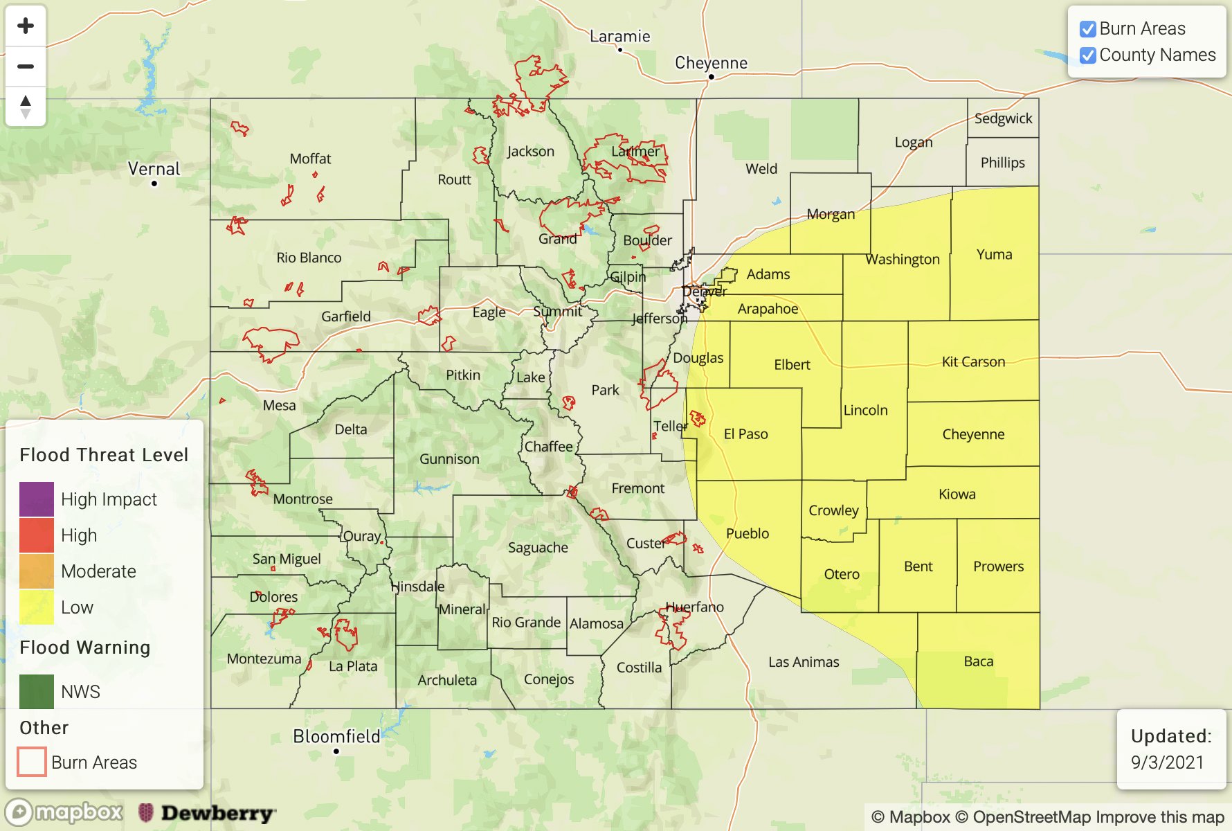
— A LOW flood threat has been posted for parts of the Palmer Ridge, Southeast Plains, Raton Ridge and Southeast Mountains
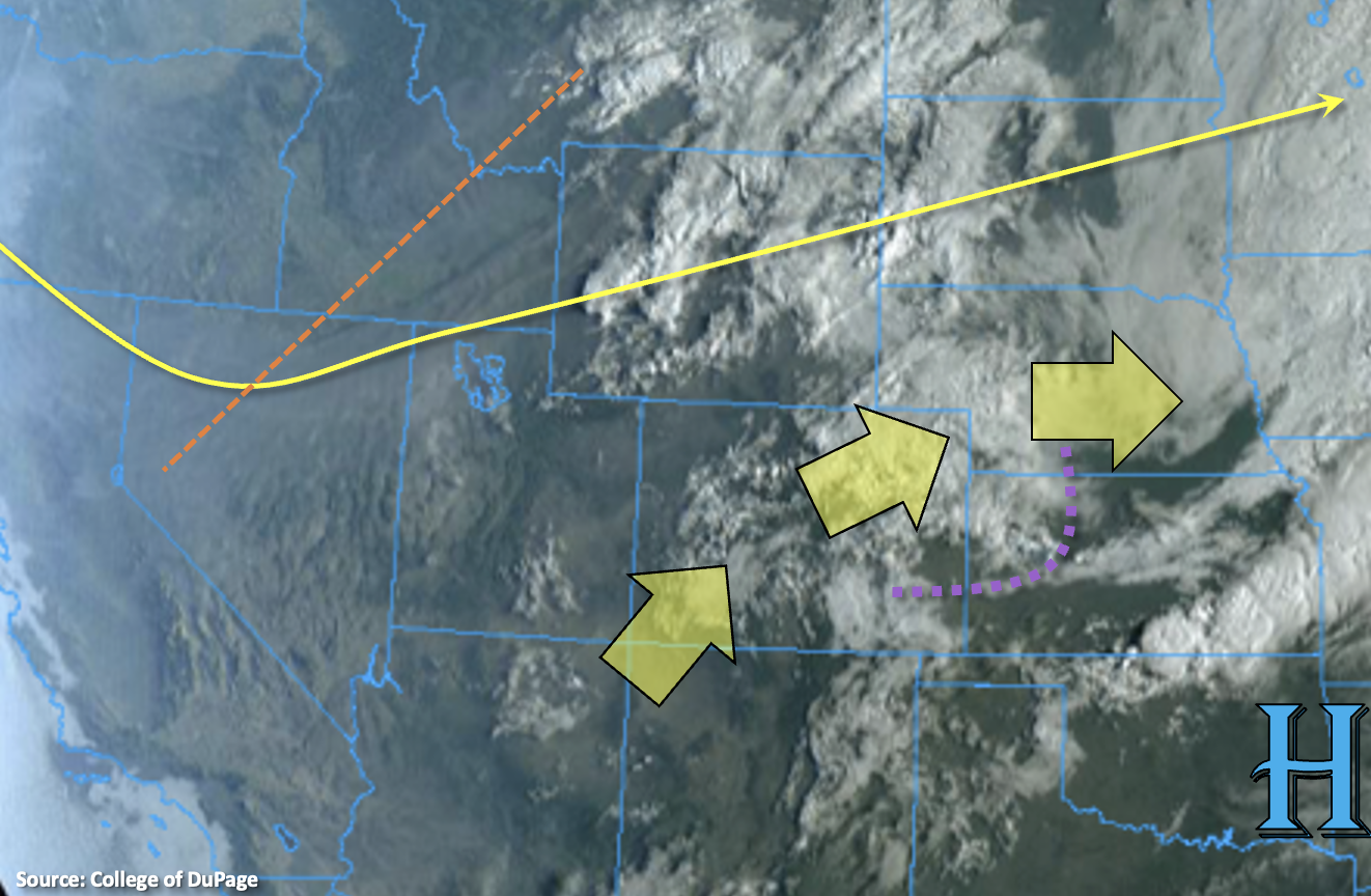
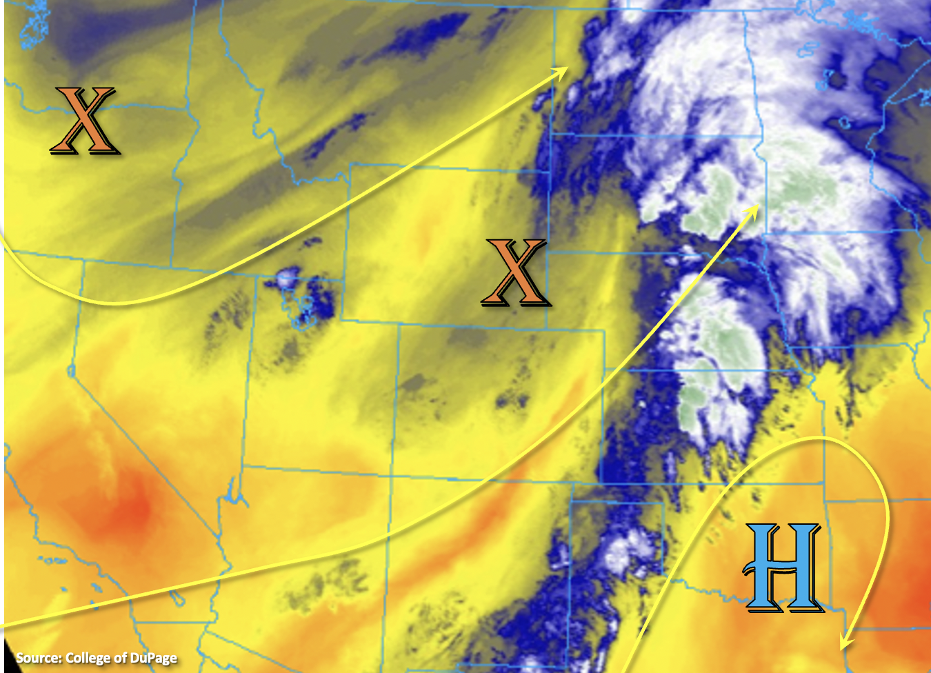
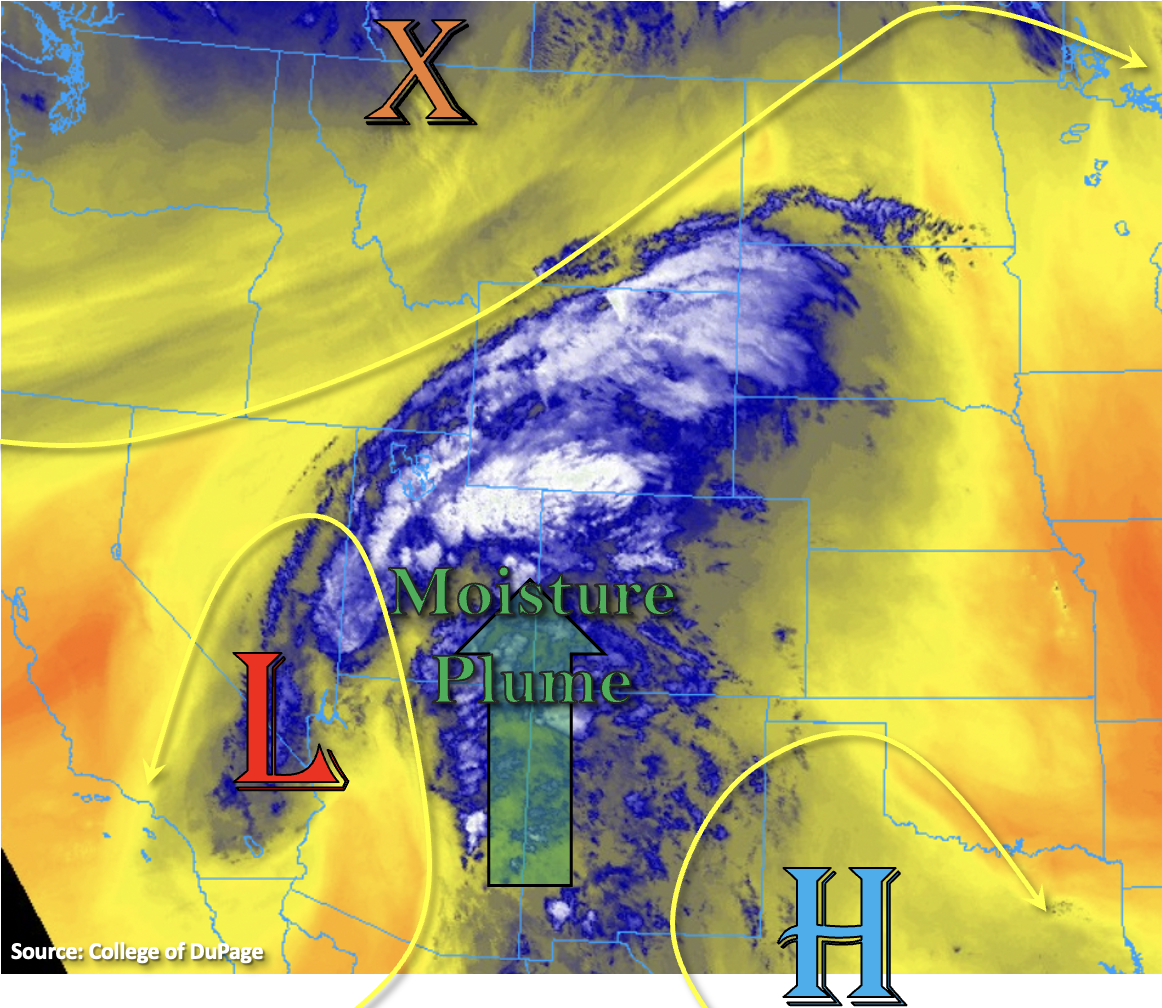
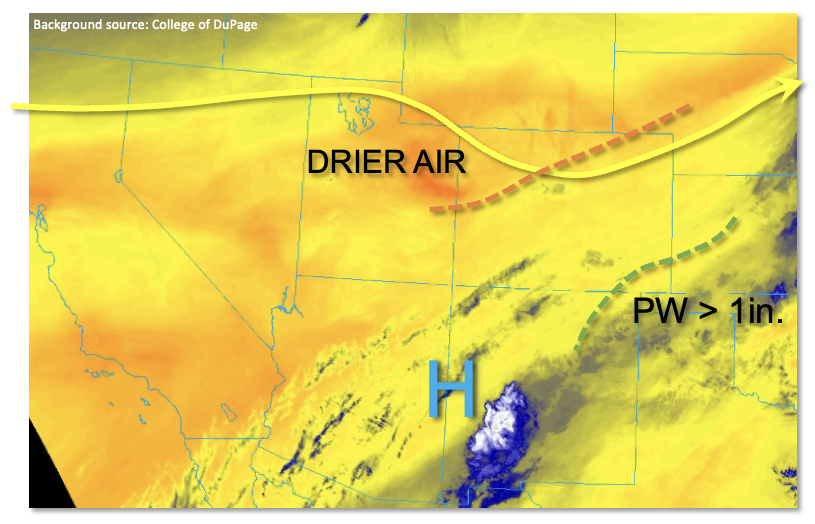
Although much drier air has begun to infiltrate into western Colorado, significant moisture will remain over the next 12-18 hours east of the Continental Divide. This will support another round of potentially heavy rainfall this afternoon and evening, although coverage will be lower than seen on Friday. The water vapor image, below, shows a pronounced disturbance draped across northern Colorado. This disturbance will move southeast today, causing a weak surface low to develop along the NM/CO border. Precipitable Water (PW) has dropped to 0.74 inches at Grand Junction and 0.69 inches in Denver this morning and will continue to drop across most of the state. However, along the southeast Colorado border with KS, OK and NM, PW is greater than 1 inch and will hold steady or even slightly increase as the aforementioned surface low causes easterly flow to advect moisture back into the state. This morning’s sounding from Dodge City, KS, showed a PW of 1.86 inches, which is near the all-time September record here. At least some of this will be drawn into CO this afternoon. Morning sunshine will boost temperatures, allowing for instability up to 1,600 J/kg in a narrow axis along and just east of I-25, south of Colorado Springs. Storm motion will be slightly faster over the Palmer Ridge, which will mitigate point rainfall here. Slower storm motion towards the NM border will allow for higher rainfall accumulations, warranting a LOW flood threat for this limited area. In addition to heavy rainfall, severe weather, in the form of large hail over 1 inch and damaging winds, will also be possible with the strongest storms.
Elsewhere, mainly dry weather and seasonably warm temperatures are expected, setting up a beautiful late summer Saturday (or early fall, depending on your preference of meteorological versus astronomical bookkeeping).
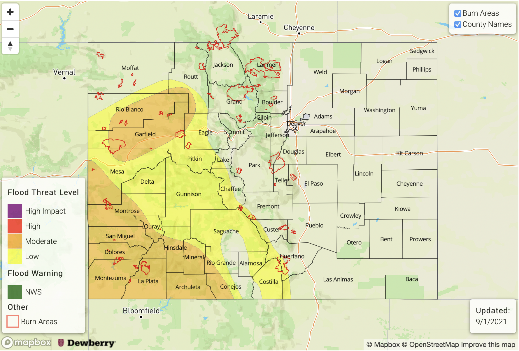
Today’s Flood Threat Map
For more information on today’s flood threat, see the map below. If there is a threat, hover over the threat areas for more details, and click on burn areas to learn more about them. For Zone-Specific forecasts, scroll below the threat map.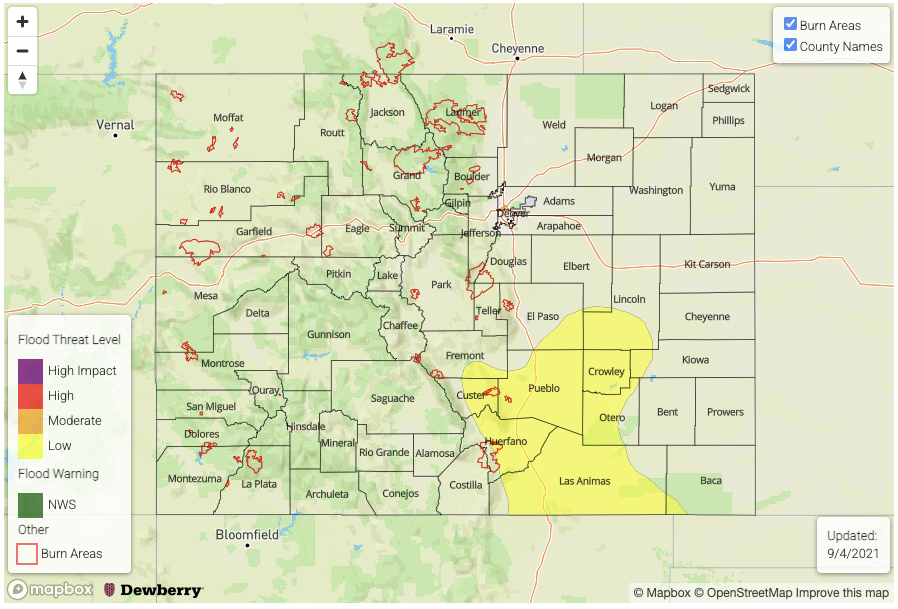
Zone-Specific Forecasts:
Palmer Ridge, Southeast Plains, Northeast Plains, Raton Ridge, Southeast Mountains:
Becoming partly cloudy with scattered showers and thunderstorms developing by mid-afternoon. Max 1-hour rainfall up to 1.2 inches (west) and 1.6 inches (east) supports a LOW flood threat south of I- 70 for isolated flash flooding, along with debris slides and mud flows over steeper terrain.
Severe weather will also be possible with the stronger storm cells.
Storms will begin to dissipate by sunset, but isolated cells could persist into the late evening.
Primetime: 1PM through 11PM
Southwest Slope, Grand Valley, Northwest Slope, Central Mountains, Northern Mountains, San Juan Mountains, San Luis Valley, Front Range, Urban Corridor:
Seasonably warm today with an isolated shower possible over the higher terrain of the Central Mountains, San Juan Mountains and southern Front Range. Max 1-hour rainfall up to 0.2 inches. Flooding is NOT expected today.