FTB 09-20-2021: Much Cooler Temperatures with Only Light Precipitation Forecast

Issue Date: Monday, September 20th, 2021
Issue Time: 9AM MDT

— Flooding is NOT expected today

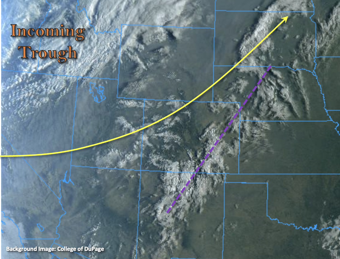
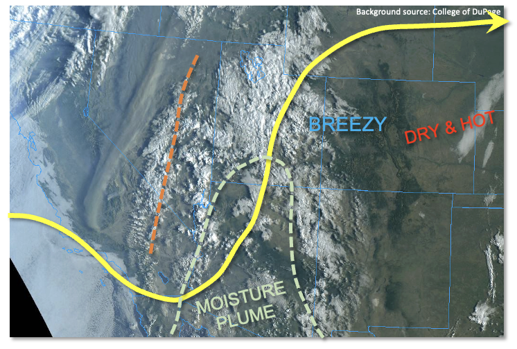
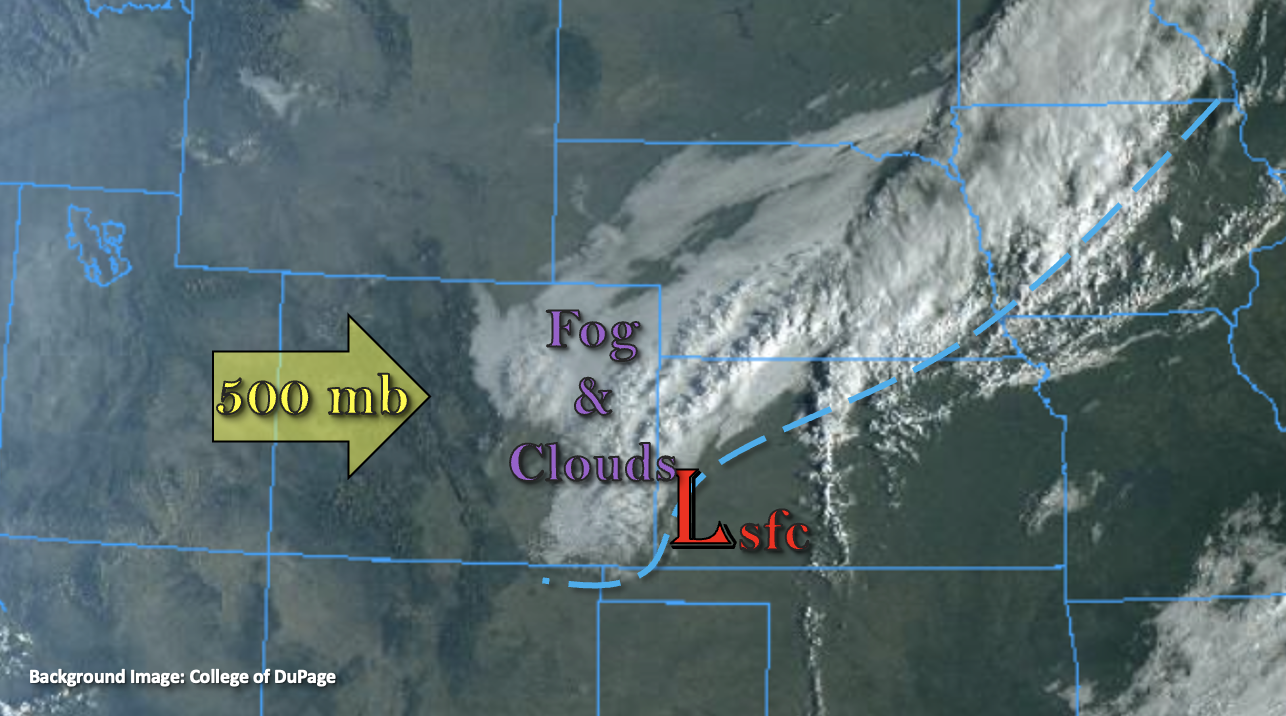
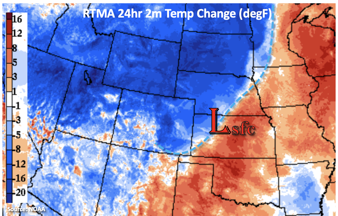
A strong cold front moved through the state yesterday during the evening and overnight hours, which is very well defined in the 24-hour temperature change image below. So, it is a much cooler start to the day, and there’s even a dusting of snow over the highest peaks of the northern mountains. It looks like the snow line fell to just under 9K feet from CDOT cameras in the area. There are also some light showers over the Northeast Plains associated with the upper trough, which are expected to continue to weaken and move across the border over the next hour or so.

Today, much cooler high temperatures are forecast behind the front along with mostly stable conditions as high pressure begins to build across the state. There is still a chance for some light showers and snow over the northern mountains throughout the day and tonight, but only minimal accumulation is forecast. Additionally, some weak showers may develop over the Palmer Ridge/southern Front Range intersect and Southeast Plains this afternoon and evening associated with a wind speed maximum overhead. With only light precipitation forecast, flooding is NOT expected today.

Today’s Flood Threat Map

For more information on today’s flood threat, see the map below. If there is a threat, hover over the threat areas for more details, and click on burn areas to learn more about them. For Zone-Specific forecasts, scroll below the threat map.

Zone-Specific Forecasts:

Northwest Slope, Northern Mountains, Front Range, Grand Valley, San Juan Mountains, San Luis Valley, Central Mountains & Southwest Slope:

Some light snow and showers are possible over these mountain regions (north) this morning and later tonight. Minimal accumulation is forecast with isolated precipitation totals up to 0.15 inches possible. Clearing conditions this afternoon (west/south) will help produce very cold overnight temperatures. A Freeze Warning has been issued for the central Yampa and Colorado River Basins tonight where surface temperatures may drop to as low as 27F. A Freeze Watch has been issued for the San Luis Valley (below 8,500 ft) where lows may fall into the upper 20Fs and lower 30Fs, which could damage vegetation/crops.

Primetime: Ongoing to 2AM

Southeast Mountains, Northeast Plains, Southeast Plains, Urban Corridor, Raton Ridge & Palmer Ridge:

Light showers are expected to continue over the Northeast Plains for the next hour as the trough axis slides east. This afternoon, some additional weak showers may develop over the eastern Palmer Ridge/southern Urban Corridor as well as over the Southeast Mountains and Southeast Plains with upper level lift in the area. Isolated totals up to 0.20 inches may be possible, but most totals should remain under 0.10 inches. Flooding is NOT forecast today.

Primetime: 1PM to 10PM

FTB 09-19-2021: Big Change To The Weather Pattern On The Way

Issue Date: Sunday, September 19th, 2021
Issue Time: 9:15AM MDT

— Flooding is NOT expected today

There are still some ongoing scattered, light showers over the southeast corner of the state that are associated with some upper-level lift in the area, continuing from yesterday. Expect these showers to linger as they move eastward throughout the morning, and perhaps increase somewhat in intensity, but not area, by mid-afternoon over the southeast border counties. For today, windy conditions are expected to continue over the mountains with the tightening pressure gradient from the incoming trough, marked below. Not much residual moisture behind the departing upper trough from yesterday, so only scattered storms over the mountains (central/south) are forecast this afternoon. A Red Flag Warning has been issued for the southern I-25 corridor, just east of the Southeast Mountains, where wind gusts could reach 35mph. Use caution with any activity that could spark a flame.

Cloud cover from a vigorous incoming trough can also be seen to our west in the visible satellite imagery below, which is expected to bring much cooler temperatures to the state beginning tonight behind a strong cold front. Afternoon high temperatures tomorrow are expected to be as much as 20F cooler than today. The leading edge of the front is forecast to reach the Northwest Slope by this evening, and there’s the potential for some weak thunderstorms to form along it over this area. With decreasing stability into the overnight hours and fast steering flows, storms that are able to develop and maintain themselves over the northern mountains should not pose a flood threat. Especially with rain turning to snow over the higher elevations overnight. Also, expect gusty winds along the front as it arrives and over the eastern plains during the overnight hours as it drops south. Flooding is NOT expected today.

Today’s Flood Threat Map

For more information on today’s flood threat, see the map below. If there is a threat, hover over the threat areas for more details, and click on burn areas to learn more about them. For Zone-Specific forecasts, scroll below the threat map.

Zone-Specific Forecasts:

Northwest Slope, Northern Mountains, Front Range & Central Mountains:

A Freeze Watch has been issued for portions of the Northwest Slope and Northern Mountains tonight (Central Yama and Central Colorado River Basins) where temperatures may drop into the upper 20Fs to near 30F behind the incoming cold front. As the front arrives to the northwest corner this evening, residual moisture may help produce some thunderstorm activity along it. Max 1-hour rain rates up to 0.60 inches are possible with most totals remaining under 0.50 inches (northwest corner). A couple showers may continue into the overnight hours with a couple inches of snow possible over the highest elevations by morning. Up to 0.50 inches of precipitation may be possible over the northern Front Range with most precipitation falling as snow above 8,500 feet early tomorrow morning. In addition to snow and rainfall, some strong wind gusts (up to 45 mph) are expected along the front. Due to the lower rain rates and more gradual nature of accumulation this evening over the mountains, along with the transition to snow, flooding is NOT expected.
Primetime: 1PM to ongoing

Grand Valley, San Juan Mountains, San Luis Valley, Southeast Mountains & Southwest Slope:

A bit of residual moisture could spark some afternoon scattered, weak thunderstorms over the mountains and elevated terrains. Highest accumulations are anticipated over the San Juan Mountains with only light accumulations forecast over the Grand Valley (higher elevations) and Southeast Mountains. Isolated max 1-hour rain rates up to 0.50 inches will be possible with most totals remaining under 0.30 inches, so flooding is NOT forecast.
Primetime: 11AM to 8PM

Northeast Plains, Southeast Plains, Urban Corridor, Raton Ridge & Palmer Ridge:

It should remain dry over these areas today with the exception of some weak storms possible over Baca/Prowers County this afternoon. Downsloping winds will help keep afternoon high temperatures in the upper 80Fs and 90Fs again. Overnight, some gusty winds (up to 35 to 45 mph) will be possible as the cold front slides south. Precipitation is not anticipated along the front as moisture looks to be lacking from this next system. Therefore, flooding is NOT forecast.

FTB 09-18-2021: Breezy And Hot With Scattered PM/Overnight Showers And Weak Storms

Issue Date: Saturday, September 18th, 2021
Issue Time: 9:20AM MDT

— Flooding is NOT expected today

The visible satellite image, below, shows that a vigorous shortwave disturbance is located over CA/NV this morning. Just downstream, deep southerly flow is pumping an impressive moisture surge northward towards the Four Corners region. Precipitable Water (PW) in the southern portion of this plume is well above 1 inch, which is much above normal for mid-September. The main issue in terms of generating rainfall for us here in Colorado is the extremely dry atmosphere overhead. Morning PW was only 0.30 and 0.43 inches in Denver and Grand Junction, respectively. Thus, it will take the majority of the afternoon hours to saturate the atmosphere enough over western Colorado to produce some isolated showers and weaker storms. The timing of this also implies that solar heating will not be able to contribute to generate instability, with maximum CAPE of only a few hundred J/kg expected late today. However, once the atmosphere does become saturated, with a sustained period of lift overhead, scattered showers and an isolated storm are expected to continue over the higher terrain of the Western Slope into the overnight hours. But with limited instability, only modest moisture and fast steering flow, flooding is NOT expected today.

Elsewhere, strong downsloping flow will push temperatures up to 12F above normal east of the Continental Divide today. With this deep boundary layer, gusty winds are expected during the afternoon hours.

Today’s Flood Threat Map

For more information on today’s flood threat, see the map below. If there is a threat, hover over the threat areas for more details, and click on burn areas to learn more about them. For Zone-Specific forecasts, scroll below the threat map.

Zone-Specific Forecasts:

Front Range, Northern Mountains, Northwest Slope, Southwest Slope, Grand Valley, Central Mountains, San Juan Mountains, San Luis Valley and Southeast Mountains:

Increasing clouds, warm and breezy with isolated to widely scattered showers and weaker storms developing late afternoon and persisting into the overnight hours. Max 1-hour rainfall up to 0.5 inches possible, with total precipitation up to 0.7 inches over the higher terrain of the San Juan Mountains and Central Mountains by tomorrow morning. Flooding is NOT expected today. Very gusty winds will be possible with the strongest storms this afternoon and evening.

Primetime: 4PM through 6AM

Raton Ridge, Southeast Plains, Palmer Ridge, Urban Corridor, Northeast Plains:

Mostly sunny, breezy and hot today with temperatures up to 12F above normal (especially over the Northeast Plains). An isolated shower cannot be ruled out over the higher foothills overnight. However, little in any precipitation is expected. Flooding is NOT expected today.

FTB 09-17-2021: Dry Day Ahead Statewide with Much Cooler Temperatures Forecast East

Issue Date: Friday, September 17th, 2021
Issue Time: 8:45AM MDT

— Flooding is NOT expected today

A fall-like cold front started to move through eastern Colorado early this morning, and it is causing some gusty northerly winds as it traverses south (marked below). Behind the front, there is plenty of fog and cloud cover accompanying the cooler temperatures, which should persist over a fairly wide swath today, east of I-25. It’s quite chilly for some locations behind the front, and temperatures have dropped as much as 8 to 12 degF from this time yesterday. PW over Denver has risen slightly to 0.64 inches, but with a strong inversion, the atmosphere will be too stable for any afternoon convection to develop. So, enjoy the cooler temperatures and cloud cover today before it heats back up tomorrow. Flooding is NOT expected today.

The front’s affects over western Colorado are not nearly as pronounced, and outside of some meager moisture around 500mb, the atmosphere remains very dry. No rainfall is anticipated over this area today either, but change is on the way tomorrow when some subtropical moisture moves into the area.

Today’s Flood Threat Map

For more information on today’s flood threat, see the map below. If there is a threat, hover over the threat areas for more details, and click on burn areas to learn more about them. For Zone-Specific forecasts, scroll below the threat map.

Zone-Specific Forecasts:

Northeast Plains, Southeast Plains, Urban Corridor, Raton Ridge, San Luis Valley, Front Range, Southeast Mountains & Palmer Ridge:

Cooler temperatures are forecast today with 70Fs for the I-25 Corridor and 60Fs for the far central eastern plains where cloud cover will likely remain all day. It will also be windy over the eastern plains with the tightened pressure gradient and the front dropping south. Gusts between 40 and 50 mph will be possible over the Southeast Plains through 11AM, and then they are only expected to drop to around 30 mph during the afternoon hours. Subsidence aloft means rainfall chances near zero, but some light showers may be possible over the central, eastern border counties. Flooding is NOT expected.

Northwest Slope, Northern Mountains, Grand Valley, San Juan Mountains, Central Mountains & Southwest Slope:

It could get a little breezy over the northwest corner by this afternoon. Outside of some scattered mountain clouds this afternoon, another clear and beautiful day is ahead. Highs are forecast in the 80Fs for the lower elevations and upper 70Fs for the mountain valleys. Too dry for any precipitation, so flooding is NOT expected. Scattered rainfall chances return tomorrow, so be sure to tune back into the FTB for the latest details.