Issue Date: Friday, September 17th, 2021
Issue Time: 8:45AM MDT
— Flooding is NOT expected today
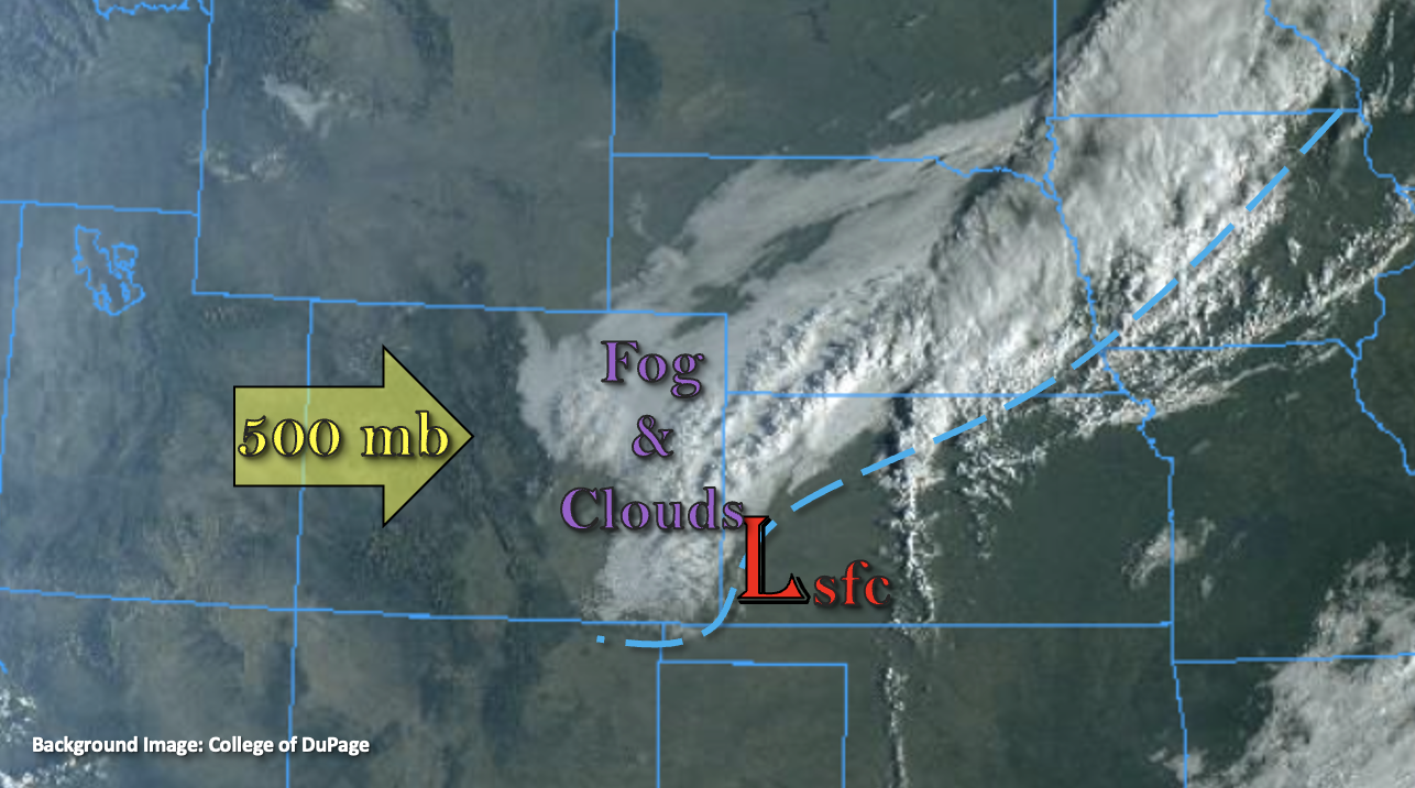
A fall-like cold front started to move through eastern Colorado early this morning, and it is causing some gusty northerly winds as it traverses south (marked below). Behind the front, there is plenty of fog and cloud cover accompanying the cooler temperatures, which should persist over a fairly wide swath today, east of I-25. It’s quite chilly for some locations behind the front, and temperatures have dropped as much as 8 to 12 degF from this time yesterday. PW over Denver has risen slightly to 0.64 inches, but with a strong inversion, the atmosphere will be too stable for any afternoon convection to develop. So, enjoy the cooler temperatures and cloud cover today before it heats back up tomorrow. Flooding is NOT expected today.
The front’s affects over western Colorado are not nearly as pronounced, and outside of some meager moisture around 500mb, the atmosphere remains very dry. No rainfall is anticipated over this area today either, but change is on the way tomorrow when some subtropical moisture moves into the area.
Today’s Flood Threat Map
For more information on today’s flood threat, see the map below. If there is a threat, hover over the threat areas for more details, and click on burn areas to learn more about them. For Zone-Specific forecasts, scroll below the threat map.
Zone-Specific Forecasts:
Northeast Plains, Southeast Plains, Urban Corridor, Raton Ridge, San Luis Valley, Front Range, Southeast Mountains & Palmer Ridge:
Cooler temperatures are forecast today with 70Fs for the I-25 Corridor and 60Fs for the far central eastern plains where cloud cover will likely remain all day. It will also be windy over the eastern plains with the tightened pressure gradient and the front dropping south. Gusts between 40 and 50 mph will be possible over the Southeast Plains through 11AM, and then they are only expected to drop to around 30 mph during the afternoon hours. Subsidence aloft means rainfall chances near zero, but some light showers may be possible over the central, eastern border counties. Flooding is NOT expected.
Northwest Slope, Northern Mountains, Grand Valley, San Juan Mountains, Central Mountains & Southwest Slope:
It could get a little breezy over the northwest corner by this afternoon. Outside of some scattered mountain clouds this afternoon, another clear and beautiful day is ahead. Highs are forecast in the 80Fs for the lower elevations and upper 70Fs for the mountain valleys. Too dry for any precipitation, so flooding is NOT expected. Scattered rainfall chances return tomorrow, so be sure to tune back into the FTB for the latest details.