Issue Date: Thursday, May 5th, 2022
Issue Time: 8:40AM MDT
— Flooding is NOT expected today
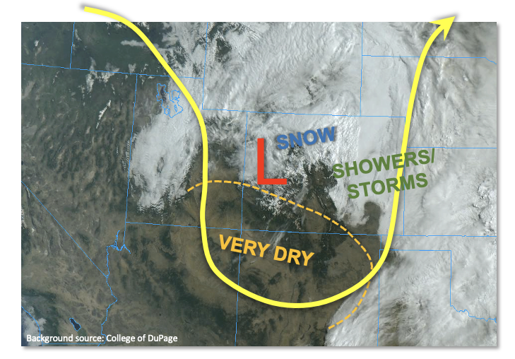
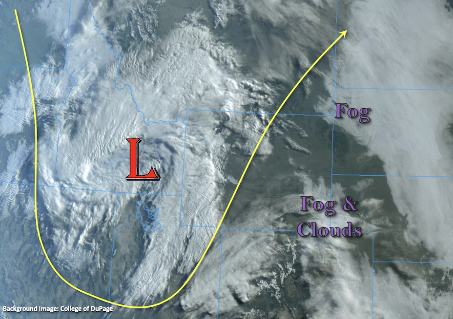
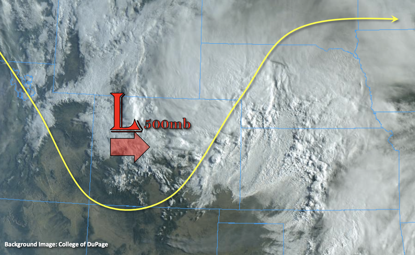
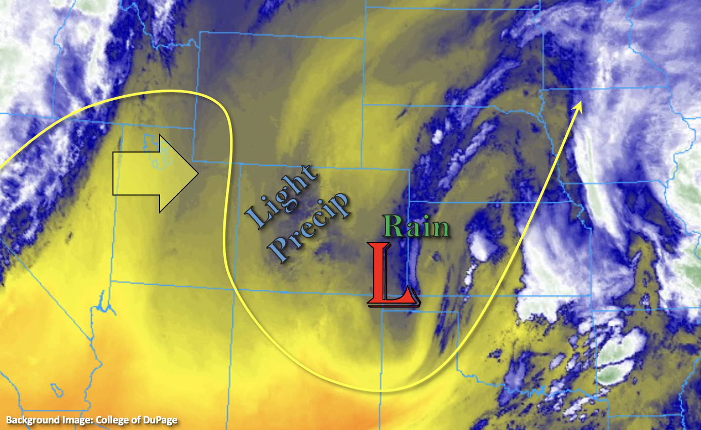
The water vapor imagery below shows the upper-level Low has moved into the eastern portion of the state. There are still some showers occurring this morning just south of I-70 along the Kansas border. These should continue to shift eastward with the disturbance throughout the morning hours. Wrap around moisture is also causing some cloud cover and perhaps some spotty precipitation at the highest elevations over the northern/central mountains this morning. This will likely continue through midday.
Today we’re expecting a statewide increase in sunshine as the moisture and lift from the trough is replaced by drying and subsidence under a ridging pattern. High temperatures should reach the mid-60Fs to low 70Fs across the lower elevations with mid-50Fs to low 60Fs for the mountain valleys. Lack of moisture and lift mean that outside of the lighter precipitation occurring this morning, it should remain dry across the state. Therefore, flooding is not expected. More cloud cover is expected to move in overnight as some mid-level lift works into the flow from a shortwave to our north.
Dry and windy conditions are anticipated again today further south, and the San Luis Valley is under a Red Flag Warning. Tune into NWS Pueblo for the most up to date information.
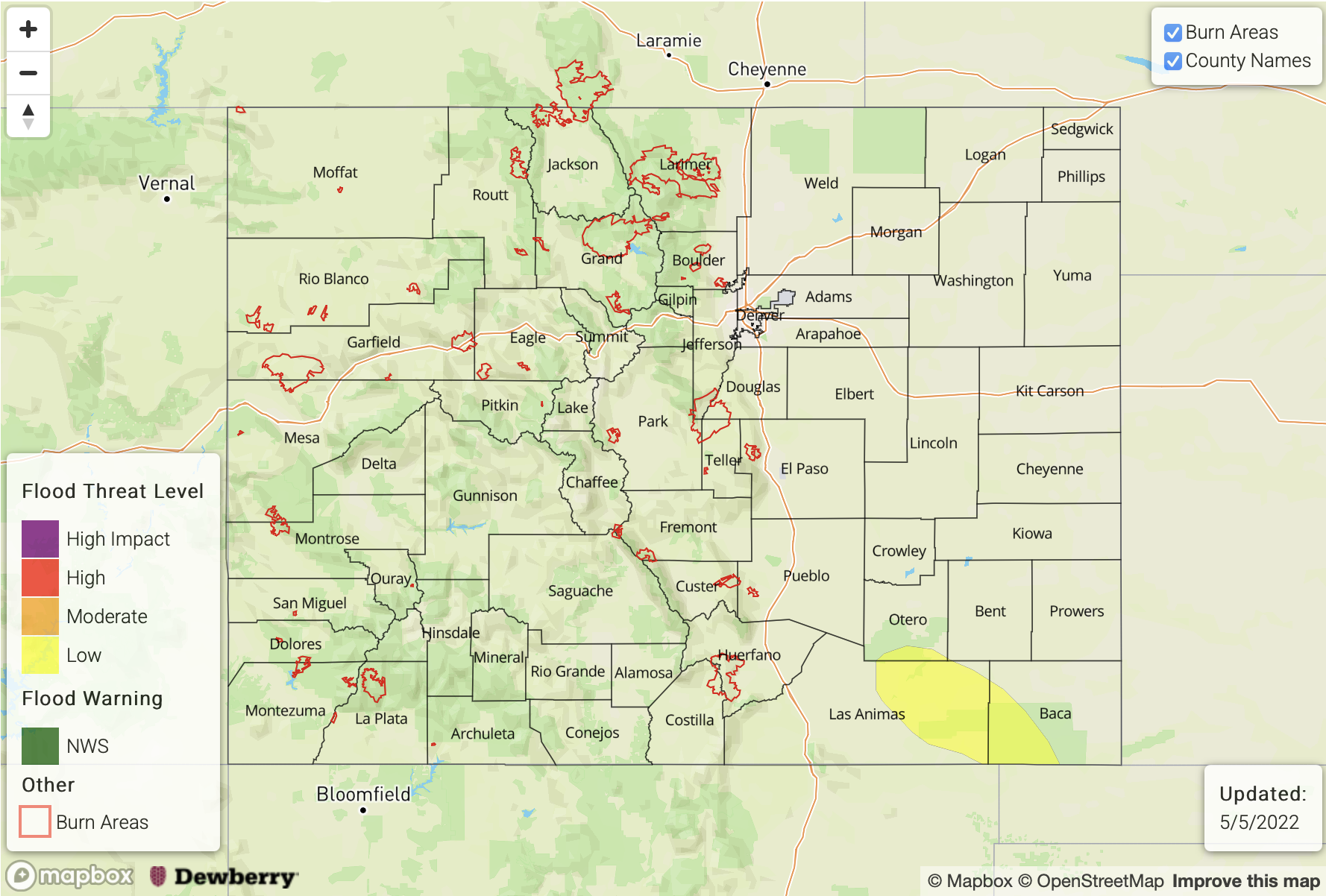
Today’s Flood Threat Map
For more information on today’s flood threat, see the map below. If there is a threat, hover over the threat areas for more details, and click on burn areas to learn more about them. For Zone-Specific forecasts, scroll below the threat map.
Zone-Specific Forecasts:
Palmer Ridge, Urban Corridor, Northeast Plains, Southeast Plains & Raton Ridge:
Isolated showers will continue along the Kansas border this morning before moving east by midday, but flooding is NOT expected. Drier conditions are forecast this afternoon with plenty of sunshine. Highs will reach the upper-60Fs to low 70Fs. Gusts between 20 and 25 mph are anticipated over the plains this afternoon.
Primetime: Ongoing to 11:30AM
Northern Mountains, Southeast Mountains, Front Range, Central Mountains & San Juan Mountains:
Likely some light precipitation/snow is falling over the northern mountain ranges this morning. This should begin to clear up throughout the morning. Could be a bit breezy along the northern Continental Divide and Southeast Mountains this afternoon. Highs should reach the mid-50Fs to low 60Fs in the mountain valleys.
San Luis Valley, Grand Valley, Northwest Slope & Southwest Slope:
Clear conditions are forecast today with an increase in cloud cover anticipated overnight. A Red Flag Warning has been issued for the San Luis Valley with increasing fire danger into tomorrow. Highs are forecast to reach into the mid-70Fs by this afternoon.