Issue Date: Tuesday, May 3rd, 2022
Issue Time: 9:25AM MDT
— Flooding is NOT expected today
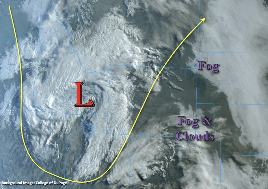
The visible satellite imagery below is showing pockets of fog and cloud cover over the eastern portion of the state this morning. This should continue to burn off with a little daytime heating. There is not much of a break between storm systems as a more active weather pattern persists. Dense cloud cover has already begun moving into western Colorado associated with the next closed Low system marked below. This Low will drop a cold front across the state today and tonight, which will support scattered showers over the north/central western valleys and snow over the mountains by midday. Precipitation will favor the Northern/Central Mountains for accumulation, but lighter accumulation is still expected over the San Juan Mountains. This area of lift will reach the Front Range and adjacent plains by late this afternoon bringing snow to the mountains and a rain/snow mix over the northern Urban Corridor tonight. Areas further south should stay dry until tomorrow. Due to the majority of precipitation falling as snow over the mountains, and only light showers anticipated for the lower elevations, flooding is NOT expected.
It is expected to remain dry across the lower elevations near the southern border, and with the approaching system, a tightening pressure gradient means windy conditions return. A Red Flag Warning has been issued for the area due to the combination of low relative humidity values and sustained winds in the 20 to 30 mph range. Be sure to tune into your local NWS office for the latest details.
Today’s Flood Threat Map
For more information on today’s flood threat, see the map below. If there is a threat, hover over the threat areas for more details, and click on burn areas to learn more about them. For Zone-Specific forecasts, scroll below the threat map.

Zone-Specific Forecasts:
Northern Mountains, Front Range, Central Mountains, Northwest Slope & San Juan Mountains:
More snow is expected for the mountains today favoring the Central, Northern, and northern Front Range Mountains for accumulation. Up to 6 inches of fresh snow can be expected over the Flat Tops and Park Range. Liquid precipitation amounts of up to 0.25 inches will be possible over the central and northern San Juan Mountains. Flooding is NOT expected.
Primetime: 1PM to 7PM
Palmer Ridge, Urban Corridor & Northeast Plains:
Warmer with increasing cloudiness, especially by afternoon. Isolated to scattered rain showers are possible this afternoon and evening with the highest coverage in the foothills. Max 1-hour rainfall up to 0.5 inches. Flooding is NOT expected today.
Primetime: 3PM to 11PM
Southeast Mountains, San Luis Valley, Grand Valley, Southwest Slope, Southeast Plains & Raton Ridge:
Mostly sunny early, then increasing cloudiness with gusty winds developing this afternoon. Isolated to widely scattered rain and higher elevation snow showers are possible over western and central areas. Max 1-hour rainfall up to 0.2 inches. Flooding is NOT expected today.
Red Flag Warnings continue to be in effect for parts of the area this afternoon. Please stay tuned to National Weather Service updates on these.
Primetime: 3PM to 9PM