Issue Date: Friday, May 13th, 2022
Issue Time: 8:45AM MDT
— Flooding is NOT expected today
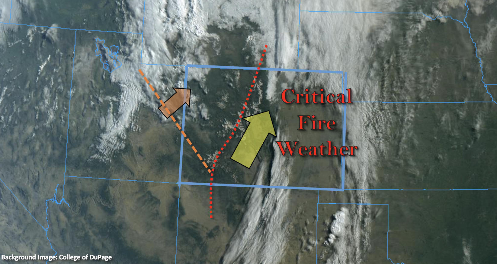
— Red Flag Warnings remain in effect for parts of the state
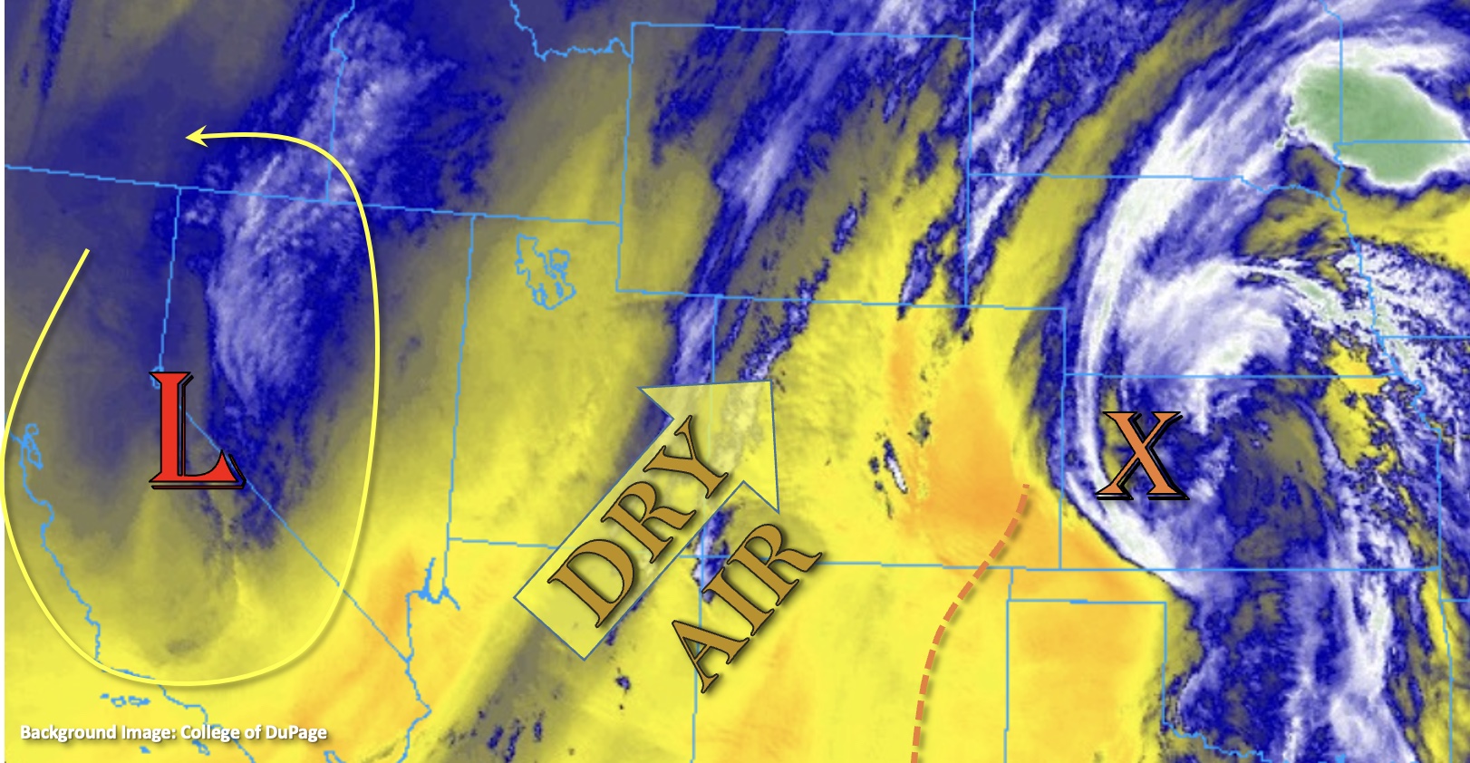
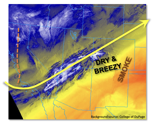
After a series of disturbances that raced across Colorado over the past few days fueling mainly a wind threat, things will quiet down in the upper atmosphere today. As shown in the visible satellite image, below, a nonchalant zonal flow is seen from the California coast all the way into Colorado. To the north, relatively higher moisture will support some enhanced cloudiness, along with breezy conditions mainly over northern Colorado. Red Flag Warnings are still in effect mainly over northeast Colorado today. To the south, bone dry conditions will persist though the subsidence of gusty winds will relax the fire threat a bit. This morning’s PW at Denver measured at an incredibly dry 0.17 inches. This would not be too unusual in January, but in mid-May, this sits in the lowest few percentiles, compared to the historical record. Thus, with no precipitation expected anywhere in the state, flooding is also NOT expected today.
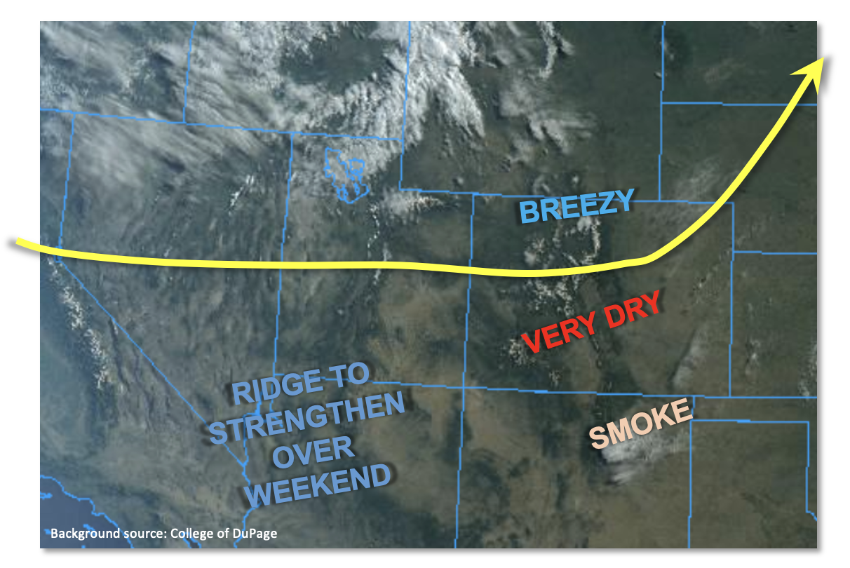
Looking ahead to the weekend, an upper-level ridge is expected to develop and push temperatures above seasonal normal statewide. Snowmelt will increase notably over the central and northern high terrains, but precipitation is not expected until perhaps Sunday afternoon.
Today’s Flood Threat Map
For more information on today’s flood threat, see the map below. If there is a threat, hover over the threat areas for more details, and click on burn areas to learn more about them. For Zone-Specific forecasts, scroll below the threat map.

Zone-Specific Forecasts:
Northeast Plains, Southeast Plains, Southeast Mountains, Raton Ridge, Front Range, Urban Corridor, San Luis Valley & Palmer Ridge:
Mostly sunny and seasonably warm today with temperatures 3-6F above normal. Breezy conditions will develop towards the WY border, and Red Flag Warnings are in effect over the Northeast Plains. Flooding is NOT expected today.
Northern Mountains, Central Mountains, Grand Valley, San Juan Mountains, Southwest Slope & Northwest Slope:
Partly cloudy and seasonably cool today with temperatures 2-5F below normal. Flooding is NOT expected today.