Issue Date: Wednesday, May 11th, 2022
Issue Time: 9:45AM MDT
— Flooding is NOT expected today
— Widespread Red Flag Warnings in effect
There’s finally a chance for isolated storms late this afternoon, although the area potentially affected will be small and storms are expected to quickly move into Kansas. The dryline (dashed orange below) will become better defined and push slightly east by late this afternoon with the development of a surface Low over southeast Wyoming. There’s a good chance that this feature will end up draped over eastern Baca and Prowers Counties, but there is a possibility that it mixes out too far east. Mid-level energy moving through the flow will help trigger scattered storms along the dryline by late this afternoon. Storms may produce some moderate rainfall, strong wind gusts and small hail, but they should quickly steer east. So, there is NO flood threat expected.
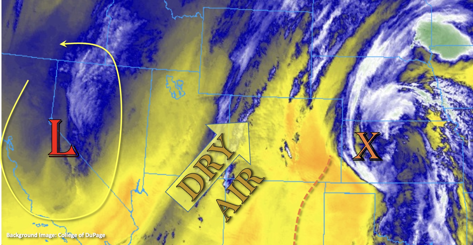
Fire danger remains high today, and into this weekend, with increasing temperatures and low moisture. The Low over the California will begin to move east. This will continue to produce strong southwest winds across the state, and between the increasing pressure gradient and warmer temperatures helping to mix these higher winds down, it’s going to get windy by late morning. Several Red Flag Warnings and High Wind Warnings have been issued, so be sure to tune into your local NWS office for more details. Winds look to subside a bit by this evening though they may continue over the far eastern plains, western Colorado and the south-central mountains.
Today’s Flood Threat Map
For more information on today’s flood threat, see the map below. If there is a threat, hover over the threat areas for more details, and click on burn areas to learn more about them. For Zone-Specific forecasts, scroll below the threat map.

Zone-Specific Forecasts:
Southeast Plains:
It’s going to be a hot one today with highs reaching 90-95F. Storms could form over the eastern portion of Baca and Prowers Counties late this afternoon. Isolated max 1-hour rain rates up to 0.70 inches are possible. The main threat from these storms will be strong outflow winds and dangerous lightning although small hail may also occur. Steering flows will quickly move them into Kansas by the early evening hours, so flooding is NOT expected. It’s also going to windy with southerly winds forecast in the 20-25 mph range and gusts up to 35 mph will be possible. Smoke and dust may impact visibility over the area.
Primetime: 4PM to 7PM
Northern Mountains, Raton Ridge, Southeast Mountains, Grand Valley, Northwest Slope, Central Mountains, San Luis Valley, San Juan Mountains & Southwest Slope:
It’s going to be windy today and potentially through the night. Red Flag Warnings and High Wind Warnings have been issued with gusts up to 60 mph forecast. This will create blowing dust, which could limit visibility. Too dry for any rainfall, and as always, be careful with activities that could cause a spark. High temperatures will also increase with 80Fs forecast for the lower elevations and upper 60Fs to low 70Fs for the mountains.
Front Range, Urban Corridor, Northeast Plains & Palmer Ridge:
Fire danger increases today as well as high temperatures. Across the lower elevations highs will reach into the upper 80Fs to low 90Fs with 70Fs for the mountain valleys. Red Flag Warnings have been issued and southwest winds are forecast to reach the 25 to 35 mph range with gusts up to 50 mph possible. Wind will likely continue overnight for the eastern plains.