FTB 05-17-2022: Scattered Storms, Some Severe, Mainly For Northeast Colorado

Issue Date: Tuesday, May 17th, 2022
Issue Time: 10AM MDT

— Flooding is NOT expected today
— One fire burn area is under an elevated threat today. Click here for more details.

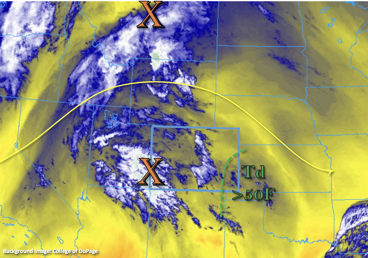
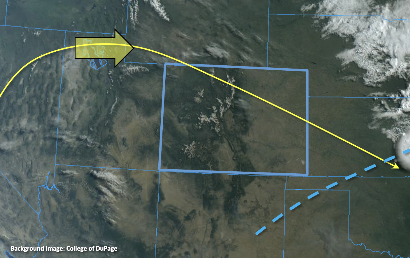
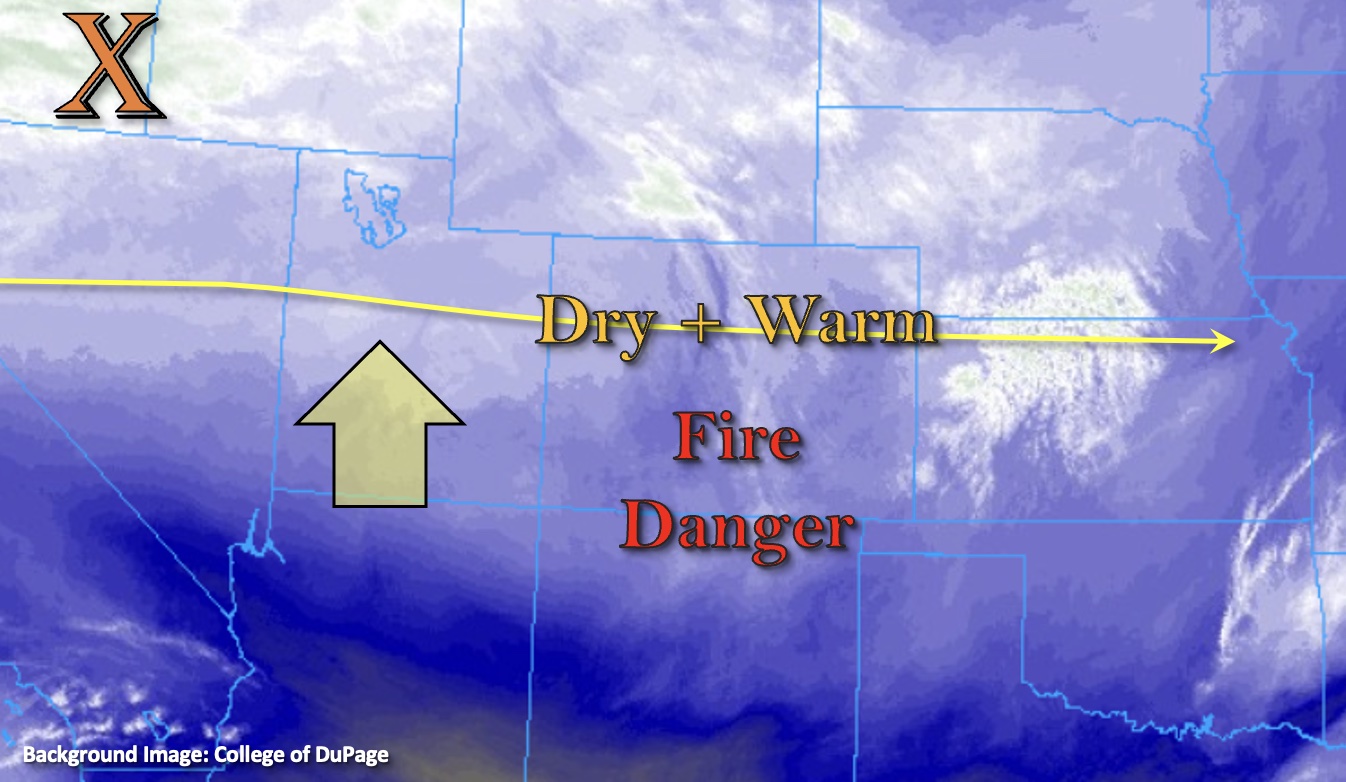
As shown in the water vapor image below, an elongated plume of moisture is clearly noted over the northern Rockies this morning. This is associated with a modest jet streak that is poised to enter Colorado today. As seen in observed and modeled atmospheric soundings, the moisture we are seeing in the water vapor image is all in the mid and upper levels of the atmosphere, while the lower levels continue to be dry. Morning PW at Denver was 0.41 inches (close to seasonal average) and 0.28 inches at Grand Junction. However, a close look at observations this morning shows the presence of a bit more boundary layer moisture over northeast CO, southeast WY and western NE.

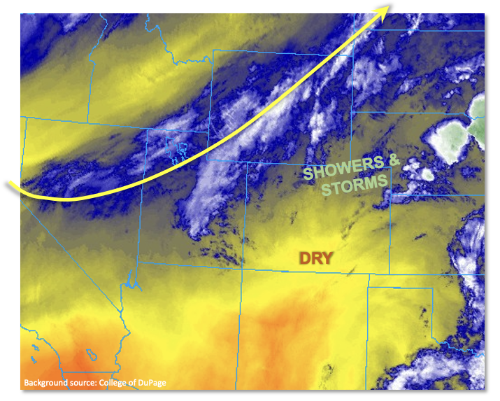
If the boundary layer moisture persists, which it may over localized pockets of our Northeast Plains, we could see instability of perhaps 1,400 J/kg. On the other hand, a look at the shear profile of the atmosphere does not show a structure conducive of heavy rainfall, but instead more supportive of severe weather. More specifically, the shear in the lower to mid-levels is quite weak, with storm motions of only 17-22 mph expected. But with the approaching jet, shear will increase dramatically in the upper levels, with flow above 500mb exceeding 50mph. This kind of shear favors “low-top” storms, which tend to be less effective at generating sustained heavy rainfall. Overall, we expect an increase in storm coverage for northern Colorado, with brief heavy rainfall possible mainly over the Northeast Plains. However, the more notable threat today will be for large hail and especially damaging winds. Thus, flooding is NOT expected.

Today’s Flood Threat Map

For more information on today’s flood threat, see the map below. If there is a threat, hover over the threat areas for more details, and click on burn areas to learn more about them. For Zone-Specific forecasts, scroll below the threat map.

Zone-Specific Forecasts:

Northeast Plains & Southeast Plains:

Mostly sunny early then becoming partly to mostly cloudy with scattered showers and storms developing by early afternoon. Highest coverage over northern areas by the WY/NE border. Max 1-hour rainfall up to 1.4 inches possible, along with large hail and damaging wind. Some nuisance field ponding is possible, but flooding is NOT expected today.

Primetime: 3PM to 10PM

Northwest Slope, Northern Mountains, Front Range, Urban Corridor, Central Mountains & Palmer Ridge:

Mostly sunny early then becoming partly cloudy with scattered showers and a few storms expected during the afternoon and evening. Max 1-hour rainfall up to 0.8 inches possible along with large hail and damaging wind. Flooding is NOT expected today.

Primetime: Noon to 8PM 

Grand Valley, San Juan Mountains, Southwest Slope, San Luis Valley, Southeast Mountains & Raton Ridge:

Mostly sunny and hot this afternoon, but winds will generally stay down. An isolated shower or storm, accompanied by some brief gusty winds, cannot be ruled out but max 1-hour rainfall of only 0.3 inches expected. Thus, flooding is NOT expected today.

Primetime: 2PM to 8PM

FTB 05-16-2022: Return of Isolated Storms

Issue Date: Monday, May 16th, 2022
Issue Time: 9:15AM MDT  

Flooding is NOT expected today

There’s finally some rainfall to forecast today due to a disturbance that has worked its way in from the west under the ridge (orange “X”). This feature will move east today, along with the axis of the ridge, and help to initiate scattered storms over the mountains by early afternoon. These storms are forecast to work their way into the adjacent plains with westerly steering flow aloft late this afternoon into the evening hours. There’s a nice plume of moisture over southeast Colorado shown in the water vapor imagery below (green dotted line), and SSW surface flow is anticipated to turn more southerly throughout the day with a developing surface Low. That means not much moisture advection back to the west, but higher dew points should remain intact over eastern Colorado that could cause some stronger thunderstorms to develop. 

PW at Denver and Grand Junction remains about the same as yesterday, 0.36 and 0.35 inches, respectively. The Grand Junction sounding showed this moisture aloft, so it will be too dry to generate storms across the lower elevations. Over the mountains and immediate adjacent plains, expect high-based storms to develop similar to yesterday. A slight increase in dynamics with the mid-level energy should help generate more coverage, although it will still be pretty spotty with only light accumulation forecast. As the storms move east and encounter the weak dryline over the far eastern plains, a couple of severe storms are possible with strong outflow winds and severe hail being the main threats. As for the flood threat, the lack of deeper surface moisture means that the storms will have high bases and likely become outflow driven, which should limit their heavy rainfall potential. Nonetheless, moderate rain rates and much needed rainfall are anticipated under these isolated storm cores. Since storms are not likely to meet flood threat criteria as they quickly move eastward, NO flood threat has been issued.

Today’s Flood Threat Map

For more information on today’s flood threat, see the map below. If there is a threat, hover over the threat areas for more details, and click on burn areas to learn more about them. For Zone-Specific forecasts, scroll below the threat map.

Zone-Specific Forecasts:

Palmer Ridge, Northeast Plains & Southeast Plains:

Expect the highest coverage and strongest storms over these forecast zones today. Over the Palmer Ridge, better moisture will be over the far eastern portion of the forecast zone. As mentioned above, slightly less moisture north than south and west than east. Isolated max 1-hour rain rates up to 1.10 inches (east) and 0.40 inches (west) are possible. Storms will likely produce strong outflow winds today and severe hail may be possible for storms that can make it to the eastern border before instability drops off. Flooding is NOT anticipated at this time.

Primetime: 3PM to 10PM

Front Range, Southeast Mountains, Central Mountains, Northern Mountains & Urban Corridor:

Isolated to scattered, high-based storms are anticipated to develop by early afternoon today favoring the Front Range and areas near and along the Continental Divide (north). A very dry surface layer will increase the wind threat with only limited rainfall forecast. Max 1-hour rain rates up to 0.15 inches are possible with most storms producing under 0.05 inches of accumulation. Flooding is NOT forecast.

Primetime: 1:30PM to 8PM

San Juan Mountains, San Luis Valley, Northwest Slope, Raton Ridge, Grand Valley & Southwest Slope:

Too dry for any rainfall today, but an isolated weak storm may be possible over the San Juan Mountains near the Continental Divide. High temperatures will climb into the mid to upper 80Fs across the lower elevations. A Red Flag Warning has been issued from 12PM to 8PM this evening for the SLV, eastern San Juan and La Garita Mountains as well as portions of the Raton Ridge. Dry southwest winds in the 15 to 25 mph range and gusts up to 35 mph are forecast with relative humidity dropping into the low teens.

FTB 05-15-2022: Isolated High-Based Storms, But Otherwise Quiet Weather Day

Issue Date: Sunday, May 15th, 2022
Issue Time: 8:45AM MDT

Flooding is NOT expected today

Plenty of sunshine and more heat are forecast to round out this mid-May weekend. Today, the ridge will continue to dominate the weather pattern with the axis sliding east. This will help to produce those warmer temperatures, but also calm the winds. There was a weak cool front that slid through eastern Colorado associated with the departing shortwave from yesterday. Currently, there are some decent northerly wind gusts over the far eastern plains being produced with a second push of this cooler air, but these should begin to settle by late morning. This cool front will help to keep high temperatures only slightly cooler over the northeast portion of the state.

As far as moisture, there was some weak moisture return behind this feature, and PW at Denver and Grand Junction has jumped up to 0.39 inches. This should be just enough moisture help kick off isolated storms over the southern Front Range and Southeast Mountains as well as the elevated Palmer and Raton Ridges as the diurnal upslope flow pattern sets up by this afternoon. Unfortunately, soundings show this moisture in the mid and upper levels. With the dry surface layer remaining intact, there is a better chance for virga and brief outflow winds versus meaningful rainfall accumulation from these storms. So, there is NO flood threat issued. Not all bad news, this slight increase in moisture, paired with less wind, will help to damper the fire danger.

Today’s Flood Threat Map

For more information on today’s flood threat, see the map below. If there is a threat, hover over the threat areas for more details, and click on burn areas to learn more about them. For Zone-Specific forecasts, scroll below the threat map.

Zone-Specific Forecasts:

San Juan Mountains, Front Range, Southeast Mountains, San Luis Valley, Raton Ridge & Palmer Ridge:

High-based, isolated storms will be possible today over the southern Front Range, Southeast Mountains, eastern San Juan Mountains as well as the ridges. More virga than meaningful rainfall is forecast due to the dry surface layer. That means that the storms that do develop may produce some brief outflow winds. Max totals up to 0.15 inches may be possible with most storms producing under 0.05 inches. Flooding is NOT expected.

Primetime: 11AM to 6:30PM

Central Mountains, Northern Mountains, Northwest Slope, Grand Valley, Southwest Slope, Northeast Plains, Southeast Plains & Urban Corridor:

Temperatures will be on the rise with slightly cooler temperatures forecast over the northeast corner. Highs are forecast to reach the upper 80Fs over the lower elevations east and west, and 80Fs are forecast for the SLV, Urban Corridor and Northeast Plains. Mountain valleys should reach into the 70Fs. There is an outside chance that some very isolated, high-based storms develop over the Northwest Slope, but they will likely only produce cloud cover and maybe a few sprinkles.

FTB 05-14-2022: Dry + Warm

Issue Date: Saturday, May 14th, 2022
Issue Time: 8:45AM MDT

Flooding is NOT expected today
Red Flag Warnings continue for south/central Colorado

Zonal flow at the mid and upper levels will gain a slightly more northerly component today as a weak ridge begins to build just to our west. This building ridge will promote subsidence or sinking motion across the state, so another beautiful spring day is on tap. PW at Grand Junction and Denver was measured at 0.30 and 0.24 inches, respectively. So, there is a slight increase in moisture, but it will still be very dry causing the probability of rainfall to remain close to zero. Therefore, there is NO flood threat expected. The good news is that the building ridge should decrease the winds. However, Red Flag Warning criteria will still be met over south-central Colorado, so elevated fire danger continues for this area.

By the afternoon hours, expect cloud cover to increase from north to south as a weak, embedded shortwave moves through the westerly flow to our north (orange “X”). This feature will help to drop a cool front through the state overnight, which is forecast to bring cooler temperatures and cloud cover to eastern Colorado tomorrow morning. This may produce some gusts as it drops south through Sunday morning, which would be most likely to occur over the far eastern plains.

Lastly, the HRRR model indicates near-surface smoke from the High Park Fire (Teller County) will cause air quality and visibility issues to areas to areas east and southeast of the area. The fire had grown to 931 acres as of 6:30AM.

Today’s Flood Threat Map

For more information on today’s flood threat, see the map below. If there is a threat, hover over the threat areas for more details, and click on burn areas to learn more about them. For Zone-Specific forecasts, scroll below the threat map.

Zone-Specific Forecasts:

Central Mountains, San Juan Mountains, Front Range, Southeast Mountains, San Luis Valley, Raton Ridge & Southeast Plains:

A Red Flag Warning has been issued for all or portions of these areas from 11AM to 8PM. West to southwest winds in the 10 to 25 mph with gusts up to 35 mph (mountains) and 30 mph (lower elevations) will be possible. Tune into your local NWS for the latest on fire danger over your area. Highs should reach into the upper 70Fs to mid-80Fs across the SLV and adjacent eastern plains with upper 60Fs for the mountain valleys. Rainfall is not forecast.

Northern Mountains, Northwest Slope, Northeast Plains, Urban Corridor, Grand Valley, Southwest Slope & Palmer Ridge:

Above average temperatures and dry conditions will stick around this Saturday. Highs will reach into the 80Fs across the lower elevations with upper 60Fs and low 70Fs forecast for the mountain valleys. No rainfall is forecast today, but expect an increase in cloud cover throughout the afternoon and into the evening.