Issue Date: Saturday, May 14th, 2022
Issue Time: 8:45AM MDT
— Flooding is NOT expected today
— Red Flag Warnings continue for south/central Colorado
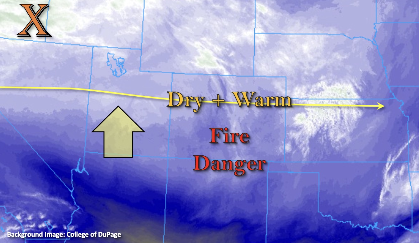
Zonal flow at the mid and upper levels will gain a slightly more northerly component today as a weak ridge begins to build just to our west. This building ridge will promote subsidence or sinking motion across the state, so another beautiful spring day is on tap. PW at Grand Junction and Denver was measured at 0.30 and 0.24 inches, respectively. So, there is a slight increase in moisture, but it will still be very dry causing the probability of rainfall to remain close to zero. Therefore, there is NO flood threat expected. The good news is that the building ridge should decrease the winds. However, Red Flag Warning criteria will still be met over south-central Colorado, so elevated fire danger continues for this area.
By the afternoon hours, expect cloud cover to increase from north to south as a weak, embedded shortwave moves through the westerly flow to our north (orange “X”). This feature will help to drop a cool front through the state overnight, which is forecast to bring cooler temperatures and cloud cover to eastern Colorado tomorrow morning. This may produce some gusts as it drops south through Sunday morning, which would be most likely to occur over the far eastern plains.
Lastly, the HRRR model indicates near-surface smoke from the High Park Fire (Teller County) will cause air quality and visibility issues to areas to areas east and southeast of the area. The fire had grown to 931 acres as of 6:30AM.
Today’s Flood Threat Map
For more information on today’s flood threat, see the map below. If there is a threat, hover over the threat areas for more details, and click on burn areas to learn more about them. For Zone-Specific forecasts, scroll below the threat map.

Zone-Specific Forecasts:
Central Mountains, San Juan Mountains, Front Range, Southeast Mountains, San Luis Valley, Raton Ridge & Southeast Plains:
A Red Flag Warning has been issued for all or portions of these areas from 11AM to 8PM. West to southwest winds in the 10 to 25 mph with gusts up to 35 mph (mountains) and 30 mph (lower elevations) will be possible. Tune into your local NWS for the latest on fire danger over your area. Highs should reach into the upper 70Fs to mid-80Fs across the SLV and adjacent eastern plains with upper 60Fs for the mountain valleys. Rainfall is not forecast.
Northern Mountains, Northwest Slope, Northeast Plains, Urban Corridor, Grand Valley, Southwest Slope & Palmer Ridge:
Above average temperatures and dry conditions will stick around this Saturday. Highs will reach into the 80Fs across the lower elevations with upper 60Fs and low 70Fs forecast for the mountain valleys. No rainfall is forecast today, but expect an increase in cloud cover throughout the afternoon and into the evening.